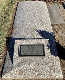
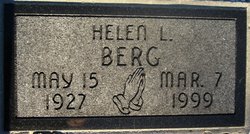
Helen L. Hardesty Berg
| Birth | : | 15 May 1927 Chanute, Neosho County, Kansas, USA |
| Death | : | 7 Mar 1999 Chanute, Neosho County, Kansas, USA |
| Burial | : | Westwood Hills Memorial Park, Placerville, El Dorado County, USA |
| Coordinate | : | 38.7367363, -120.8326035 |
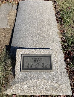
| Description | : | ~✿~ HELEN L. HARDESTY BERG ~✿~ (May 15, 1927 ~ March 7, 1999) Helen L. Hardesty Berg, 71, of Chanute, Kansas, passed away at Neosho Memorial Regional Medical Center at Chanute. She was born May 15, 1927 in Chanute to William J. and Grace B. Howard Hardesty. She married Ralph A. Berg on April 12, 1947 at Chanute, Kansas. He passed away on Aug. 6, 1995. Children: Greg L. Berg of Lake Elsinor, Calif. Brad Berg of Topeka, Ks. Dale Berg of Lawrence, Ks. Ronald Berg (infant deceased) and 4 grandchildren. Brother: Howard Hardesty (deceased) ~✿~ |
frequently asked questions (FAQ):
-
Where is Helen L. Hardesty Berg's memorial?
Helen L. Hardesty Berg's memorial is located at: Westwood Hills Memorial Park, Placerville, El Dorado County, USA.
-
When did Helen L. Hardesty Berg death?
Helen L. Hardesty Berg death on 7 Mar 1999 in Chanute, Neosho County, Kansas, USA
-
Where are the coordinates of the Helen L. Hardesty Berg's memorial?
Latitude: 38.7367363
Longitude: -120.8326035
Family Members:
Spouse
Children
Flowers:
Nearby Cemetories:
1. Westwood Hills Memorial Park
Placerville, El Dorado County, USA
Coordinate: 38.7367363, -120.8326035
2. Westwood Hills Memorial Park Pet Cemetery
Placerville, El Dorado County, USA
Coordinate: 38.7365210, -120.8323130
3. Middletown Cemetery
Placerville, El Dorado County, USA
Coordinate: 38.7358704, -120.8301010
4. Jewish Pioneer Cemetery
Placerville, El Dorado County, USA
Coordinate: 38.7299500, -120.8091965
5. Placerville Union Cemetery
Placerville, El Dorado County, USA
Coordinate: 38.7317390, -120.8084106
6. Boles Family Cemetery
Placerville, El Dorado County, USA
Coordinate: 38.7309860, -120.8069580
7. Missouri Flat Cemetery
Placerville, El Dorado County, USA
Coordinate: 38.7157360, -120.8403400
8. Saint Patrick Cemetery
Placerville, El Dorado County, USA
Coordinate: 38.7327995, -120.8047638
9. County Hospital Cemetery
Placerville, El Dorado County, USA
Coordinate: 38.7342796, -120.8028488
10. Old Placerville City Cemetery
Placerville, El Dorado County, USA
Coordinate: 38.7258987, -120.8059464
11. Old Saint Patricks Cemetery
Placerville, El Dorado County, USA
Coordinate: 38.7249107, -120.8024673
12. Methodist Episcopal Federated Cemetery
Placerville, El Dorado County, USA
Coordinate: 38.7283287, -120.7942200
13. Cold Springs Cemetery
Cold Springs, El Dorado County, USA
Coordinate: 38.7441444, -120.8721619
14. Uppertown Cemetery
Placerville, El Dorado County, USA
Coordinate: 38.7320900, -120.7890625
15. Chili Bar Toll House Cemetery
Placerville, El Dorado County, USA
Coordinate: 38.7700530, -120.8177660
16. Kingsville Cemetery
El Dorado, El Dorado County, USA
Coordinate: 38.6993870, -120.8516060
17. Odd Fellows Cemetery
Diamond Springs, El Dorado County, USA
Coordinate: 38.6963882, -120.8151932
18. Carpenter Family Residence Burial Plot
Diamond Springs, El Dorado County, USA
Coordinate: 38.6941590, -120.8187750
19. Diamond Springs Cemetery
Diamond Springs, El Dorado County, USA
Coordinate: 38.6940960, -120.8186620
20. Gold Hill Cemetery
Gold Hill, El Dorado County, USA
Coordinate: 38.7604010, -120.8849970
21. Weberville Cemetery
Placerville, El Dorado County, USA
Coordinate: 38.7024170, -120.7901000
22. Wakamastu Tea and Silk Farm Colony Burial Site
Coloma, El Dorado County, USA
Coordinate: 38.7674100, -120.8858100
23. Jacquier Family Cemetery
Placerville, El Dorado County, USA
Coordinate: 38.7424420, -120.7602750
24. El Dorado Cemetery
El Dorado, El Dorado County, USA
Coordinate: 38.6804085, -120.8490067


