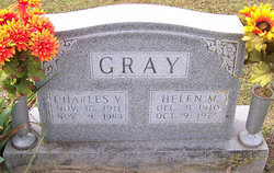
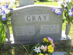
Helen Merritt Gray
| Birth | : | 31 Dec 1910 Shawneetown, Gallatin County, Illinois, USA |
| Death | : | 9 Oct 1975 Jefferson City, Cole County, Missouri, USA |
| Burial | : | Castroville Public Cemetery, Moss Landing, Monterey County, USA |
| Coordinate | : | 36.7930145, -121.7851410 |
| Description | : | Jefferson City Daily Capital News Saturday, October 11, 1975, Jefferson City, Missouri, United States Of America Mrs. Helen Merritt Gray, 64, Olean, died Thursday at Charles Still Hospital. She was born Dec. 31, 1910, in Shawnee Town, Ill., the daughter of Thomas and Fina Bahr Merritt. Her mother survives in St. Louis. She was married Sept. 3, 1938, in Arcadia, to Vancil Gray, who survives at the home. Mrs. Gray was a registered nurse, who served 17 years as company nurse for the International Shoe Co., Eldon, and as the Miller County nurse until her retirement in 1973. She was a member of the... Read More |
frequently asked questions (FAQ):
-
Where is Helen Merritt Gray's memorial?
Helen Merritt Gray's memorial is located at: Castroville Public Cemetery, Moss Landing, Monterey County, USA.
-
When did Helen Merritt Gray death?
Helen Merritt Gray death on 9 Oct 1975 in Jefferson City, Cole County, Missouri, USA
-
Where are the coordinates of the Helen Merritt Gray's memorial?
Latitude: 36.7930145
Longitude: -121.7851410
Family Members:
Spouse
Children
Flowers:
Nearby Cemetories:
1. Castroville Public Cemetery
Moss Landing, Monterey County, USA
Coordinate: 36.7930145, -121.7851410
2. Stephen Norriss Gravesite
Monterey County, USA
Coordinate: 36.8214110, -121.7601080
3. Monterey Bay Loved Pet Cemetery
Monterey County, USA
Coordinate: 36.8326160, -121.6812820
4. Hambey Cemetery
Monterey County, USA
Coordinate: 36.8372002, -121.6793976
5. Queen of Heaven Cemetery
Prunedale, Monterey County, USA
Coordinate: 36.7602425, -121.6611252
6. All Saints Episcopal Church Memorial Garden
Watsonville, Santa Cruz County, USA
Coordinate: 36.9102310, -121.7568950
7. Santa Rita Chapel and Cemetery
Salinas, Monterey County, USA
Coordinate: 36.7281303, -121.6565475
8. Calvary Catholic Cemetery
Salinas, Monterey County, USA
Coordinate: 36.6880341, -121.6818085
9. Pioneer Cemetery
Watsonville, Santa Cruz County, USA
Coordinate: 36.9258560, -121.7642790
10. Watsonville Catholic Cemetery
Watsonville, Santa Cruz County, USA
Coordinate: 36.9278564, -121.7658463
11. Saint Georges Episcopal Church Columbarium
Salinas, Monterey County, USA
Coordinate: 36.7062580, -121.6440980
12. Whitcher Cemetery
East Garrison, Monterey County, USA
Coordinate: 36.6501730, -121.7305270
13. Monterey County Potters Field Cemetery
Salinas, Monterey County, USA
Coordinate: 36.6960900, -121.6381950
14. Chinese Cemetery
Salinas, Monterey County, USA
Coordinate: 36.6952057, -121.6390381
15. Valley Catholic Cemetery
Watsonville, Santa Cruz County, USA
Coordinate: 36.9415932, -121.7405777
16. Valley Public Cemetery
Watsonville, Santa Cruz County, USA
Coordinate: 36.9418983, -121.7400513
17. California Central Coast Veterans Cemetery
Seaside, Monterey County, USA
Coordinate: 36.6371900, -121.7963600
18. Saint Pauls Episcopal Church Columbarium
Salinas, Monterey County, USA
Coordinate: 36.6588430, -121.6558850
19. Mission Memorial Park
Seaside, Monterey County, USA
Coordinate: 36.6191635, -121.8217926
20. Pajaro Valley Memorial Park
Watsonville, Santa Cruz County, USA
Coordinate: 36.9629669, -121.7219391
21. Garden of Memories
Salinas, Monterey County, USA
Coordinate: 36.6565247, -121.6384125
22. Yamato Cemetery
Salinas, Monterey County, USA
Coordinate: 36.6552811, -121.6307297
23. Christ Lutheran Church Columbarium
Aptos, Santa Cruz County, USA
Coordinate: 36.9700550, -121.8704370
24. El Carmelo Cemetery
Pacific Grove, Monterey County, USA
Coordinate: 36.6325836, -121.9319763


