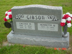
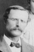
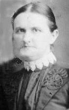
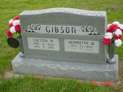
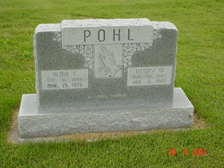
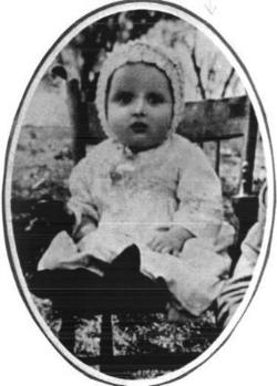
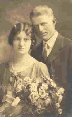
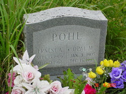
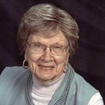
Henrietta Wilhelmina Pohl Gibson
| Birth | : | 25 Sep 1896 Worden, Douglas County, Kansas, USA |
| Death | : | 17 Feb 1979 Ottawa, Franklin County, Kansas, USA |
| Burial | : | Inskip Baptist Churchyard, Inskip with Sowerby, Wyre Borough, England |
| Coordinate | : | 53.8353150, -2.8299610 |
| Description | : | Mrs. Henrietta W. Gibson The Ottawa Herald February 19, 1979 Services for Mrs. Henrietta Wilhelmina Gibson, 82, 534 S. Oak, who died Saturday at Ransom Memorial Hospital, will be at 2 p.m., Tuesday at Lamb-Roberts Funeral Home with burial in Worden Cemetery. Rev. Dean Knewtson and Rev. Frederick J. Ackman will officiate. Mrs. Gibson was born Sept. 15, 1896, at Douglas County. She had been a lifelong resident of this area. She belonged to the Worden United Methodist Church and the Senior Club of Ottawa. She was the last of her family. ... Read More |
frequently asked questions (FAQ):
-
Where is Henrietta Wilhelmina Pohl Gibson's memorial?
Henrietta Wilhelmina Pohl Gibson's memorial is located at: Inskip Baptist Churchyard, Inskip with Sowerby, Wyre Borough, England.
-
When did Henrietta Wilhelmina Pohl Gibson death?
Henrietta Wilhelmina Pohl Gibson death on 17 Feb 1979 in Ottawa, Franklin County, Kansas, USA
-
Where are the coordinates of the Henrietta Wilhelmina Pohl Gibson's memorial?
Latitude: 53.8353150
Longitude: -2.8299610
Family Members:
Parent
Spouse
Siblings
Children
Flowers:
Nearby Cemetories:
1. Inskip Baptist Churchyard
Inskip with Sowerby, Wyre Borough, England
Coordinate: 53.8353150, -2.8299610
2. St. Peters Churchyard
Inskip with Sowerby, Wyre Borough, England
Coordinate: 53.8347100, -2.8175200
3. St. Michael’s Churchyard
St Michael's on Wyre, Wyre Borough, England
Coordinate: 53.8628050, -2.8195430
4. Elswick Congregational Chapelyard
Elswick, Fylde Borough, England
Coordinate: 53.8378950, -2.8775320
5. St Mary Roman Catholic Churchyard
Great Eccleston, Wyre Borough, England
Coordinate: 53.8535420, -2.8710090
6. Christ Churchyard
Treales, Fylde Borough, England
Coordinate: 53.8045970, -2.8440710
7. St Anne Churchyard
Great Eccleston, Wyre Borough, England
Coordinate: 53.8481413, -2.8835925
8. St. Helen's Churchyard
Kirkland (Churchtown), Wyre Borough, England
Coordinate: 53.8790700, -2.7901000
9. Saint Anne's Church
Woodplumpton, City of Preston, England
Coordinate: 53.8038130, -2.7621940
10. Saint Joseph's Roman Catholic Church
Wesham, Fylde Borough, England
Coordinate: 53.7928600, -2.8871800
11. St. Hilda's Churchyard
Bilsborrow, Wyre Borough, England
Coordinate: 53.8522170, -2.7420090
12. St Mary's Newhouse
Barton, City of Preston, England
Coordinate: 53.8205240, -2.7406500
13. St. John’s Churchyard
Out Rawcliffe, Wyre Borough, England
Coordinate: 53.8741650, -2.8959310
14. Christ Church Churchyard
Wesham, Fylde Borough, England
Coordinate: 53.7905000, -2.8845600
15. St. Lawrence Churchyard
Barton, City of Preston, England
Coordinate: 53.8289213, -2.7366654
16. St Michael Churchyard
Kirkham, Fylde Borough, England
Coordinate: 53.7843570, -2.8709520
17. Zion Chapel Cemetery
Kirkham, Fylde Borough, England
Coordinate: 53.7814380, -2.8721260
18. St. John the Evangelist Churchyard
Clifton, Fylde Borough, England
Coordinate: 53.7758600, -2.8158500
19. Kirkland Strict and Particular Baptist Chapel
Nateby, Wyre Borough, England
Coordinate: 53.8961210, -2.8170130
20. St Anne Churchyard
Singleton, Fylde Borough, England
Coordinate: 53.8379280, -2.9359890
21. St. Anne's Churchyard
Blackburn, Blackburn with Darwen Unitary Authority, England
Coordinate: 53.8381160, -2.9362870
22. St Andrew George Haydock Roman Catholic Churchyard
Cottam, City of Preston, England
Coordinate: 53.7879280, -2.7591570
23. Saint John the Evangelist Churchyard
Kirkham, Fylde Borough, England
Coordinate: 53.7808000, -2.8873870
24. St. Mary's Churchyard
Lea, City of Preston, England
Coordinate: 53.7733810, -2.7942770

