
| Birth | : | 1 May 1887 Kingston, Des Moines County, Iowa, USA |
| Death | : | 27 Apr 1960 Danville, Des Moines County, Iowa, USA |
| Burial | : | Cosby Cemetery, Cosby, Blaby District, England |
| Coordinate | : | 52.5560490, -1.1962970 |
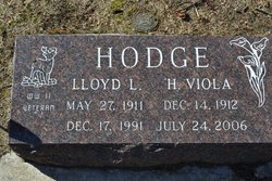
| Description | : | Henry Clay Dean, 72, retired Iowa Ordnance plant employee, died at 2:20 p.m. Wednesday in his home at Danville. Services will be held at 2 p.m. Saturday in the Danville Methodist church with Reverend Horace Ireland officiating. Burial will be in Loper cemetery. The body is at the Elliott chapel, New London. Dean was born May 1, 1887, at Kingston, the son of Mary Susan Deen and Isaac Newton Dean, and was married June 2, 1908, at Burlington, to Maggie Walker, who died February 27, 1953. Surviving are 10 children, Pearl (sic) of Morning Sun, Harold of Mediapolis, Mrs. Viola Hodge, Bettendorf, Jesse... Read More |
frequently asked questions (FAQ):
-
Where is Henry Clay “Clay” Dean's memorial?
Henry Clay “Clay” Dean's memorial is located at: Cosby Cemetery, Cosby, Blaby District, England.
-
When did Henry Clay “Clay” Dean death?
Henry Clay “Clay” Dean death on 27 Apr 1960 in Danville, Des Moines County, Iowa, USA
-
Where are the coordinates of the Henry Clay “Clay” Dean's memorial?
Latitude: 52.5560490
Longitude: -1.1962970
Family Members:
Parent

Spouse
Siblings
Children
Flowers:


Nearby Cemetories:
1. Cosby Cemetery
Cosby, Blaby District, England
Coordinate: 52.5560490, -1.1962970
2. St Michael and All Angels Churchyard
Cosby, Blaby District, England
Coordinate: 52.5488260, -1.1933700
3. All Saints Churchyard
Narborough, Blaby District, England
Coordinate: 52.5730420, -1.2038480
4. Whetstone Cemetery
Whetstone, Blaby District, England
Coordinate: 52.5722900, -1.1779200
5. Saint Peter's Churchyard
Whetstone, Blaby District, England
Coordinate: 52.5727910, -1.1788510
6. Sutton Elms Baptist Chapelyard
Broughton Astley, Harborough District, England
Coordinate: 52.5389370, -1.2328020
7. All Saints Churchyard
Blaby, Blaby District, England
Coordinate: 52.5754960, -1.1600850
8. Blaby Cemetery
Blaby, Blaby District, England
Coordinate: 52.5738950, -1.1541280
9. St Michael & All Angels
Croft, Blaby District, England
Coordinate: 52.5593821, -1.2484472
10. St Marys Parish Churchyard
Broughton Astley, Harborough District, England
Coordinate: 52.5287810, -1.2253600
11. Huncote Cemetery
Huncote, Blaby District, England
Coordinate: 52.5764090, -1.2391220
12. Enderby New Cemetery
Enderby, Blaby District, England
Coordinate: 52.5902330, -1.2048290
13. Enderby Dissenters' Cemetery
Enderby, Blaby District, England
Coordinate: 52.5904190, -1.2049480
14. St John the Baptist Churchyard
Enderby, Blaby District, England
Coordinate: 52.5901570, -1.2077130
15. St Andrew's Churchyard
Countesthorpe, Blaby District, England
Coordinate: 52.5536270, -1.1379810
16. Broughton Astley Cemetery
Broughton Astley, Harborough District, England
Coordinate: 52.5259830, -1.2325190
17. St Mary's Churchyard
Willoughby Waterleys, Harborough District, England
Coordinate: 52.5270920, -1.1532770
18. Countesthorpe Parish Cemetery
Countesthorpe, Blaby District, England
Coordinate: 52.5577540, -1.1309080
19. South Leicestershire Memorial Park and Crematorium
Countesthorpe, Blaby District, England
Coordinate: 52.5562541, -1.1289665
20. Church of All Saints
Dunton Bassett, Harborough District, England
Coordinate: 52.5091000, -1.1946000
21. All Saints Churchyard
Thurlaston, Blaby District, England
Coordinate: 52.5870530, -1.2599600
22. St Michael's Churchyard
Stoney Stanton, Blaby District, England
Coordinate: 52.5487420, -1.2794980
23. Nock Verges Cemetery
Stoney Stanton, Blaby District, England
Coordinate: 52.5492300, -1.2807020
24. St Bartholomew in Foston
Kilby, Blaby District, England
Coordinate: 52.5494780, -1.1117810