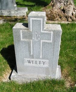
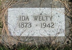
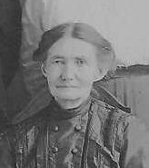
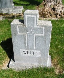
Ida M. Hand Welty
| Birth | : | 1873 |
| Death | : | 25 Feb 1942 Olympia, Thurston County, Washington, USA |
| Burial | : | Wilson Cemetery, Burning Springs, Clay County, USA |
| Coordinate | : | 37.2826450, -83.8543290 |
| Description | : | Funeral services for Mrs. Ida M. Welty, 69, will be held in Mills & Mills chapel this Saturday afternoon at 1 o'clock. the Reverend Dwight Smith will preside. The body will be taken to Colville for burial. Mrs. Welty, who died at the home of her sister, Mrs. Linnie Hull, 1209 San Francisco street, Wednesday evening, was a resident of Enumclaw. Surviving is the husband, George, of Emunclaw. Morning Olympian Friday, February 27, 1942 Page 8 |
frequently asked questions (FAQ):
-
Where is Ida M. Hand Welty's memorial?
Ida M. Hand Welty's memorial is located at: Wilson Cemetery, Burning Springs, Clay County, USA.
-
When did Ida M. Hand Welty death?
Ida M. Hand Welty death on 25 Feb 1942 in Olympia, Thurston County, Washington, USA
-
Where are the coordinates of the Ida M. Hand Welty's memorial?
Latitude: 37.2826450
Longitude: -83.8543290
Family Members:
Parent
Spouse
Siblings
Flowers:
Nearby Cemetories:
1. Wilson Cemetery
Burning Springs, Clay County, USA
Coordinate: 37.2826450, -83.8543290
2. Lloyd Bowling Cemetery
Burning Springs, Clay County, USA
Coordinate: 37.2714000, -83.8484860
3. Dewey McQueen Cemetery
Burning Springs, Clay County, USA
Coordinate: 37.2806000, -83.8700900
4. York Cemetery
Burning Springs, Clay County, USA
Coordinate: 37.2667500, -83.8624100
5. Cress Cemetery
Shepherdtown, Clay County, USA
Coordinate: 37.2638100, -83.8709100
6. Robinson Cemetery #1
Clay County, USA
Coordinate: 37.3055992, -83.8694000
7. Lewis Cemetery
Clay County, USA
Coordinate: 37.3097000, -83.8424988
8. Smith Cemetery #9
Burning Springs, Clay County, USA
Coordinate: 37.2692250, -83.8176530
9. Smith Cemetery #4
Burning Springs, Clay County, USA
Coordinate: 37.2691100, -83.8175700
10. George McQueen Cemetery
Clay County, USA
Coordinate: 37.2618100, -83.8162100
11. Mcqueen Family Cemetery
Burning Springs, Clay County, USA
Coordinate: 37.2607180, -83.8157650
12. Pine Grove Cemetery
Fogertown, Clay County, USA
Coordinate: 37.2431400, -83.8606400
13. Mount Olivet Cemetery
Sextons Creek, Clay County, USA
Coordinate: 37.3203100, -83.8355300
14. McDaniel Cemetery
Chestnutburg, Clay County, USA
Coordinate: 37.2825012, -83.7996979
15. Macedonia Church Cemetery
Burning Springs, Clay County, USA
Coordinate: 37.2413400, -83.8358900
16. Pennington-Morgan Cemetery
Sextons Creek, Clay County, USA
Coordinate: 37.3227997, -83.8281021
17. Thompson Cemetery
Burning Springs, Clay County, USA
Coordinate: 37.2430000, -83.8148500
18. Genty Cemetery
Chestnutburg, Clay County, USA
Coordinate: 37.2971992, -83.7932968
19. Neeley Cemetery
Clay County, USA
Coordinate: 37.3274994, -83.8158035
20. Mize Branch Community Cemetery
Manchester, Clay County, USA
Coordinate: 37.2347259, -83.8159595
21. Woods Cemetery
Burning Springs, Clay County, USA
Coordinate: 37.2621700, -83.7846000
22. Ball Cemetery
Chestnutburg, Clay County, USA
Coordinate: 37.2933006, -83.7810974
23. Old Harris Cemetery
Sidell, Clay County, USA
Coordinate: 37.2226100, -83.8327800
24. Benge Cemetery
Fogertown, Clay County, USA
Coordinate: 37.2300400, -83.8987400

