
| Birth | : | 20 Mar 1922 Sioux Falls, Minnehaha County, South Dakota, USA |
| Death | : | 16 Nov 2016 Pierre, Hughes County, South Dakota, USA |
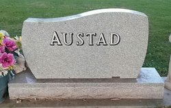
| Burial | : | Riverside Cemetery, Pierre, Hughes County, USA |
| Coordinate | : | 44.3608017, -100.3071976 |
| Description | : | Irene was born to Earl and Annie LuVernie (Langford) Thompson. She grew up in Sioux Falls where she graduated from Washington High School. On May 14, 1941 she married Stanley “Sam” Austad, to this union seven children were born: Over the years Irene worked many jobs. On June 1, 1974 she married Virgil Hansler and moved to Vivian where she and Virgil lived on the farm until 2000 when they moved to Pierre. Irene is survived by 5 children, 10 grandchildren, five step-grandchildren and several great and great-great grandchildren. She was preceded in death by her parents, husbands Sam Austad and... Read More |
frequently asked questions (FAQ):
-
Where is Irene Thompson Hansler's memorial?
Irene Thompson Hansler's memorial is located at: Riverside Cemetery, Pierre, Hughes County, USA.
-
When did Irene Thompson Hansler death?
Irene Thompson Hansler death on 16 Nov 2016 in Pierre, Hughes County, South Dakota, USA
-
Where are the coordinates of the Irene Thompson Hansler's memorial?
Latitude: 44.3608017
Longitude: -100.3071976
Family Members:
Parent
Spouse

Siblings
Children

Flowers:


Nearby Cemetories:
1. Riverside Cemetery
Pierre, Hughes County, USA
Coordinate: 44.3608017, -100.3071976
2. South Dakota State Capitol Grounds
Pierre, Hughes County, USA
Coordinate: 44.3660100, -100.3448000
3. Fort Pierre Chouteau Cemetery
Fort Pierre, Stanley County, USA
Coordinate: 44.3908700, -100.3878300
4. Mount Calvary Cemetery
Pierre, Hughes County, USA
Coordinate: 44.4197006, -100.3557968
5. Cedar Hill Cemetery
Fort Pierre, Stanley County, USA
Coordinate: 44.3356018, -100.3964005
6. Scotty Philip Cemetery
Fort Pierre, Stanley County, USA
Coordinate: 44.4019012, -100.4036026
7. Byron Township Cemetery
Blunt, Hughes County, USA
Coordinate: 44.4979200, -100.1904700
8. Canning Cemetery
Hughes County, USA
Coordinate: 44.3986890, -100.0278460
9. Holy Name Episcopal Cemetery
Fort Pierre, Stanley County, USA
Coordinate: 44.2694960, -100.0357300
10. Holy Name Chapel Cemetery
Fort Pierre, Stanley County, USA
Coordinate: 44.2694292, -100.0356989
11. Mathews Family Cemetery
Stanley County, USA
Coordinate: 44.1816040, -100.5581080
12. Pleasant Hill Cemetery
Blunt, Hughes County, USA
Coordinate: 44.5135994, -100.0156021
13. Okobojo Cemetery
Sully County, USA
Coordinate: 44.6568985, -100.3647003
14. Meers Cemetery
Stanley County, USA
Coordinate: 44.4116970, -100.7360760
15. Fort Sully Post Cemetery
Sully County, USA
Coordinate: 44.5866480, -100.6087530
16. Holy Faith Cemetery
Lyman County, USA
Coordinate: 44.1356010, -99.9878006
17. Chapelle Cemetery
Hughes County, USA
Coordinate: 44.3025017, -99.8653030
18. Fort Bennett Post Cemetery
Stanley County, USA
Coordinate: 44.6716500, -100.6404200
19. Onida Cemetery
Onida, Sully County, USA
Coordinate: 44.7147000, -100.0650000
20. Immanuel Lutheran Cemetery
Van Metre, Jones County, USA
Coordinate: 44.0958800, -100.7263300
21. Saint Catherines Cemetery
Harrold, Hughes County, USA
Coordinate: 44.2091100, -99.7868200
22. Ascension Cemetery
Canning, Hughes County, USA
Coordinate: 44.1523700, -99.7927100
23. Medicine Hill Cemetery
Harrold, Hughes County, USA
Coordinate: 44.5116997, -99.7453003
24. Saint John Catholic Cemetery
Harrold, Hughes County, USA
Coordinate: 44.5127983, -99.7335968