
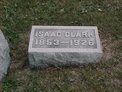
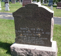
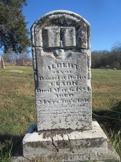
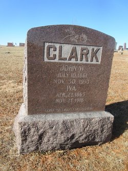
Isaac Clark
| Birth | : | 11 Sep 1853 Waterloo, Black Hawk County, Iowa, USA |
| Death | : | 19 Feb 1926 Kellerton, Ringgold County, Iowa, USA |
| Burial | : | St. James the Great Churchyard, Wrightington, West Lancashire District, England |
| Coordinate | : | 53.6168220, -2.7175670 |
| Plot | : | 4A |
| Description | : | survived by his wife, Lavina |
frequently asked questions (FAQ):
-
Where is Isaac Clark's memorial?
Isaac Clark's memorial is located at: St. James the Great Churchyard, Wrightington, West Lancashire District, England.
-
When did Isaac Clark death?
Isaac Clark death on 19 Feb 1926 in Kellerton, Ringgold County, Iowa, USA
-
Where are the coordinates of the Isaac Clark's memorial?
Latitude: 53.6168220
Longitude: -2.7175670
Family Members:
Parent

Spouse
Siblings
Children
Flowers:


Nearby Cemetories:
1. St. James the Great Churchyard
Wrightington, West Lancashire District, England
Coordinate: 53.6168220, -2.7175670
2. St. Peter and St. Paul Churchyard
Mawdesley, Chorley Borough, England
Coordinate: 53.6266580, -2.7451420
3. St. Joseph's Roman Catholic Church Cemetery
Wrightington, West Lancashire District, England
Coordinate: 53.5923300, -2.7010200
4. St Oswald’s Churchyard
Coppull, Chorley Borough, England
Coordinate: 53.6217176, -2.6714738
5. Christ Church
Charnock Richard, Chorley Borough, England
Coordinate: 53.6367200, -2.6773400
6. Christ Church Churchyard
Parbold, West Lancashire District, England
Coordinate: 53.5908500, -2.7531900
7. St. Peter's Churchyard
Mawdesley, Chorley Borough, England
Coordinate: 53.6237600, -2.7734100
8. Coppull Parish Churchyard Extension
Coppull, Chorley Borough, England
Coordinate: 53.6170200, -2.6555420
9. Coppull Parish Churchyard
Coppull, Chorley Borough, England
Coordinate: 53.6168000, -2.6549710
10. St Mary the Virgin Churchyard
Eccleston, Chorley Borough, England
Coordinate: 53.6528800, -2.7331920
11. Our Lady and All Saints Roman Catholic
Parbold, West Lancashire District, England
Coordinate: 53.5911900, -2.7644350
12. Charnock Richard Crematorium
Chorley, Chorley Borough, England
Coordinate: 53.6518550, -2.6763080
13. St Marie Churchyard
Standish, Metropolitan Borough of Wigan, England
Coordinate: 53.5844610, -2.6704070
14. St Wilfrid Churchyard
Standish, Metropolitan Borough of Wigan, England
Coordinate: 53.5868240, -2.6616530
15. Christchurch Churchyard
Newburgh, West Lancashire District, England
Coordinate: 53.5876845, -2.7842440
16. Croston Cemetery
Croston, Chorley Borough, England
Coordinate: 53.6586700, -2.7733100
17. Euxton Parish Churchyard
Euxton, Chorley Borough, England
Coordinate: 53.6650950, -2.6743630
18. St. Mary's Churchyard
Euxton, Chorley Borough, England
Coordinate: 53.6669580, -2.6768350
19. St Gregory Weld Bank Church Cemetery
Chorley, Chorley Borough, England
Coordinate: 53.6390300, -2.6307480
20. St. Michael's Churchyard
Dalton, West Lancashire District, England
Coordinate: 53.5670360, -2.7640390
21. Chorley Cemetery
Chorley, Chorley Borough, England
Coordinate: 53.6549770, -2.6447530
22. St. Mary the Virgin Churchyard
Rufford, West Lancashire District, England
Coordinate: 53.6349960, -2.8126410
23. St Laurence's Church
Chorley, Chorley Borough, England
Coordinate: 53.6546880, -2.6327020
24. St George's Churchyard
Chorley, Chorley Borough, England
Coordinate: 53.6521460, -2.6295520