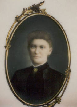
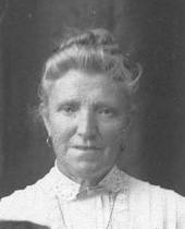
Jane Alexander-Kerr Coker
| Birth | : | 21 Jan 1866 |
| Death | : | 23 Feb 1957 |
| Burial | : | St. John the Baptist Churchyard, Bentham, Craven District, England |
| Coordinate | : | 54.1180880, -2.5454540 |
| Description | : | Jane Alexander was my great grandmother. She was born Jane Kerr, the illegitimate child of Miss Margaret Kerr in Scotland. Margaret emigrated to the United States with her parents, siblings, and nine month old daughter, Jane in Oct 1866. After arriving in the U.S., as was sometimes the case with Scottish illegitimate births, Jane was given the use of her fathers surname, (Stewart) Alexander. Verbal family history states that Jane's father died in Scotland. It is not known if this is what her mother told her or fact. To date, I have not been... Read More |
frequently asked questions (FAQ):
-
Where is Jane Alexander-Kerr Coker's memorial?
Jane Alexander-Kerr Coker's memorial is located at: St. John the Baptist Churchyard, Bentham, Craven District, England.
-
When did Jane Alexander-Kerr Coker death?
Jane Alexander-Kerr Coker death on 23 Feb 1957 in
-
Where are the coordinates of the Jane Alexander-Kerr Coker's memorial?
Latitude: 54.1180880
Longitude: -2.5454540
Family Members:
Spouse
Children
Flowers:
Nearby Cemetories:
1. St. John the Baptist Churchyard
Bentham, Craven District, England
Coordinate: 54.1180880, -2.5454540
2. Friends Burial Group
Bentham, Craven District, England
Coordinate: 54.1265450, -2.5374290
3. St Margaret Churchyard
Bentham, Craven District, England
Coordinate: 54.1146000, -2.5087300
4. All Saints Churchyard
Burton-in-Lonsdale, Craven District, England
Coordinate: 54.1437630, -2.5357130
5. St James the Less Churchyard
Tatham, City of Lancaster, England
Coordinate: 54.1190100, -2.6043200
6. Church of the Good Shepherd Churchyard
Tatham, City of Lancaster, England
Coordinate: 54.0830170, -2.5301250
7. Holy Trinity Churchyard
Wray, City of Lancaster, England
Coordinate: 54.1022960, -2.6081510
8. St Wilfrids Churchyard
Melling, City of Lancaster, England
Coordinate: 54.1346900, -2.6165100
9. St John The Baptist Churchyard
Tunstall, City of Lancaster, England
Coordinate: 54.1596600, -2.5924200
10. St. Margaret's Churchyard
Hornby, City of Lancaster, England
Coordinate: 54.1114000, -2.6362000
11. St Oswald Churchyard
Thornton-in-Lonsdale, Craven District, England
Coordinate: 54.1573600, -2.4830810
12. St John The Baptist Churchyard
Arkholme, City of Lancaster, England
Coordinate: 54.1406220, -2.6307800
13. St. Wilfred Priory
Hornby, City of Lancaster, England
Coordinate: 54.1143640, -2.6405490
14. St Mary Churchyard
Ingleton, Craven District, England
Coordinate: 54.1540480, -2.4682980
15. Ingleton Cemetery
Ingleton, Craven District, England
Coordinate: 54.1495470, -2.4569780
16. St. John The Evangelist Churchyard
Gressingham, City of Lancaster, England
Coordinate: 54.1233910, -2.6557800
17. Saint Peter's Churchyard
Leck, City of Lancaster, England
Coordinate: 54.1836860, -2.5485980
18. St. Chad's Churchyard
Claughton, City of Lancaster, England
Coordinate: 54.0931310, -2.6643990
19. St. Matthew's Churchyard
Keasden, Craven District, England
Coordinate: 54.0945680, -2.4245830
20. St. Michael the Archangel Churchyard
Whittington, City of Lancaster, England
Coordinate: 54.1807620, -2.6148790
21. St. Saviour's Church
Halton, City of Lancaster, England
Coordinate: 54.1025610, -2.6891750
22. Clapham Parish Cemetery
Clapham, Craven District, England
Coordinate: 54.1110400, -2.3963100
23. St James Churchyard
Clapham, Craven District, England
Coordinate: 54.1202400, -2.3904970
24. St Mary the Virgin Churchyard
Kirkby Lonsdale, South Lakeland District, England
Coordinate: 54.2036550, -2.5976790

