
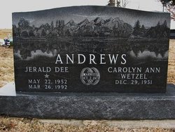

Jerald Dee Andrews
| Birth | : | 22 May 1952 Pawnee City, Pawnee County, Nebraska, USA |
| Death | : | 26 Mar 1992 Kansas City, Wyandotte County, Kansas, USA |
| Burial | : | DuBois Cemetery, Du Bois, Pawnee County, USA |
| Coordinate | : | 40.0231018, -96.0488968 |
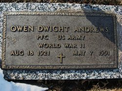
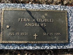
| Description | : | Son of Owen & Fern (Yoble) Andrews. Married Oct 2, 1971 to Carolyn Ann Wetzel at Bern, KS. Father of Jerrad, Jerry & Jay. SABETHA HERALD (Sabetha, Kansas)-Wednesday, April 1, 1992- Page 7. JERALD DEE ANDREWS Jerald Dee Andrews, 34, Bern, died Thursday, March 26, 1992, at Kansas City, Kan., medical center. He had cancer since 1988. Mr. Andres worked with the Nemaha County Road and Bridge Crew. He was born May 22, 1952, at Pawnee City, Neb., the son of Owen and Fern Yoble Andrews. He attended Pawnee City schools and was graduated from... Read More |
frequently asked questions (FAQ):
-
Where is Jerald Dee Andrews's memorial?
Jerald Dee Andrews's memorial is located at: DuBois Cemetery, Du Bois, Pawnee County, USA.
-
When did Jerald Dee Andrews death?
Jerald Dee Andrews death on 26 Mar 1992 in Kansas City, Wyandotte County, Kansas, USA
-
Where are the coordinates of the Jerald Dee Andrews's memorial?
Latitude: 40.0231018
Longitude: -96.0488968
Family Members:
Parent
Siblings
Flowers:


Nearby Cemetories:
1. DuBois Cemetery
Du Bois, Pawnee County, USA
Coordinate: 40.0231018, -96.0488968
2. Cincinnati Cemetery
Du Bois, Pawnee County, USA
Coordinate: 40.0042000, -96.0274963
3. Friedens United Church of Christ Cemetery
Bern, Nemaha County, USA
Coordinate: 39.9929008, -96.0529480
4. Prairie Star Pioneer Cemetery
Du Bois, Pawnee County, USA
Coordinate: 40.0293000, -96.1041000
5. German Lutheran Cemetery
Bern, Nemaha County, USA
Coordinate: 39.9794500, -96.0234300
6. Saint Peters Evangelican Cemetery
Du Bois, Pawnee County, USA
Coordinate: 40.0010000, -96.1095000
7. Athens Cemetery
Richardson County, USA
Coordinate: 40.0449982, -95.9852982
8. Scotch Valley Cemetery
Nemaha County, USA
Coordinate: 39.9578018, -96.0699997
9. Coal City Cemetery
Seneca, Nemaha County, USA
Coordinate: 39.9498500, -96.0689600
10. Evergreen Cemetery
Pawnee County, USA
Coordinate: 40.0485992, -96.1417007
11. Pleasant Ridge Cemetery
Du Bois, Pawnee County, USA
Coordinate: 40.0156000, -96.1494000
12. Saint John Lutheran Cemetery
Bern, Nemaha County, USA
Coordinate: 39.9538900, -95.9977700
13. Four Mile Cemetery
Bern, Nemaha County, USA
Coordinate: 39.9857900, -95.9568900
14. Bern Cemetery
Bern, Nemaha County, USA
Coordinate: 39.9637299, -95.9781494
15. Pleasant Valley Cemetery
Pawnee County, USA
Coordinate: 40.0299988, -96.1554794
16. McCaffrey Cemetery
Nemaha County, USA
Coordinate: 39.9827100, -96.1474500
17. Four Mile Cemetery
Humboldt, Richardson County, USA
Coordinate: 40.0589000, -95.9455000
18. Bohemian Cemetery
Richardson County, USA
Coordinate: 40.1175003, -95.9955978
19. Dry Branch Pioneer Cemetery
Richardson County, USA
Coordinate: 40.1292000, -96.0100021
20. Pleasant Hill Cemetery
Richardson County, USA
Coordinate: 40.0471992, -95.9075012
21. East Amish Cemetery
Table Rock, Pawnee County, USA
Coordinate: 40.1310000, -96.0854000
22. Bestwick Cemetery
Sabetha, Nemaha County, USA
Coordinate: 39.9862595, -95.9100037
23. Williams Cemetery
Bern, Nemaha County, USA
Coordinate: 39.9219017, -95.9741974
24. Brewer Cemetery
Baileyville, Nemaha County, USA
Coordinate: 39.9556900, -96.1736500