
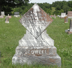

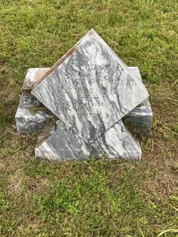
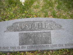
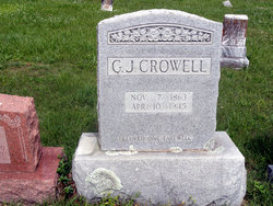
John A “Jack” Crowell
| Birth | : | 24 Nov 1868 Tennessee, USA |
| Death | : | 16 Jan 1910 USA |
| Burial | : | All Saints Churchyard, Faldingworth, West Lindsey District, England |
| Coordinate | : | 53.3490800, -0.3995900 |
| Description | : | Son of Wiley Crowell and Sarah (Turner) Crowell. |
frequently asked questions (FAQ):
-
Where is John A “Jack” Crowell's memorial?
John A “Jack” Crowell's memorial is located at: All Saints Churchyard, Faldingworth, West Lindsey District, England.
-
When did John A “Jack” Crowell death?
John A “Jack” Crowell death on 16 Jan 1910 in USA
-
Where are the coordinates of the John A “Jack” Crowell's memorial?
Latitude: 53.3490800
Longitude: -0.3995900
Family Members:
Parent
Siblings
Flowers:


Nearby Cemetories:
1. All Saints Churchyard
Faldingworth, West Lindsey District, England
Coordinate: 53.3490800, -0.3995900
2. St. Peter's Churchyard
Friesthorpe, West Lindsey District, England
Coordinate: 53.3367420, -0.3915860
3. St. Michael's Churchyard
Buslingthorpe, West Lindsey District, England
Coordinate: 53.3520370, -0.3772470
4. St. Lawrence Churchyard
Snarford, West Lindsey District, England
Coordinate: 53.3283300, -0.4239900
5. St Michaels Churchyard
Newton by Toft, West Lindsey District, England
Coordinate: 53.3726210, -0.4216430
6. All Saints Churchyard
Cold Hanworth, West Lindsey District, England
Coordinate: 53.3357700, -0.4471700
7. All Saints Churchyard
Snelland, West Lindsey District, England
Coordinate: 53.3120800, -0.3812000
8. St. John The Baptist Churchyard
Lissington, West Lindsey District, England
Coordinate: 53.3363600, -0.3359800
9. St. Cornelius Churchyard
Linwood, West Lindsey District, England
Coordinate: 53.3626176, -0.3361707
10. St. Peter & St. Paul Churchyard
Middle Rasen, West Lindsey District, England
Coordinate: 53.3914120, -0.3664170
11. God's Acre
Middle Rasen, West Lindsey District, England
Coordinate: 53.3904700, -0.3614800
12. St. Thomas Churchyard
Market Rasen, West Lindsey District, England
Coordinate: 53.3883500, -0.3376700
13. All Saints Churchyard
Holton-cum-Beckering, West Lindsey District, England
Coordinate: 53.3167370, -0.3257753
14. Market Rasen Cemetery
Market Rasen, West Lindsey District, England
Coordinate: 53.3830880, -0.3275890
15. St. Helen's Churchyard
Saxby, West Lindsey District, England
Coordinate: 53.3625100, -0.4920400
16. St. Chad Churchyard
Dunholme, West Lindsey District, England
Coordinate: 53.3018330, -0.4638100
17. St Chad Church Extension
Dunholme, West Lindsey District, England
Coordinate: 53.3008900, -0.4621500
18. St. Oswald's Churchyard
Rand, West Lindsey District, England
Coordinate: 53.2970600, -0.3404500
19. St. Peter & Paul Churchyard
Owmby-by-Spital, West Lindsey District, England
Coordinate: 53.3735080, -0.4981220
20. St. John the Baptist Churchyard
Langworth, West Lindsey District, England
Coordinate: 53.2843900, -0.4086800
21. St. Peter's Churchyard
Normanby by Spital, West Lindsey District, England
Coordinate: 53.3802120, -0.4963050
22. Owmby-Normanby Cemetery
Owmby-by-Spital, West Lindsey District, England
Coordinate: 53.3770850, -0.4992190
23. St Michael Churchyard
Hackthorn, West Lindsey District, England
Coordinate: 53.3288810, -0.5134350
24. Kirkby cum Osgodby Cemetery
Kirkby cum Osgodby, West Lindsey District, England
Coordinate: 53.4202700, -0.3977200