John David Gilstrap
| Birth | : | 2 Jun 1807 Washington County, Indiana, USA |
| Death | : | 24 Feb 1881 Washington County, Indiana, USA |
| Burial | : | Lone Fir Cemetery, Long Beach, Pacific County, USA |
| Coordinate | : | 46.3622017, -124.0175018 |
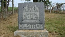
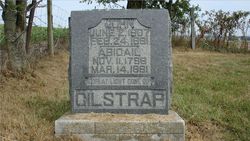
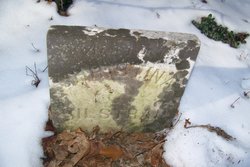
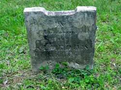
| Inscription | : | JOHN JUNE 2, 1807 FEB. 24, 1881 ABIGAIL NOV 11, 1758 MAR 14, 1881 A GREAT LIGHT GONE OUT GILSTRAP |
| Description | : | Siblings: Sally, Elizabeth M., Barbara, Aaron, Jeremiah M.,Alexander, John David, Mary, Selah, Rachel, Welthy, Sarina, and Levina Children: Matilda, Nancy, Aaron, John H., Welthy, Rachael OBIT supplied by:H2Ofowlhunter The following obituary for John David Gilstrap was found in the 28 Feb 1881 edition of The Daily Ledger-Standard of New Albany, Indiana on page 1, column 2: Another Pioneer Departs. John Gilstrap, Esq., died last Friday, aged seventy-two years. His disease was pneumonia. He had been justice of the peace and county commissioner many years. In 1854 he failed of a renomination by the democracy, since which time he had acted politically with the opposition party. He was... Read More |
frequently asked questions (FAQ):
-
Where is John David Gilstrap's memorial?
John David Gilstrap's memorial is located at: Lone Fir Cemetery, Long Beach, Pacific County, USA.
-
When did John David Gilstrap death?
John David Gilstrap death on 24 Feb 1881 in Washington County, Indiana, USA
-
Where are the coordinates of the John David Gilstrap's memorial?
Latitude: 46.3622017
Longitude: -124.0175018
Family Members:
Parent
Spouse
Siblings
Children
Flowers:
Nearby Cemetories:
1. Lone Fir Cemetery
Long Beach, Pacific County, USA
Coordinate: 46.3622017, -124.0175018
2. Briscoe Family Cemetery
Pacific County, USA
Coordinate: 46.3867690, -124.0541310
3. Ilwaco Cemetery
Ilwaco, Pacific County, USA
Coordinate: 46.3180008, -124.0227966
4. Ocean Park Cemetery
Ocean Park, Pacific County, USA
Coordinate: 46.4903970, -124.0427580
5. Peaceful Hill Cemetery
Naselle, Pacific County, USA
Coordinate: 46.3678017, -123.7994003
6. Fort Stevens National Cemetery
Warrenton, Clatsop County, USA
Coordinate: 46.1949997, -123.9597015
7. Oysterville Cemetery
Oysterville, Pacific County, USA
Coordinate: 46.5478670, -124.0337350
8. Salmon Creek Cemetery Old
Wahkiakum County, USA
Coordinate: 46.3578630, -123.7178340
9. Salmon Creek Cemetery
Deep River, Wahkiakum County, USA
Coordinate: 46.3634000, -123.7164000
10. Warrenton Pauper Cemetery
Warrenton, Clatsop County, USA
Coordinate: 46.1572266, -123.9399033
11. Ocean View Cemetery
Warrenton, Clatsop County, USA
Coordinate: 46.1519800, -123.9372400
12. Astoria Pioneer Cemetery
Astoria, Clatsop County, USA
Coordinate: 46.1819000, -123.8264008
13. Deep River Cemetery
Deep River, Wahkiakum County, USA
Coordinate: 46.3587910, -123.6849890
14. Bay Center Cemetery
Bay Center, Pacific County, USA
Coordinate: 46.5986490, -123.9355650
15. Clatsop Plains Pioneer Cemetery
Warrenton, Clatsop County, USA
Coordinate: 46.1222000, -123.9263992
16. Seal River Cemetery
Rosburg, Wahkiakum County, USA
Coordinate: 46.3329210, -123.6600870
17. Grays River Old Cemetery
Rosburg, Wahkiakum County, USA
Coordinate: 46.3210130, -123.6440080
18. Rosburg Cemetery
Wahkiakum County, USA
Coordinate: 46.3348000, -123.6400000
19. Greenwood Cemetery
Astoria, Clatsop County, USA
Coordinate: 46.1371994, -123.8028030
20. Bay Center Pioneer Cemetery
Bay Center, Pacific County, USA
Coordinate: 46.6298850, -123.9538870
21. Lewis and Clark Cemetery
Miles Crossing, Clatsop County, USA
Coordinate: 46.1133800, -123.8541000
22. Eden Valley Cemetery
Eden, Wahkiakum County, USA
Coordinate: 46.3018270, -123.6254030
23. Grays River Grange Cemetery
Grays River, Wahkiakum County, USA
Coordinate: 46.3548000, -123.6144000
24. Wilsonville Cemetery
Pacific County, USA
Coordinate: 46.6379710, -123.9387740

