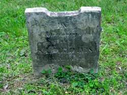
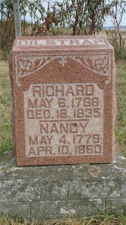
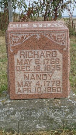
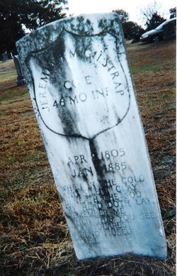
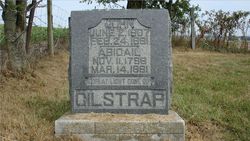
Sarah “Sally” Gilstrap Davis
| Birth | : | 13 Jun 1797 North Carolina, USA |
| Death | : | 8 May 1847 Washington County, Indiana, USA |
| Burial | : | St George's Churchyard, Wales |
| Coordinate | : | 51.4819300, -3.2911700 |
| Description | : | Age 50y Daughter of Richard Gilstrap and Nancy Ann Wright Wife of B Davis Information collected from the files of the Washington County Indiana Historical Society Wife of Benjamin Davis, b 6 Jun 1794 in Kentucky. Children:Mary Polly DAVIS-b 28 Jul 1818 d 1887 Richard DAVIS-b 16 Sep 1819 Jane DAVIS-b 8 Jul 1820 John DAVIS-b 13 Aug 1822 David DAVIS-b 13 Jan 1827. He died in 1887 David married Margaret EVANS Rebecca DAVIS-b 3 Mar 1829 d 1887 Rebecca married John M MCDANIEL William DAVIS-b 26 Jan 1831 Benjamin DAVIS Jr-b 7 Apr 1833 Jacob DAVIS-b 28 Oct 1835 Sarah DAVIS-b 1837 d 1910 in Eugene,... Read More |
frequently asked questions (FAQ):
-
Where is Sarah “Sally” Gilstrap Davis's memorial?
Sarah “Sally” Gilstrap Davis's memorial is located at: St George's Churchyard, Wales.
-
When did Sarah “Sally” Gilstrap Davis death?
Sarah “Sally” Gilstrap Davis death on 8 May 1847 in Washington County, Indiana, USA
-
Where are the coordinates of the Sarah “Sally” Gilstrap Davis's memorial?
Latitude: 51.4819300
Longitude: -3.2911700
Family Members:
Parent
Spouse
Siblings
Children
Flowers:
Nearby Cemetories:
1. St George's Churchyard
Wales
Coordinate: 51.4819300, -3.2911700
2. St Nicholas Church
Wales
Coordinate: 51.4605000, -3.3098000
3. Twyn yr Odyn Baptist Chapel Burial Ground
Wales
Coordinate: 51.4563708, -3.2739268
4. Newcastle St. Illtyd Churchyard
Wales
Coordinate: 51.5080900, -3.5829600
5. Penrhys Cemetery
Wales
Coordinate: 51.6420500, -3.4425800
6. St. Peter's Churchyard
Wales
Coordinate: 51.6133800, -3.0590490
7. Holy Trinity Churchyard
Ilfracombe, North Devon District, England
Coordinate: 51.5571712, -3.5946496
8. St. John the Baptist Churchyard
Weston-super-Mare, North Somerset Unitary Authority, England
Coordinate: 51.3523010, -2.9813260
9. Weston-super-Mare Emmanuel Churchyard
Weston-super-Mare, North Somerset Unitary Authority, England
Coordinate: 51.3458940, -2.9773860
10. Saint Pauls Churchyard
Kewstoke, North Somerset Unitary Authority, England
Coordinate: 51.3655500, -2.9568900
11. Weston-Super-Mare Cemetery
Weston-super-Mare, North Somerset Unitary Authority, England
Coordinate: 51.3541300, -2.9676900
12. St Paul's Churchyard
Kewstoke, North Somerset Unitary Authority, England
Coordinate: 51.3655390, -2.9566120
13. St Nicholas Churchyard (New)
Uphill, North Somerset Unitary Authority, England
Coordinate: 51.3246210, -2.9778420
14. Old St Nicholas Churchyard
Uphill, North Somerset Unitary Authority, England
Coordinate: 51.3203480, -2.9828110
15. Ebdon Road Crematorium and Cemetery
Weston-super-Mare, North Somerset Unitary Authority, England
Coordinate: 51.3707090, -2.9254530
16. Saint Bridget Churchyard
Brean, Sedgemoor District, England
Coordinate: 51.2983000, -3.0100000
17. St. Martin's Churchyard
Worle, North Somerset Unitary Authority, England
Coordinate: 51.3609960, -2.9301250
18. Wick St. Lawrence Churchyard
Wick St Lawrence, North Somerset Unitary Authority, England
Coordinate: 51.3844000, -2.9117000
19. St Mark Churchyard
Weston-super-Mare, North Somerset Unitary Authority, England
Coordinate: 51.3640650, -2.9195540
20. Clevedon Cemetery
Clevedon, North Somerset Unitary Authority, England
Coordinate: 51.4322600, -2.8747270
21. St Andrew Churchyard
Clevedon, North Somerset Unitary Authority, England
Coordinate: 51.4331670, -2.8735760
22. St Mary the Virgin Churchyard
Hutton, North Somerset Unitary Authority, England
Coordinate: 51.3228030, -2.9306350
23. St. Mary's Churchyard
Clevedon, North Somerset Unitary Authority, England
Coordinate: 51.4495200, -2.8514000
24. Saint Mary Magdalene Churchyard
Berrow, Sedgemoor District, England
Coordinate: 51.2669160, -3.0136980

