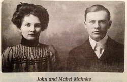
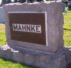
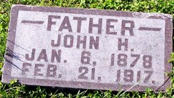
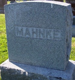
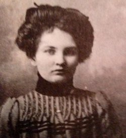
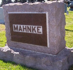
John Henry Mahnke
| Birth | : | 6 Jan 1878 Garwin, Tama County, Iowa, USA |
| Death | : | 21 Feb 1917 Pierson, Woodbury County, Iowa, USA |
| Burial | : | Stone Chapel United Methodist Church Cemetery, Pikesville, Baltimore County, USA |
| Coordinate | : | 39.3934000, -76.7407500 |
| Description | : | Obit in The Correctionville News, 1 March 1917, page 2: John Henry Mahnke, son of Frederick and Freda Mahnke was born January 6, 1878, near Garwin, Tama Co., Iowa. He moved to Grand Meadow Township in Cherokee County with his parents in the spring of 1885 and resided there until the time of his death. He married Mabel Mahoney February 11, 1902, and to them were born three sons, all of whom remain at home. Mr. Mahnke was active in public affairs and was affiliated with the Providence M.E. Church of Grand Meadow Township, serving as... Read More |
frequently asked questions (FAQ):
-
Where is John Henry Mahnke's memorial?
John Henry Mahnke's memorial is located at: Stone Chapel United Methodist Church Cemetery, Pikesville, Baltimore County, USA.
-
When did John Henry Mahnke death?
John Henry Mahnke death on 21 Feb 1917 in Pierson, Woodbury County, Iowa, USA
-
Where are the coordinates of the John Henry Mahnke's memorial?
Latitude: 39.3934000
Longitude: -76.7407500
Family Members:
Parent
Spouse
Siblings
Children
Flowers:
Nearby Cemetories:
1. Stone Chapel United Methodist Church Cemetery
Pikesville, Baltimore County, USA
Coordinate: 39.3934000, -76.7407500
2. Howard Graveyard at Grayrock
Pikesville, Baltimore County, USA
Coordinate: 39.3954560, -76.7367020
3. Holy Trinity Monastery Cemetery
Pikesville, Baltimore County, USA
Coordinate: 39.3971991, -76.7277734
4. Croxall Family Cemetery
Baltimore County, USA
Coordinate: 39.3968735, -76.7207870
5. Druid Ridge Cemetery
Pikesville, Baltimore County, USA
Coordinate: 39.3793800, -76.7275700
6. Mettam Memorial Baptist Church Cemetery
Pikesville, Baltimore County, USA
Coordinate: 39.3780700, -76.7197300
7. Saint Charles Borromeo Church Cemetery
Pikesville, Baltimore County, USA
Coordinate: 39.3738100, -76.7254000
8. Rosewood State Hospital Cemetery
Owings Mills, Baltimore County, USA
Coordinate: 39.4215500, -76.7619000
9. Saint Thomas Episcopal Church Cemetery
Owings Mills, Baltimore County, USA
Coordinate: 39.4215500, -76.7619000
10. Saint Thomas Cemetery
Milford, Baltimore County, USA
Coordinate: 39.3605995, -76.7735977
11. Mount Olive Cemetery
Randallstown, Baltimore County, USA
Coordinate: 39.3623400, -76.7769800
12. Har Sinai Cemetery
Owings Mills, Baltimore County, USA
Coordinate: 39.4353900, -76.7683800
13. Garrison Forest Cemetery
Owings Mills, Baltimore County, USA
Coordinate: 39.4363000, -76.7674800
14. Garrison Forest Veterans Cemetery
Owings Mills, Baltimore County, USA
Coordinate: 39.4407600, -76.7680800
15. Pleasant Hill United Methodist Church Cemetery
Owings Mills, Baltimore County, USA
Coordinate: 39.4294400, -76.7912700
16. Carrolls-Gills United Methodist Church Cemetery
Lutherville, Baltimore County, USA
Coordinate: 39.4465300, -76.7185900
17. Hook Family Cemetery
Bare Hills, Baltimore County, USA
Coordinate: 39.3886600, -76.6653300
18. Arlington Chizuk Amuno Cemetery
Baltimore, Baltimore City, USA
Coordinate: 39.3442001, -76.6971970
19. Saters Baptist Historical Church Cemetery
Timonium, Baltimore County, USA
Coordinate: 39.4362920, -76.6870810
20. Holy Family Cemetery
Randallstown, Baltimore County, USA
Coordinate: 39.3752800, -76.8156000
21. Resurrection Acres Cemetery
Randallstown, Baltimore County, USA
Coordinate: 39.3353340, -76.7691617
22. Shaarei Zion Cemetery Liberty Park
Randallstown, Baltimore County, USA
Coordinate: 39.3793600, -76.8196000
23. Cockey-Reed Cemetery
Greenspring, Baltimore County, USA
Coordinate: 39.4196400, -76.6671300
24. Beth El Memorial Park
Randallstown, Baltimore County, USA
Coordinate: 39.3800400, -76.8209600

