
| Birth | : | 14 Apr 1888 Wetmore, Nemaha County, Kansas, USA |
| Death | : | 20 Sep 1969 Topeka, Shawnee County, Kansas, USA |
| Burial | : | St Mary Churchyard, Goathland, Scarborough Borough, England |
| Coordinate | : | 54.3950300, -0.7266400 |
frequently asked questions (FAQ):
-
Where is John Jack DeBusk's memorial?
John Jack DeBusk's memorial is located at: St Mary Churchyard, Goathland, Scarborough Borough, England.
-
When did John Jack DeBusk death?
John Jack DeBusk death on 20 Sep 1969 in Topeka, Shawnee County, Kansas, USA
-
Where are the coordinates of the John Jack DeBusk's memorial?
Latitude: 54.3950300
Longitude: -0.7266400
Family Members:
Parent
Spouse

Siblings
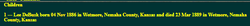

Children
Flowers:


Nearby Cemetories:
1. St Mary Churchyard
Goathland, Scarborough Borough, England
Coordinate: 54.3950300, -0.7266400
2. St Matthew Churchyard
Grosmont, Scarborough Borough, England
Coordinate: 54.4348410, -0.7243950
3. Ebenezers Baptist Church
Scarborough Borough, England
Coordinate: 54.3744655, -0.6557164
4. St Hilda Churchyard
Egton, Scarborough Borough, England
Coordinate: 54.4414240, -0.7535720
5. Egton Cemetery
Egton, Scarborough Borough, England
Coordinate: 54.4482300, -0.7690700
6. St Thomas Churchyard
Glaisdale, Scarborough Borough, England
Coordinate: 54.4373700, -0.8083400
7. St John the Evangelist Churchyard
Sleights, Scarborough Borough, England
Coordinate: 54.4503500, -0.6651200
8. Glaisdale Head Methodist Church
Glaisdale, Scarborough Borough, England
Coordinate: 54.4294940, -0.8331749
9. All Saints Churchyard
Ugglebarnby, Scarborough Borough, England
Coordinate: 54.4522340, -0.6446610
10. St. Margaret's Churchyard
Aislaby, Scarborough Borough, England
Coordinate: 54.4653900, -0.6792400
11. St James the Greater Churchyard
Lealholm, Scarborough Borough, England
Coordinate: 54.4586200, -0.8240300
12. Our Lady of Sacred Heart Roman Catholic Churchyard
Lealholm, Scarborough Borough, England
Coordinate: 54.4592200, -0.8234600
13. Quaker Burial Ground
Lealholm, Scarborough Borough, England
Coordinate: 54.4575270, -0.8285030
14. St. Hilda's Churchyard
Sneaton, Scarborough Borough, England
Coordinate: 54.4579490, -0.6226930
15. St. John’s Churchyard
Newton-on-Rawcliffe, Ryedale District, England
Coordinate: 54.3022700, -0.7520000
16. St Mary the Virgin Churchyard
Levisham, Ryedale District, England
Coordinate: 54.2992000, -0.7223000
17. Newton upon Rawcliffe Cemetery
Newton-on-Rawcliffe, Ryedale District, England
Coordinate: 54.2998382, -0.7503566
18. St Giles Churchyard
Lockton, Ryedale District, England
Coordinate: 54.2987100, -0.7057700
19. Christ Church Churchyard
Ugthorpe, Scarborough Borough, England
Coordinate: 54.4892300, -0.7672700
20. Lockton Cemetery
Lockton, Ryedale District, England
Coordinate: 54.2977400, -0.7003200
21. St Hilda Priory Cemetery
Whitby, Scarborough Borough, England
Coordinate: 54.4823300, -0.6431400
22. St Mary and St Laurence Churchyard
Rosedale Abbey, Ryedale District, England
Coordinate: 54.3537300, -0.8872700
23. Whitby Cemetery
Whitby, Scarborough Borough, England
Coordinate: 54.4755000, -0.6106500
24. Quaker Burial Ground
Whitby, Scarborough Borough, England
Coordinate: 54.4847790, -0.6194700