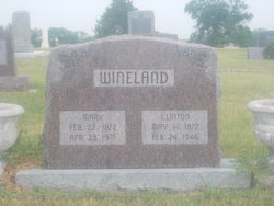
| Birth | : | 4 Oct 1862 Pottawattamie County, Iowa, USA |
| Death | : | 3 Dec 1941 Alton, Osborne County, Kansas, USA |
| Burial | : | Kill Creek Cemetery, Alton, Osborne County, USA |
| Coordinate | : | 39.3805528, -98.8967658 |
| Description | : | Lafe Wineland Died Thursday, Dec. 4th Lafayette Wineland, well known and highly respected citizen of Osborne county and a member of a prominent pioneer family of the county passed away at this homestead home in the Alton vicinity, December 4 after a lingering illness. His passing is universally mourned by a large circle of friends over the county. Funeral services were held at 2 p.m. Saturday, December 6, in the Kill Creek Presbyterian church with Rev. J.A. Bales officiating and with the I.O.O.F lodge of Alton, Kansas, in charge. Music was furnished by a quartette including Winifred Peterson and... Read More |
frequently asked questions (FAQ):
-
Where is John Lafayette “Lafe” Wineland's memorial?
John Lafayette “Lafe” Wineland's memorial is located at: Kill Creek Cemetery, Alton, Osborne County, USA.
-
When did John Lafayette “Lafe” Wineland death?
John Lafayette “Lafe” Wineland death on 3 Dec 1941 in Alton, Osborne County, Kansas, USA
-
Where are the coordinates of the John Lafayette “Lafe” Wineland's memorial?
Latitude: 39.3805528
Longitude: -98.8967658
Family Members:
Parent
Spouse
Siblings
Children
Flowers:
Nearby Cemetories:
1. Kill Creek Cemetery
Alton, Osborne County, USA
Coordinate: 39.3805528, -98.8967658
2. Mount Hope Cemetery
Bloomington, Osborne County, USA
Coordinate: 39.3939018, -98.8450012
3. Mount Ayr Cemetery
Alton, Osborne County, USA
Coordinate: 39.3764000, -98.9717026
4. Sumner Cemetery
Alton, Osborne County, USA
Coordinate: 39.4799995, -98.9338913
5. Bloomington Cemetery
Bloomington, Osborne County, USA
Coordinate: 39.4669800, -98.8120800
6. Pioneer Cemetery
Alton, Osborne County, USA
Coordinate: 39.4742012, -98.9749985
7. Covert Cemetery
Osborne County, USA
Coordinate: 39.2896996, -98.8107986
8. Pleasant Valley Cemetery
Osborne County, USA
Coordinate: 39.4583015, -99.0077972
9. Bristow Cemetery
Osborne, Osborne County, USA
Coordinate: 39.3506012, -98.7506027
10. Pleasant Plain Cemetery
Osborne County, USA
Coordinate: 39.3367004, -99.0372009
11. Round Mound Cemetery
Osborne County, USA
Coordinate: 39.2630997, -98.9636002
12. IXL Cemetery
Natoma, Osborne County, USA
Coordinate: 39.2491989, -98.9218979
13. Cedar Bluff Cemetery
Osborne County, USA
Coordinate: 39.2496986, -98.8431015
14. Immanuel Lutheran Cemetery
Natoma, Osborne County, USA
Coordinate: 39.2708015, -99.0096970
15. Victor Cemetery
Osborne County, USA
Coordinate: 39.2380981, -98.8613968
16. Grant Center Cemetery
Alton, Osborne County, USA
Coordinate: 39.5242004, -98.9708023
17. Chalk Mound Cemetery
Laton, Rooks County, USA
Coordinate: 39.3208008, -99.0852966
18. Osborne Cemetery
Osborne, Osborne County, USA
Coordinate: 39.4514008, -98.7138977
19. Cole Cemetery
Osborne County, USA
Coordinate: 39.2352982, -98.8060989
20. Butler Cemetery
Osborne County, USA
Coordinate: 39.5400009, -98.8494034
21. Saint Aloysius Cemetery
Osborne, Osborne County, USA
Coordinate: 39.4536018, -98.6903000
22. Aurora Cemetery
Laton, Rooks County, USA
Coordinate: 39.2778015, -99.0847015
23. Spring Branch Cemetery
Woodston, Rooks County, USA
Coordinate: 39.5099983, -99.0580978
24. Survey Cemetery
Woodston, Rooks County, USA
Coordinate: 39.3722000, -99.1333008


