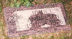
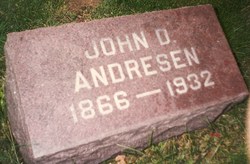
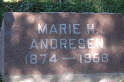
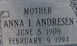
John Ludwig Andresen
| Birth | : | 26 Jun 1901 Clinton, Clinton County, Iowa, USA |
| Death | : | 5 May 1976 Clinton, Clinton County, Iowa, USA |
| Burial | : | St George the Martyr Churchyard, Southwark, London Borough of Southwark, England |
| Coordinate | : | 51.5012000, -0.0926700 |
| Plot | : | Lot 2 sec 90 |
frequently asked questions (FAQ):
-
Where is John Ludwig Andresen's memorial?
John Ludwig Andresen's memorial is located at: St George the Martyr Churchyard, Southwark, London Borough of Southwark, England.
-
When did John Ludwig Andresen death?
John Ludwig Andresen death on 5 May 1976 in Clinton, Clinton County, Iowa, USA
-
Where are the coordinates of the John Ludwig Andresen's memorial?
Latitude: 51.5012000
Longitude: -0.0926700
Family Members:
Parent
Spouse
Siblings
Children
Flowers:
Nearby Cemetories:
1. St George the Martyr Churchyard
Southwark, London Borough of Southwark, England
Coordinate: 51.5012000, -0.0926700
2. Crossbones Cemetery
Southwark, London Borough of Southwark, England
Coordinate: 51.5041500, -0.0933730
3. St. Margaret Churchyard
Southwark, London Borough of Southwark, England
Coordinate: 51.5044900, -0.0907270
4. Baptist Chapel Burial Ground
Southwark, London Borough of Southwark, England
Coordinate: 51.5027900, -0.0978580
5. Colliers Rents Congregational Chapel
Southwark, London Borough of Southwark, England
Coordinate: 51.5042800, -0.0890700
6. Guy's Hospital Chapel and Burial Ground
Southwark, London Borough of Southwark, England
Coordinate: 51.5016230, -0.0863980
7. St. Saviour's Almshouses Cemetery
Southwark, London Borough of Southwark, England
Coordinate: 51.5051460, -0.0914880
8. Horsemonger Lane Gaol Cemetery
Southwark, London Borough of Southwark, England
Coordinate: 51.4977000, -0.0960000
9. Deadman's Place Burial Ground
Southwark, London Borough of Southwark, England
Coordinate: 51.5056040, -0.0944280
10. Maze Pond Baptist Chapel Burial Ground
Southwark, London Borough of Southwark, England
Coordinate: 51.5034850, -0.0862760
11. Ewer Street Burial Ground
Southwark, London Borough of Southwark, England
Coordinate: 51.5045560, -0.0990240
12. Southwark Cathedral
Southwark, London Borough of Southwark, England
Coordinate: 51.5061417, -0.0895970
13. Long Lane Friends Burial Ground
Southwark, London Borough of Southwark, England
Coordinate: 51.4978590, -0.0825360
14. St. Mary Magdalene
Bermondsey, London Borough of Southwark, England
Coordinate: 51.4983920, -0.0807240
15. St. John's Churchyard (Defunct)
Southwark, London Borough of Southwark, England
Coordinate: 51.5024320, -0.0786460
16. All Hallows the Great
London, City of London, England
Coordinate: 51.5099720, -0.0900440
17. All Hallows the Less
London, City of London, England
Coordinate: 51.5099000, -0.0893000
18. St. Magnus the Martyr Churchyard
London, City of London, England
Coordinate: 51.5092500, -0.0862880
19. Christ Church Churchyard
Southwark, London Borough of Southwark, England
Coordinate: 51.5061200, -0.1053500
20. St Mary Magdalene (Defunct)
London, City of London, England
Coordinate: 51.5100480, -0.0862540
21. St Laurence Pountney Churchyard
London, City of London, England
Coordinate: 51.5106100, -0.0885930
22. St Botolph Billingsgate Churchyard (Defunct)
London, City of London, England
Coordinate: 51.5096860, -0.0847310
23. Great Fire of London Monument
London, City of London, England
Coordinate: 51.5101100, -0.0859990
24. St James Garlickhythe Churchyard
London, City of London, England
Coordinate: 51.5111070, -0.0937560

