

John Robert Jerred
| Birth | : | 8 Nov 1818 England |
| Death | : | 25 Dec 1895 Chester, Howard County, Iowa, USA |
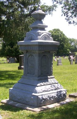
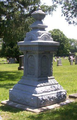
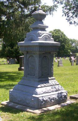
| Burial | : | Chester Hill Cemetery, Chester, Howard County, USA |
| Coordinate | : | 43.4897003, -92.4072037 |
| Plot | : | B15d |
| Description | : | This obituary was copied from the 12/19/1895 issue of the LeRoy Independent. DIED. JERRED--At his residence in the village of LeRoy, Wednesday, December 25th, 1895, at 6 o'clock AM, Mr. Robert Jerred died, at the age of 77 years, 1 month, and 17 days, and was buried from the Presbyterian church at 10:30 AM. Mr. Jerred was one of the oldest settlers of the region, having been born, raised and married in England, he came to America in 1850, and moved to Howard Co., Iowa in the fall of 1854, where he took up a homestead and resided until he... Read More |
frequently asked questions (FAQ):
-
Where is John Robert Jerred's memorial?
John Robert Jerred's memorial is located at: Chester Hill Cemetery, Chester, Howard County, USA.
-
When did John Robert Jerred death?
John Robert Jerred death on 25 Dec 1895 in Chester, Howard County, Iowa, USA
-
Where are the coordinates of the John Robert Jerred's memorial?
Latitude: 43.4897003
Longitude: -92.4072037
Family Members:
Spouse
Children


Flowers:


Nearby Cemetories:
1. Chester Hill Cemetery
Chester, Howard County, USA
Coordinate: 43.4897003, -92.4072037
2. Bethlehem Cemetery
Fillmore County, USA
Coordinate: 43.5303001, -92.3486023
3. Bethany Lutheran Cemetery
Le Roy, Mower County, USA
Coordinate: 43.5588989, -92.4794006
4. Le Roy Lutheran Cemetery
Le Roy, Mower County, USA
Coordinate: 43.5217750, -92.5196340
5. Saint Patricks Cemetery
Le Roy, Mower County, USA
Coordinate: 43.5217018, -92.5207977
6. Le Roy Cemetery
Le Roy, Mower County, USA
Coordinate: 43.5214005, -92.5227966
7. Bloomfield Lutheran Church Cemetery
Ostrander, Fillmore County, USA
Coordinate: 43.5932999, -92.4085999
8. Canfield Cemetery
Fillmore County, USA
Coordinate: 43.5305595, -92.2680588
9. Pleasant Hill Cemetery
Lime Springs, Howard County, USA
Coordinate: 43.4502983, -92.2671967
10. Saratoga Township Cemetery
Saratoga, Howard County, USA
Coordinate: 43.3710000, -92.4023000
11. Etna Cemetery
Etna, Fillmore County, USA
Coordinate: 43.6025009, -92.3538971
12. Love Cemetery
York, Fillmore County, USA
Coordinate: 43.5531845, -92.2575226
13. Foreston Cemetery
Howard County, USA
Coordinate: 43.4794006, -92.2331009
14. Ostrander Cemetery
Ostrander, Fillmore County, USA
Coordinate: 43.6167100, -92.4200400
15. Cherry Grove Cemetery
Cherry Grove, Fillmore County, USA
Coordinate: 43.5875015, -92.2880630
16. Wayne Cemetery
McIntire, Mitchell County, USA
Coordinate: 43.4411011, -92.5744019
17. Saetersdal Norwegian Evangelical Lutheran Cemetery
Harmony, Fillmore County, USA
Coordinate: 43.5315018, -92.2290268
18. Old Bloomfield Cemetery
Bloomfield Township, Fillmore County, USA
Coordinate: 43.6380200, -92.4090600
19. Bennington Pioneer Cemetery
Mower County, USA
Coordinate: 43.6013565, -92.5503693
20. Duff Cemetery
Fillmore County, USA
Coordinate: 43.6305618, -92.3183289
21. Bennington Cemetery
Le Roy, Mower County, USA
Coordinate: 43.6258011, -92.5093994
22. Bristol Grove Cemetery
Bristol, Fillmore County, USA
Coordinate: 43.5435867, -92.2045212
23. Riverside Cemetery
Riceville, Mitchell County, USA
Coordinate: 43.3676834, -92.5576324
24. Greenleafton Cemetery
Greenleafton, Fillmore County, USA
Coordinate: 43.5819397, -92.2180634