
Josiah Kendall
| Birth | : | 16 Oct 1769 Dunstable, Middlesex County, Massachusetts, USA |
| Death | : | 31 Jul 1850 Dunstable, Middlesex County, Massachusetts, USA |
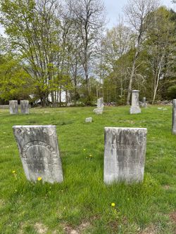
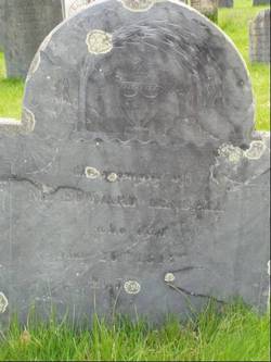
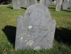
| Burial | : | St. Peter's in the Forest Anglican Cemetery, Bombay, Auckland Council, New Zealand |
| Coordinate | : | -37.1869100, 174.9914100 |
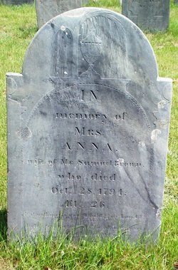
| Inscription | : | JOSIAH KENDALL d. July 31, 1850 aged 81 Source: Nason, Elias "History of Dunstable, Massachusetts": A Mudge & Son, printers, Boston 1877 |
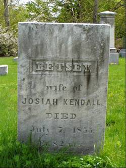
| Description | : | Josiah Kendall, son of Edward and Sarah (Thompson) Kendall, born in Dunstable, Middlesex, Massachusetts 16 October 1769; married in Dunstable, Middlesex, Massachusetts 29 March 1796. Bettey Proctor Source: Vital Records of Dunstable, Massachusetts Births: Page 51 Marriages: Pages 150 & 173 |
frequently asked questions (FAQ):
-
Where is Josiah Kendall's memorial?
Josiah Kendall's memorial is located at: St. Peter's in the Forest Anglican Cemetery, Bombay, Auckland Council, New Zealand.
-
When did Josiah Kendall death?
Josiah Kendall death on 31 Jul 1850 in Dunstable, Middlesex County, Massachusetts, USA
-
Where are the coordinates of the Josiah Kendall's memorial?
Latitude: -37.1869100
Longitude: 174.9914100
Family Members:
Parent
Spouse
Siblings
Flowers:


Nearby Cemetories:
1. St. Peter's in the Forest Anglican Cemetery
Bombay, Auckland Council, New Zealand
Coordinate: -37.1869100, 174.9914100
2. Bombay Presbyterian Church Cemetery
Bombay, Auckland Council, New Zealand
Coordinate: -37.1790700, 174.9826900
3. Pukekohe East Cemetery
Pukekohe East, Auckland Council, New Zealand
Coordinate: -37.1883500, 174.9459000
4. Pratt's Road Catholic Cemetery
Ramarama, Auckland Council, New Zealand
Coordinate: -37.1425500, 174.9871300
5. Pokeno Old Soldiers Cemetery
Pokeno, Waikato District, New Zealand
Coordinate: -37.2386120, 175.0094760
6. Ararimu Schoolhouse Cemetery
Ararimu, Auckland Council, New Zealand
Coordinate: -37.1448376, 175.0359288
7. Pokeno Cemetery
Pokeno, Waikato District, New Zealand
Coordinate: -37.2364600, 175.0215400
8. Ararimu Cemetery
Ararimu, Auckland Council, New Zealand
Coordinate: -37.1321000, 175.0484200
9. Pukekohe Catholic Cemetery
Pukekohe, Auckland Council, New Zealand
Coordinate: -37.1951510, 174.9014640
10. Heights Park Cemetery
Paerata, Auckland Council, New Zealand
Coordinate: -37.1781928, 174.8938836
11. Pukekohe Public Cemetery
Pukekohe, Auckland Council, New Zealand
Coordinate: -37.2106400, 174.8974900
12. St John's Anglican Cemetery Drury
Drury, Auckland Council, New Zealand
Coordinate: -37.1033710, 174.9506070
13. Drury-Runciman War Memorial
Drury, Auckland Council, New Zealand
Coordinate: -37.1025480, 174.9528240
14. Drury Presbyterian Cemetery
Drury, Auckland Council, New Zealand
Coordinate: -37.0991270, 174.9497870
15. Tuakau Cemetery
Tuakau, Waikato District, New Zealand
Coordinate: -37.2844420, 174.9465660
16. Mercer Cemetery
Mercer, Waikato District, New Zealand
Coordinate: -37.2764860, 175.0578300
17. Papakura South Cemetery
Papakura, Auckland Council, New Zealand
Coordinate: -37.0877300, 174.9464700
18. Alexandra Redoubt Cemetery
Tuakau, Waikato District, New Zealand
Coordinate: -37.2858200, 174.9419600
19. Papakura Cemetery
Papakura, Auckland Council, New Zealand
Coordinate: -37.0698600, 174.9448300
20. Hunua Presbyterian Cemetery
Hunua, Auckland Council, New Zealand
Coordinate: -37.0792290, 175.0742700
21. St Brides Church of England Cemetery
Mauku, Auckland Council, New Zealand
Coordinate: -37.2011260, 174.8120370
22. Onewhero Cemetery
Onewhero, Waikato District, New Zealand
Coordinate: -37.3158900, 174.9104900
23. Mauku Cemetery
Mauku, Auckland Council, New Zealand
Coordinate: -37.2011420, 174.8109100
24. St James Churchyard Ardmore
Auckland Council, New Zealand
Coordinate: -37.0364180, 174.9992160