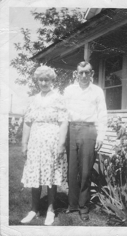
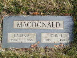
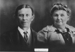
Laura Bell Cavanaugh MacDonald
| Birth | : | 26 May 1888 Wright County, Missouri, USA |
| Death | : | 15 Oct 1958 Waterville, Douglas County, Washington, USA |
| Burial | : | Spring Grove Cemetery, Cincinnati, Hamilton County, USA |
| Coordinate | : | 39.1647900, -84.5231500 |
| Plot | : | Sec 2, Blk 13, Gr #8 |
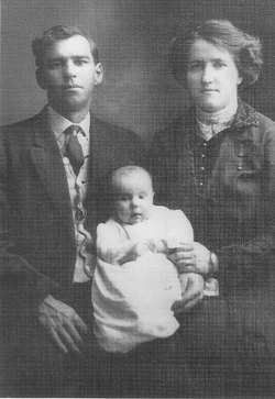
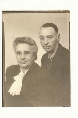
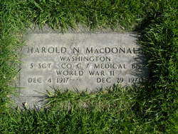
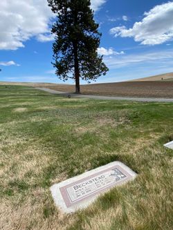
| Description | : | Daughter of Henry and Susan (Hoggatt) Cavanaugh Wife of John MacDonald Mother of Ernest, Harold, Nina and Mina Laura MacDonald Mrs. Laura Macdonald, 70, a pioneer resident of Waterville, died Wednesday in a local hospital following a long illness. Born May 26, 1888, in Wright County, Mo., Mrs. Macdonald came to Washington with her parents the next year, settling near Waterville. In 1911 she was married to John J. Macdonald at Waterville. Surviving are: her husband; two sons, Ernest Macdonald, Everett, and Harold Macdonald, Ephrata; twin daughters, Nina Beckstead, Douglas, and... Read More |
frequently asked questions (FAQ):
-
Where is Laura Bell Cavanaugh MacDonald's memorial?
Laura Bell Cavanaugh MacDonald's memorial is located at: Spring Grove Cemetery, Cincinnati, Hamilton County, USA.
-
When did Laura Bell Cavanaugh MacDonald death?
Laura Bell Cavanaugh MacDonald death on 15 Oct 1958 in Waterville, Douglas County, Washington, USA
-
Where are the coordinates of the Laura Bell Cavanaugh MacDonald's memorial?
Latitude: 39.1647900
Longitude: -84.5231500
Family Members:
Parent
Spouse
Siblings
Children
Flowers:
Nearby Cemetories:
1. Spring Grove Cemetery
Cincinnati, Hamilton County, USA
Coordinate: 39.1647900, -84.5231500
2. Saint John Cemetery
Saint Bernard, Hamilton County, USA
Coordinate: 39.1643982, -84.5053024
3. Vine Street Hill Cemetery
Cincinnati, Hamilton County, USA
Coordinate: 39.1516991, -84.5091019
4. Clifton United Jewish Cemetery
Cincinnati, Hamilton County, USA
Coordinate: 39.1470871, -84.5292816
5. Wesleyan Cemetery
Cincinnati, Hamilton County, USA
Coordinate: 39.1599998, -84.5468979
6. Third Quaker Cemetery (Defunct)
Cincinnati, Hamilton County, USA
Coordinate: 39.1542400, -84.5523720
7. Hillside Chapel Crematory and Columbarium
Cincinnati, Hamilton County, USA
Coordinate: 39.1393509, -84.5247192
8. Saint Mary Cemetery
Saint Bernard, Hamilton County, USA
Coordinate: 39.1664009, -84.4880981
9. Old Finneytown Cemetery
Finneytown, Hamilton County, USA
Coordinate: 39.1962220, -84.5206120
10. First German Protestant Cemetery
Avondale, Hamilton County, USA
Coordinate: 39.1492004, -84.4863968
11. Bishop Cemetery (Defunct)
College Hill, Hamilton County, USA
Coordinate: 39.1910210, -84.5489570
12. Methodist Protestant Cemetery (Defunct)
Cincinnati, Hamilton County, USA
Coordinate: 39.1324770, -84.4983160
13. Baltimore Pike Cemetery
Cincinnati, Hamilton County, USA
Coordinate: 39.1397018, -84.5681000
14. Convent of the Good Shepherd Cemetery (Defunct)
Carthage, Hamilton County, USA
Coordinate: 39.2055250, -84.5042780
15. Walnut Hills Cemetery
Cincinnati, Hamilton County, USA
Coordinate: 39.1355950, -84.4809040
16. Walnut Hills Jewish Cemetery
Evanston, Hamilton County, USA
Coordinate: 39.1403700, -84.4731300
17. Gard-Brown Cemetery
North Bend, Hamilton County, USA
Coordinate: 39.2035200, -84.5553300
18. Calvary Cemetery
Cincinnati, Hamilton County, USA
Coordinate: 39.1403008, -84.4697037
19. Longview Hospital Cemetery
Roselawn, Hamilton County, USA
Coordinate: 39.1887730, -84.4691660
20. Martini United Church of Christ Cemetery
Fairmount, Hamilton County, USA
Coordinate: 39.1296272, -84.5664902
21. Second Quaker Cemetery (Defunct)
Cincinnati, Hamilton County, USA
Coordinate: 39.1153090, -84.5305240
22. Christ Church Cemetery
Over-The-Rhine, Hamilton County, USA
Coordinate: 39.1126480, -84.5157623
23. Griffins Station Cemetery
Carthage, Hamilton County, USA
Coordinate: 39.2047000, -84.4770730
24. Jessup Cemetery
Mount Airy, Hamilton County, USA
Coordinate: 39.1970870, -84.5794270

