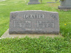
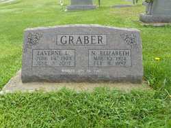
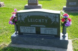
LaVerne Louis Graber
| Birth | : | 14 Jun 1923 Washington County, Iowa, USA |
| Death | : | 4 Jun 2007 Mount Pleasant, Henry County, Iowa, USA |
| Burial | : | Emery Gates Cemetery, Ash, Guildford Borough, England |
| Coordinate | : | 51.2500370, -0.7163210 |
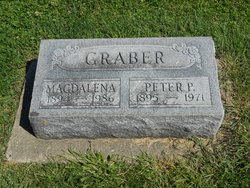
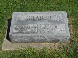
| Description | : | LaVerne L. Graber, 83, of Wayland died Sunday, June 3, 2007, at the Henry County Health Center in Mount Pleasant. Born June 14, 1923, in Crawfordsville, he was the son of Peter and Magdelena Wenger Graber. On June 24, 1945, he married N. Elizabeth Schroll in Wayland. She died Feb. 8, 1997. In October of 1998, he married Ruth Leichty. She died in January 2007. He taught at the Douglas School in rural Wayland. During World War II, as a conscientious objector, he served his country working in Michigan testing milk at a dairy and built a dam in Terry, Mont.... Read More |
frequently asked questions (FAQ):
-
Where is LaVerne Louis Graber's memorial?
LaVerne Louis Graber's memorial is located at: Emery Gates Cemetery, Ash, Guildford Borough, England.
-
When did LaVerne Louis Graber death?
LaVerne Louis Graber death on 4 Jun 2007 in Mount Pleasant, Henry County, Iowa, USA
-
Where are the coordinates of the LaVerne Louis Graber's memorial?
Latitude: 51.2500370
Longitude: -0.7163210
Family Members:
Parent
Spouse
Siblings
Flowers:
Nearby Cemetories:
1. Emery Gates Cemetery
Ash, Guildford Borough, England
Coordinate: 51.2500370, -0.7163210
2. St Peter Churchyard
Ash, Guildford Borough, England
Coordinate: 51.2490760, -0.7155380
3. Ash War Memorial
Ash, Guildford Borough, England
Coordinate: 51.2546746, -0.7157783
4. Aldershot Military Cemetery
Aldershot, Rushmoor Borough, England
Coordinate: 51.2554779, -0.7449350
5. Aldershot Jewish Cemetery
Aldershot, Rushmoor Borough, England
Coordinate: 51.2508900, -0.7463000
6. Redan Road Cemetery
Aldershot, Rushmoor Borough, England
Coordinate: 51.2495610, -0.7488900
7. St. Mark's Churchyard
Pirbright, Guildford Borough, England
Coordinate: 51.2549050, -0.6812810
8. Aldershot Crematorium
Aldershot, Rushmoor Borough, England
Coordinate: 51.2325970, -0.7443200
9. St Michael the Archangel Churchyard
Aldershot, Rushmoor Borough, England
Coordinate: 51.2414300, -0.7558900
10. St Lawrence Churchyard
Seale, Guildford Borough, England
Coordinate: 51.2231840, -0.7170140
11. St. Bartholomew's Churchyard
Wanborough, Guildford Borough, England
Coordinate: 51.2317700, -0.6625100
12. St. John the Baptist Churchyard
Puttenham, Guildford Borough, England
Coordinate: 51.2222610, -0.6650440
13. Puttenham Cemetery
Puttenham, Guildford Borough, England
Coordinate: 51.2204130, -0.6590980
14. St. Peter's Churchyard
Farnborough, Rushmoor Borough, England
Coordinate: 51.2924100, -0.7499300
15. Saint John the Evangelist Churchyard
Hale, Waverley Borough, England
Coordinate: 51.2280880, -0.7849360
16. St Michael's Abbey
Farnborough, Rushmoor Borough, England
Coordinate: 51.2971140, -0.7497110
17. Victoria Road Cemetery
Farnborough, Rushmoor Borough, England
Coordinate: 51.2941300, -0.7593900
18. Upper Hale Cemetery
Farnham, Waverley Borough, England
Coordinate: 51.2352700, -0.8001800
19. Deepcut Military Cemetery
Deepcut, Surrey Heath Borough, England
Coordinate: 51.3062170, -0.7049060
20. St. Mary's Churchyard
Shackleford, Guildford Borough, England
Coordinate: 51.2017210, -0.6629560
21. Ship Lane Cemetery
Farnborough, Rushmoor Borough, England
Coordinate: 51.3057800, -0.7488900
22. St Michael and All Angels Churchyard
Pirbright, Guildford Borough, England
Coordinate: 51.2945800, -0.6500000
23. Compton Village Cemetery
Compton, Guildford Borough, England
Coordinate: 51.2181370, -0.6326920
24. St. Nicholas' Churchyard
Compton, Guildford Borough, England
Coordinate: 51.2145300, -0.6348400

