
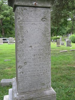
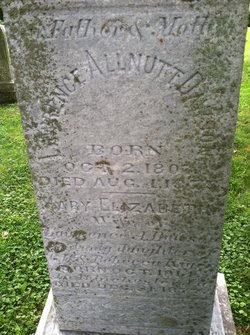
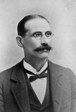
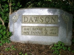
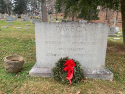
Lawrence Allnutt Dawson
| Birth | : | 2 Oct 1807 Dawsonville, Montgomery County, Maryland, USA |
| Death | : | 4 Aug 1875 Rockville, Montgomery County, Maryland, USA |
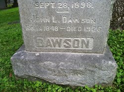
| Burial | : | Rockville Cemetery, Rockville, Montgomery County, USA |
| Coordinate | : | 39.0844002, -77.1260986 |
| Plot | : | Section B2, Lot 20, Site 1 |
| Description | : | Lawrence Allnutt Dawson (1807-1875) A farmer and attorney who owned “Rocky Glen” Farm. He was elected to the Maryland Legislature as a Whig in 1837. He served as Union Commissioner of the Draft during the Civil War and was one of the Christ Church vestrymen taken by Gen. Stuart’s troops. |
frequently asked questions (FAQ):
-
Where is Lawrence Allnutt Dawson's memorial?
Lawrence Allnutt Dawson's memorial is located at: Rockville Cemetery, Rockville, Montgomery County, USA.
-
When did Lawrence Allnutt Dawson death?
Lawrence Allnutt Dawson death on 4 Aug 1875 in Rockville, Montgomery County, Maryland, USA
-
Where are the coordinates of the Lawrence Allnutt Dawson's memorial?
Latitude: 39.0844002
Longitude: -77.1260986
Family Members:
Parent

Spouse
Siblings
Children
Flowers:


Nearby Cemetories:
1. Rockville Cemetery
Rockville, Montgomery County, USA
Coordinate: 39.0844002, -77.1260986
2. New Saint Mary's Catholic Church Cemetery
Rockville, Montgomery County, USA
Coordinate: 39.0830994, -77.1268997
3. Avery Road Colored Cemetery
Rockville, Montgomery County, USA
Coordinate: 39.0897220, -77.1255560
4. Rockville United Church Memorial Garden
Rockville, Montgomery County, USA
Coordinate: 39.0783570, -77.1158440
5. Old Saint Mary's Catholic Church Cemetery
Rockville, Montgomery County, USA
Coordinate: 39.0819830, -77.1453850
6. Martin Family Cemetery
Rockville, Montgomery County, USA
Coordinate: 39.0960100, -77.1428960
7. Lincoln Park Cemetery
Rockville, Montgomery County, USA
Coordinate: 39.0954300, -77.1452900
8. Christ Episcopal Church Columbarium
Rockville, Montgomery County, USA
Coordinate: 39.0823100, -77.1528500
9. Rockville United Methodist Church Columbarium
Rockville, Montgomery County, USA
Coordinate: 39.0839060, -77.1554180
10. Rockville Baptist Cemetery
Rockville, Montgomery County, USA
Coordinate: 39.0835400, -77.1562300
11. Parklawn Memorial Park and Menorah Gardens
Rockville, Montgomery County, USA
Coordinate: 39.0639000, -77.1091995
12. Montgomery County Poor Farm Cemetery
Rockville, Montgomery County, USA
Coordinate: 39.0727400, -77.1540500
13. Haiti Cemetery
Rockville, Montgomery County, USA
Coordinate: 39.0931000, -77.1573100
14. Higgins Family Cemetery
Rockville, Montgomery County, USA
Coordinate: 39.0597400, -77.1162300
15. Prather Family Cemetery
Montgomery County, USA
Coordinate: 39.1133330, -77.1147220
16. Faith United Methodist Church Memorial Garden
Rockville, Montgomery County, USA
Coordinate: 39.0536300, -77.1392600
17. Aspin Hill Memorial Park
Silver Spring, Montgomery County, USA
Coordinate: 39.0799600, -77.0772300
18. Crabb Family Cemetery
Derwood, Montgomery County, USA
Coordinate: 39.1151300, -77.1582400
19. Gate of Heaven Cemetery
Silver Spring, Montgomery County, USA
Coordinate: 39.0825005, -77.0738983
20. Derwood Cemetery
Derwood, Montgomery County, USA
Coordinate: 39.1186400, -77.1580800
21. Mount Pleasant Methodist Church Cemetery
Norbeck, Montgomery County, USA
Coordinate: 39.1104800, -77.0810960
22. Trinity Lutheran Church Columbarium
Rockville, Montgomery County, USA
Coordinate: 39.0387727, -77.1235788
23. Saint Lukes Lutheran Cemetery
Derwood, Montgomery County, USA
Coordinate: 39.1304800, -77.1494800
24. Beall Cemetery
Silver Spring, Montgomery County, USA
Coordinate: 39.0877991, -77.0607986