
| Birth | : | 3 Sep 1796 Allegany County, Maryland, USA |
| Death | : | 25 Sep 1796 Allegany County, Maryland, USA |
| Burial | : | Upper Sang Run Cemetery, McHenry, Garrett County, USA |
| Coordinate | : | 39.5717810, -79.4242430 |
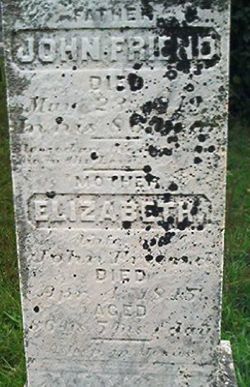
| Description | : | Birth: September 3, 1796 Friend's Delight Sang Run, Allegany (now Garrett), Maryland Death: September 25, 1796 Friend's Delight Sang Run, Allegany (now Garrett), Maryland Twin daughter of John Friend, Jr. and Elizabeth Ward Friend. Soon after their marriage on February 14, 1795, John Friend, Jr. and Elizabeth Ward Friend settled at Friend's Delight. The first born of their thirteen children were twins... Read More |
frequently asked questions (FAQ):
-
Where is Leah Friend's memorial?
Leah Friend's memorial is located at: Upper Sang Run Cemetery, McHenry, Garrett County, USA.
-
When did Leah Friend death?
Leah Friend death on 25 Sep 1796 in Allegany County, Maryland, USA
-
Where are the coordinates of the Leah Friend's memorial?
Latitude: 39.5717810
Longitude: -79.4242430
Family Members:
Parent

Siblings

Flowers:


Nearby Cemetories:
1. Upper Sang Run Cemetery
McHenry, Garrett County, USA
Coordinate: 39.5717810, -79.4242430
2. Hoye Family Cemetery - Crab Tree Bottom
McHenry, Garrett County, USA
Coordinate: 39.5642220, -79.3855000
3. Oak Grove Church of the Brethren Cemetery
McHenry, Garrett County, USA
Coordinate: 39.5694400, -79.3834300
4. Hoyes Run Cemetery
Garrett County, USA
Coordinate: 39.5313100, -79.4110900
5. Saint Dominic Catholic Cemetery
Hoyes, Garrett County, USA
Coordinate: 39.5868300, -79.3698600
6. Hoyes Cemetery
Garrett County, USA
Coordinate: 39.5905991, -79.3683014
7. Cranesville Cemetery
Cranesville, Preston County, USA
Coordinate: 39.5543920, -79.4929870
8. Flatwood Cemetery
Accident, Garrett County, USA
Coordinate: 39.5923500, -79.3515400
9. Lake Ford Cemetery
Garrett County, USA
Coordinate: 39.5278015, -79.4792023
10. Sisler Cemetery
Mountain Dale, Preston County, USA
Coordinate: 39.6081009, -79.4938965
11. Skiles Cemetery
Accident, Garrett County, USA
Coordinate: 39.5971570, -79.3439160
12. Keeler Glade Cemetery
Garrett County, USA
Coordinate: 39.6308000, -79.4768000
13. Bumblebee Ridge Cemetery
McHenry, Garrett County, USA
Coordinate: 39.5774400, -79.3296800
14. Bray Cemetery
Oakland, Garrett County, USA
Coordinate: 39.5006900, -79.3858100
15. Miller Cemetery
Preston County, USA
Coordinate: 39.5250015, -79.5081024
16. Taylor-Sines Cemetery
Oakland, Garrett County, USA
Coordinate: 39.4894470, -79.4165480
17. Savage Cemetery
Hazelton, Preston County, USA
Coordinate: 39.6323470, -79.5003360
18. Blooming Rose Church Cemetery
Friendsville, Garrett County, USA
Coordinate: 39.6558900, -79.4399500
19. Kelly Cemetery
Afton, Preston County, USA
Coordinate: 39.5492200, -79.5333720
20. Friend Cemetery
Oakland, Garrett County, USA
Coordinate: 39.4913500, -79.3778000
21. Friend Family Graveyard
Friendsville, Garrett County, USA
Coordinate: 39.6622000, -79.4124200
22. Andrew Friend Cemetery
Friendsville, Garrett County, USA
Coordinate: 39.6631700, -79.4197000
23. Cuppett-Falkner Cemetery
Hazelton, Preston County, USA
Coordinate: 39.6493900, -79.4879280
24. Steele Cemetery
Friendsville, Garrett County, USA
Coordinate: 39.6650009, -79.4005966