
| Birth | : | 29 Oct 1883 Nemaha County, Kansas, USA |
| Death | : | 30 Aug 1958 Richardson County, Nebraska, USA |
| Burial | : | Humboldt Cemetery, Humboldt, Richardson County, USA |
| Coordinate | : | 40.1610985, -95.9578018 |
| Plot | : | Lot 597 Sect. B |
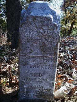
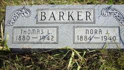
| Description | : | Son of Samuel and Lucinda Elizabeth Isabelle (McGehee) Barker. Married to Minnie B. Miller on Nov. 8, 1907. The 1910 Nemaha County, Kansas, Mitchell Township, has Lewis A. Barker, a farmer, and his wife, Minnie B. Barker. They have had two children, only one is living, George C. age 5, born in MO. Also living with them is his father, Samuel Barker, age 58 & born in KY, widowed, a farmer. A brother William B. Barker, age 13, a wood chopper, is also living with them. Lewis moved to a farm south of Humboldt, Nebraska... Read More |
frequently asked questions (FAQ):
-
Where is Lewis A. Barker's memorial?
Lewis A. Barker's memorial is located at: Humboldt Cemetery, Humboldt, Richardson County, USA.
-
When did Lewis A. Barker death?
Lewis A. Barker death on 30 Aug 1958 in Richardson County, Nebraska, USA
-
Where are the coordinates of the Lewis A. Barker's memorial?
Latitude: 40.1610985
Longitude: -95.9578018
Family Members:
Parent
Spouse
Siblings

Flowers:


Nearby Cemetories:
1. Humboldt Cemetery
Humboldt, Richardson County, USA
Coordinate: 40.1610985, -95.9578018
2. Longbranch Cemetery
Humboldt, Richardson County, USA
Coordinate: 40.1996000, -95.9740000
3. Lynchburg Cemetery
Humboldt, Richardson County, USA
Coordinate: 40.1306000, -95.9068985
4. Standerford Cemetery
Humboldt, Richardson County, USA
Coordinate: 40.2110000, -95.9656000
5. Dry Branch Pioneer Cemetery
Richardson County, USA
Coordinate: 40.1292000, -96.0100021
6. Bohemian Cemetery
Richardson County, USA
Coordinate: 40.1175003, -95.9955978
7. Bohemian Cemetery
Table Rock, Pawnee County, USA
Coordinate: 40.1786003, -96.0374985
8. Starr Cemetery
Dawson, Richardson County, USA
Coordinate: 40.1464005, -95.8692017
9. Mound Cemetery
Humboldt, Richardson County, USA
Coordinate: 40.1960983, -95.8602982
10. Saint Marys Cemetery
Dawson, Richardson County, USA
Coordinate: 40.1307983, -95.8414001
11. Heim Cemetery
Dawson, Richardson County, USA
Coordinate: 40.1380997, -95.8328018
12. Saint Johns Cemetery
Table Rock, Pawnee County, USA
Coordinate: 40.2148000, -96.0657000
13. East Amish Cemetery
Table Rock, Pawnee County, USA
Coordinate: 40.1310000, -96.0854000
14. Four Mile Cemetery
Humboldt, Richardson County, USA
Coordinate: 40.0589000, -95.9455000
15. Pleasant View Cemetery
Auburn, Nemaha County, USA
Coordinate: 40.2681007, -95.9163971
16. Table Rock Cemetery
Table Rock, Pawnee County, USA
Coordinate: 40.1791400, -96.1037400
17. Iliff Cemetery
Dawson, Richardson County, USA
Coordinate: 40.1241989, -95.8127975
18. Athens Cemetery
Richardson County, USA
Coordinate: 40.0449982, -95.9852982
19. Pleasant Hill Cemetery
Richardson County, USA
Coordinate: 40.0471992, -95.9075012
20. Mount Zion Cemetery
Nemaha County, USA
Coordinate: 40.2761002, -96.0113983
21. Saint James Lutheran Cemetery
Nemaha County, USA
Coordinate: 40.2757500, -96.0161500
22. Liberty Township Cemetery
Verdon, Richardson County, USA
Coordinate: 40.1597200, -95.7664100
23. Trinity Lutheran Cemetery
Nemaha County, USA
Coordinate: 40.3058014, -96.0093994
24. Clear Creek Cemetery
Table Rock, Pawnee County, USA
Coordinate: 40.2193985, -96.1391983