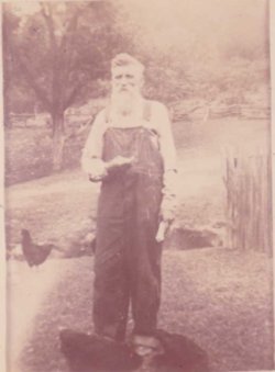
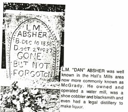
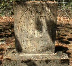
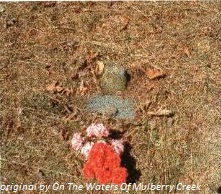
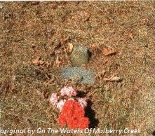
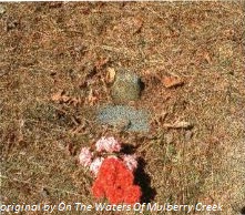
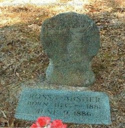
Lewis McDaniel “Dan” Absher
| Birth | : | 10 Dec 1858 Wilkes County, North Carolina, USA |
| Death | : | 29 Oct 1937 Mulberry, Wilkes County, North Carolina, USA |
| Burial | : | Waynoka Municipal Cemetery, Waynoka, Woods County, USA |
| Coordinate | : | 36.5793991, -98.8630981 |
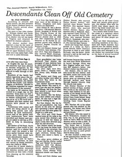
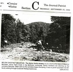
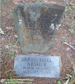
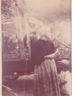
| Description | : | Lewis McDaniel "Dan" Absher was the youngest son & child of the 10 children of Jacob & Sarah Hall Absher. Sarah Hall Absher "his mother" was around the age of 43 when he was born and his father Jacob around the age of 49. "Dan" is first recorded in the 1860 census record "recorded to be age 3" living with his family on the waters of Halls Creek, Lower Division, Wilkes, NC, Post Office, Mulberry. His family consist of Jacob Absher age 51 & Sarah Hall Absher age 46 and "Dan's siblings "Benjamin age 23" "Owen age... Read More |
frequently asked questions (FAQ):
-
Where is Lewis McDaniel “Dan” Absher's memorial?
Lewis McDaniel “Dan” Absher's memorial is located at: Waynoka Municipal Cemetery, Waynoka, Woods County, USA.
-
When did Lewis McDaniel “Dan” Absher death?
Lewis McDaniel “Dan” Absher death on 29 Oct 1937 in Mulberry, Wilkes County, North Carolina, USA
-
Where are the coordinates of the Lewis McDaniel “Dan” Absher's memorial?
Latitude: 36.5793991
Longitude: -98.8630981
Family Members:
Parent
Spouse
Siblings
Children
Flowers:
Nearby Cemetories:
1. Waynoka Municipal Cemetery
Waynoka, Woods County, USA
Coordinate: 36.5793991, -98.8630981
2. Memorial Hill Cemetery
Waynoka, Woods County, USA
Coordinate: 36.6535988, -98.8550034
3. Walnut Grove Cemetery
Woods County, USA
Coordinate: 36.5353012, -98.7827988
4. Ziegler-Lone Star Cemetery
Bouse Junction, Major County, USA
Coordinate: 36.4775009, -98.8617020
5. West Creek Cemetery
Major County, USA
Coordinate: 36.4921989, -98.9317017
6. Highland Cemetery
Woods County, USA
Coordinate: 36.5642014, -98.7292023
7. Galena Cemetery
Waynoka, Woods County, USA
Coordinate: 36.4919014, -98.6980972
8. Avard Cemetery
Avard, Woods County, USA
Coordinate: 36.7103600, -98.7472800
9. Red Top Cemetery
Quinlan, Woodward County, USA
Coordinate: 36.4930992, -99.0402985
10. Manila Cemetery
Alva, Woods County, USA
Coordinate: 36.7580986, -98.7733002
11. Pleasant View Cemetery
Woods County, USA
Coordinate: 36.6385000, -98.6297200
12. Highland Cemetery
Woodward County, USA
Coordinate: 36.5341988, -99.1016998
13. Union Cemetery
Quinlan, Woodward County, USA
Coordinate: 36.4199982, -99.0235977
14. Conner Cemetery
Major County, USA
Coordinate: 36.3768310, -98.8192150
15. Liberty Cemetery
Major County, USA
Coordinate: 36.3624992, -98.8878021
16. Good Hope Cemetery
Woods County, USA
Coordinate: 36.5360985, -98.5875015
17. Star Cemetery
Alva, Woods County, USA
Coordinate: 36.8036003, -98.8277969
18. Fairvalley Cemetery
Woods County, USA
Coordinate: 36.7556000, -99.0419006
19. Lone Star Cemetery
Major County, USA
Coordinate: 36.3725014, -98.7300034
20. Mount Zion Cemetery
Major County, USA
Coordinate: 36.3189011, -98.8491974
21. Lutheran Cemetery
Alva, Woods County, USA
Coordinate: 36.7676315, -98.6331940
22. Curtis Cemetery
Woodward County, USA
Coordinate: 36.4356003, -99.1380997
23. Antioch Cemetery
Major County, USA
Coordinate: 36.3182983, -98.7953033
24. Sacred Heart Cemetery
Alva, Woods County, USA
Coordinate: 36.8044014, -98.6838989

