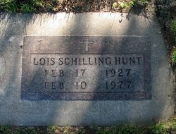
Lois Marie Drewis Hunt
| Birth | : | 17 Feb 1927 Tripoli, Bremer County, Iowa, USA |
| Death | : | 10 Feb 1977 Waverly, Bremer County, Iowa, USA |
| Burial | : | Oakwood Cemetery, Parsons, Labette County, USA |
| Coordinate | : | 37.3375500, -95.2402800 |
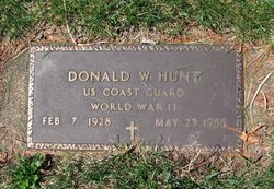
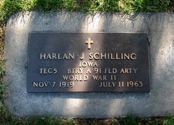
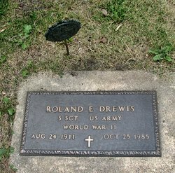
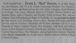
| Description | : | Mrs. Lois Schilling Hunt, 49, a resident of Waverly, died Thursday afternoon Feb. 10, at the Waverly Municipal Hospital where she had been a patient for six days. Lois M. Drewis was born on February 17, 1927 in Tripoli, the daughter of Ernest and Emma Drewis. In 1945 she was united in marriage to Harlan J. Schilling. They lived in Horton, moved to Waverly in 1948, lived in Tripoli for one year before again moving back to Waverly. Mr. Schilling died in 1963. Two years later she was married to Donald Hunt. They were later divorced. For the past six months she... Read More |
frequently asked questions (FAQ):
-
Where is Lois Marie Drewis Hunt's memorial?
Lois Marie Drewis Hunt's memorial is located at: Oakwood Cemetery, Parsons, Labette County, USA.
-
When did Lois Marie Drewis Hunt death?
Lois Marie Drewis Hunt death on 10 Feb 1977 in Waverly, Bremer County, Iowa, USA
-
Where are the coordinates of the Lois Marie Drewis Hunt's memorial?
Latitude: 37.3375500
Longitude: -95.2402800
Family Members:
Parent
Spouse
Siblings
Flowers:
Nearby Cemetories:
1. Oakwood Cemetery
Parsons, Labette County, USA
Coordinate: 37.3375500, -95.2402800
2. Lucken Cemetery
Parsons, Labette County, USA
Coordinate: 37.3547870, -95.2854960
3. Pefley Cemetery
Parsons, Labette County, USA
Coordinate: 37.3564900, -95.2856000
4. Parsons State Hospital Cemetery
Parsons, Labette County, USA
Coordinate: 37.3571060, -95.2856310
5. Calvary Cemetery
Parsons, Labette County, USA
Coordinate: 37.3578100, -95.2855000
6. Memorial Lawn Cemetery
Parsons, Labette County, USA
Coordinate: 37.3013992, -95.2833023
7. Spring Hill Cemetery
Parsons, Labette County, USA
Coordinate: 37.2882000, -95.2497500
8. Mount Olivet Roman Catholic Cemetery
Parsons, Labette County, USA
Coordinate: 37.2998500, -95.2857500
9. Franklin Cemetery
Montana, Labette County, USA
Coordinate: 37.3182983, -95.1746979
10. East Bethany Cemetery
Neosho County, USA
Coordinate: 37.3983002, -95.2692032
11. West Bethany Cemetery
Neosho County, USA
Coordinate: 37.3983002, -95.2699966
12. Center Cemetery
Labette County, USA
Coordinate: 37.3396730, -95.1576630
13. Evergreen Cemetery
Neosho County, USA
Coordinate: 37.4008446, -95.2063217
14. Oak Grove Cemetery
Neosho County, USA
Coordinate: 37.3968925, -95.1700974
15. Fairview Cemetery
Parsons, Labette County, USA
Coordinate: 37.2963700, -95.1408800
16. Old Oak Grove Cemetery
Neosho County, USA
Coordinate: 37.4050751, -95.1635742
17. Ladore Cemetery
Ladore Township, Neosho County, USA
Coordinate: 37.4059000, -95.3169500
18. South Mound Cemetery
South Mound, Neosho County, USA
Coordinate: 37.4349800, -95.2245400
19. Brown Cemetery
Neosho County, USA
Coordinate: 37.4244003, -95.1725006
20. Labette Cemetery
Labette, Labette County, USA
Coordinate: 37.2447014, -95.1772003
21. Valley Cemetery
Galesburg, Neosho County, USA
Coordinate: 37.3986500, -95.3522400
22. Wilsonton Cemetery
Parsons, Labette County, USA
Coordinate: 37.2597700, -95.3397800
23. Richland Cemetery
Neosho County, USA
Coordinate: 37.4024162, -95.1253357
24. Montana Cemetery
Montana, Labette County, USA
Coordinate: 37.2661157, -95.1315282

