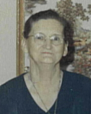
Lona Mae Rhodes Comer
| Birth | : | 28 Dec 1900 Ashe County, North Carolina, USA |
| Death | : | 31 Jul 1979 Norrisville, Harford County, Maryland, USA |
| Burial | : | St Boniface Old Churchyard, Bonchurch, Isle of Wight Unitary Authority, England |
| Coordinate | : | 50.5988889, -1.1850000 |
| Description | : | Lona M. Comer, 78, wife of George W. Comer, died Tuesday, July 31, 1979, at her home, 5138 Jolly Acres Road, White Hall, MD. A homemaker, she was a member of Friendship Baptist Church. Born in North Carolina, she was the daughter of the late Wilburn and Ruth Reedy Rhodes. In addition to her husband, Mrs. Comer is survived by a daughter, Jean Lytle of White Hall; two sons, Odis G. Comer of Greencastle, PA, and C. Darrel Comer of White Hall; 14 grandchildren; nine... Read More |
frequently asked questions (FAQ):
-
Where is Lona Mae Rhodes Comer's memorial?
Lona Mae Rhodes Comer's memorial is located at: St Boniface Old Churchyard, Bonchurch, Isle of Wight Unitary Authority, England.
-
When did Lona Mae Rhodes Comer death?
Lona Mae Rhodes Comer death on 31 Jul 1979 in Norrisville, Harford County, Maryland, USA
-
Where are the coordinates of the Lona Mae Rhodes Comer's memorial?
Latitude: 50.5988889
Longitude: -1.1850000
Family Members:
Parent
Spouse
Siblings
Children
Flowers:
Nearby Cemetories:
1. St Boniface Old Churchyard
Bonchurch, Isle of Wight Unitary Authority, England
Coordinate: 50.5988889, -1.1850000
2. St Boniface Bonchurch Churchyard
Bonchurch, Isle of Wight Unitary Authority, England
Coordinate: 50.6000880, -1.1867990
3. Old Church of St Lawrence
Ventnor, Isle of Wight Unitary Authority, England
Coordinate: 50.5871078, -1.2438191
4. Parish Church of St. Lawrence
Ventnor, Isle of Wight Unitary Authority, England
Coordinate: 50.5858807, -1.2436714
5. Shanklin Cemetery
Shanklin, Isle of Wight Unitary Authority, England
Coordinate: 50.6441740, -1.1738343
6. Shanklin Cemetery
Sandown, Isle of Wight Unitary Authority, England
Coordinate: 50.6445083, -1.1742694
7. Lake Cemetery
Lake, Isle of Wight Unitary Authority, England
Coordinate: 50.6498713, -1.1734786
8. Whitwell New Burial Ground
Whitwell, Isle of Wight Unitary Authority, England
Coordinate: 50.5943366, -1.2689275
9. Christ Churchyard
Sandown, Isle of Wight Unitary Authority, England
Coordinate: 50.6521319, -1.1621056
10. All Saints Churchyard
Godshill, Isle of Wight Unitary Authority, England
Coordinate: 50.6336900, -1.2558300
11. Niton Baptist Church
Ventnor, Isle of Wight Unitary Authority, England
Coordinate: 50.5850100, -1.2864900
12. St Mary the Virgin Churchyard
Brading, Isle of Wight Unitary Authority, England
Coordinate: 50.6824400, -1.1429600
13. Billingham Manor
Newport, Isle of Wight Unitary Authority, England
Coordinate: 50.6347663, -1.3140535
14. St Olave's Churchyard
Gatcombe, Isle of Wight Unitary Authority, England
Coordinate: 50.6636110, -1.3041670
15. Lane End Cemetery
Bembridge, Isle of Wight Unitary Authority, England
Coordinate: 50.6863554, -1.0809575
16. St Peter's
Havenstreet, Isle of Wight Unitary Authority, England
Coordinate: 50.7095580, -1.2063290
17. St Peter New Churchyard
Shorwell, Isle of Wight Unitary Authority, England
Coordinate: 50.6433100, -1.3541400
18. Carisbrooke Priory
Carisbrooke, Isle of Wight Unitary Authority, England
Coordinate: 50.6859710, -1.3070000
19. St Peter's Parish Church
Shorwell, Isle of Wight Unitary Authority, England
Coordinate: 50.6449290, -1.3545580
20. St. Johns Churchyard
Ryde, Isle of Wight Unitary Authority, England
Coordinate: 50.7149770, -1.1482370
21. Carisbrooke Cemetery
Carisbrooke, Isle of Wight Unitary Authority, England
Coordinate: 50.6882160, -1.3083040
22. St Thomas Church
Newport, Isle of Wight Unitary Authority, England
Coordinate: 50.6997610, -1.2940130
23. Newport Cemetery
Newport, Isle of Wight Unitary Authority, England
Coordinate: 50.7041360, -1.2887540
24. St Paul's Cemetery
Newport, Isle of Wight Unitary Authority, England
Coordinate: 50.7072300, -1.2827400


