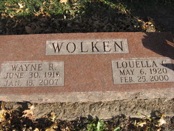
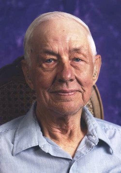
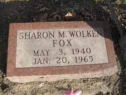
Louella Grace Elben Wolken
| Birth | : | 6 May 1920 Missouri, USA |
| Death | : | 25 Feb 2000 Marshall County, Iowa, USA |
| Burial | : | Fordington Cemetery, Dorchester, West Dorset District, England |
| Coordinate | : | 50.7131110, -2.4263720 |
| Description | : | 1940 United States Federal Census about Luella Wolken Name: Luella Wolken Age: 19 Estimated Birth Year: abt 1921 Gender: Female Race: White Birthplace: Missouri Marital Status: Married Relation to Head of House: Wife Home in 1940: Marshalltown, Marshall, Iowa View Map Street: Woodbury Street House Number: 512 1/2 Inferred Residence in 1935: Marshalltown, Marshall, Iowa Residence in 1935: Same Place Sheet Number: 16A Attended School or College: No Highest Grade Completed: High School, 3rd year Neighbors: View others on page Household Members: Name Age Wayne Wolken 24 Luella Wolken 19 Social Security Death Index about Louella G. Wolken Name: Louella G.... Read More |
frequently asked questions (FAQ):
-
Where is Louella Grace Elben Wolken's memorial?
Louella Grace Elben Wolken's memorial is located at: Fordington Cemetery, Dorchester, West Dorset District, England.
-
When did Louella Grace Elben Wolken death?
Louella Grace Elben Wolken death on 25 Feb 2000 in Marshall County, Iowa, USA
-
Where are the coordinates of the Louella Grace Elben Wolken's memorial?
Latitude: 50.7131110
Longitude: -2.4263720
Family Members:
Spouse
Children
Flowers:
Nearby Cemetories:
1. Fordington Cemetery
Dorchester, West Dorset District, England
Coordinate: 50.7131110, -2.4263720
2. St George's Churchyard
Fordington, West Dorset District, England
Coordinate: 50.7136510, -2.4286550
3. Dorchester Gallows Hill Cemetery
Dorchester, West Dorset District, England
Coordinate: 50.7127930, -2.4315480
4. All Saints Churchyard
Dorchester, West Dorset District, England
Coordinate: 50.7153670, -2.4355750
5. Dorchester Gaol Cemetery
Dorchester, West Dorset District, England
Coordinate: 50.7153670, -2.4355750
6. Greyfriars Churchyard
Dorchester, West Dorset District, England
Coordinate: 50.7172150, -2.4354070
7. St. Peter's Church
Dorchester, West Dorset District, England
Coordinate: 50.7155740, -2.4369030
8. Holy Trinity Church
Dorchester, West Dorset District, England
Coordinate: 50.7154890, -2.4379470
9. Maumbury Rings Cemetery
Dorchester, West Dorset District, England
Coordinate: 50.7079000, -2.4403900
10. Dorchester Cemetery
Dorchester, West Dorset District, England
Coordinate: 50.7062110, -2.4422800
11. Poundbury Cemetery
Dorchester, West Dorset District, England
Coordinate: 50.7181090, -2.4544830
12. West Stafford New Burial Ground
Dorchester, West Dorset District, England
Coordinate: 50.7050192, -2.3872764
13. St Mary the Virgin Churchyard
Charminster, West Dorset District, England
Coordinate: 50.7330600, -2.4557900
14. Charminster Cemetery
Charminster, Bournemouth Unitary Authority, England
Coordinate: 50.7341430, -2.4627060
15. St. Martin's Churchyard
Broadmayne, West Dorset District, England
Coordinate: 50.6787530, -2.3856840
16. St. Mary's Churchyard
Bradford Peverell, West Dorset District, England
Coordinate: 50.7356600, -2.4857900
17. Holy Trinity
Bincombe, West Dorset District, England
Coordinate: 50.6598000, -2.4449000
18. St Laurence Churchyard
Upwey, Weymouth and Portland Borough, England
Coordinate: 50.6658560, -2.4813840
19. St Mary the Virgin Churchyard
Piddlehinton, West Dorset District, England
Coordinate: 50.7732980, -2.4045680
20. St. Mary the Virgin Churchyard
Puddletown, West Dorset District, England
Coordinate: 50.7484670, -2.3434700
21. St. Andrew's Churchyard
Preston, West Dorset District, England
Coordinate: 50.6456500, -2.4173900
22. Broadwey New Cemetery
Broadwey, Weymouth and Portland Borough, England
Coordinate: 50.6512040, -2.4702530
23. St Nicholas Churchyard
Broadwey, Weymouth and Portland Borough, England
Coordinate: 50.6504630, -2.4712110
24. Holy Trinity Churchyard
Godmanstone, West Dorset District, England
Coordinate: 50.7748310, -2.4750600


