| Birth | : | 19 Jun 1893 |
| Death | : | 29 Oct 1965 |
| Burial | : | Lower Amwell Cemetery - New Yard, Sergeantsville, Hunterdon County, USA |
| Coordinate | : | 40.4475098, -74.9133453 |
| Plot | : | Block 17, Lot 03, Space 05 |
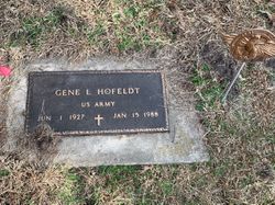
| Description | : | Husband of Adella Graham Coddington Hofeldt (Buried in the Grandview Cemetery, Long Pine, Nebraska). ____________________ Memorial Stone Reads: (THE SIGN OF THE CROSS) LOUIS A HOFELDT SOUTH DAKOTA PFC MG CO 349 INFANTRY WORLD WAR I JUNE 19 1893 OCT 29 1965 ____________________ SPRINGVIEW HERALD Thursday November 18, 1965 Springview Keya Paha County Nebraska Louis A. Hofeldt Funeral services for Louis A. Hofeldt were conducted Nov. 2, 1965, in the Methodist church in Winner, S. S., the REV. James Patten officiating. Acting pallbearers were John Larsen, Lawrence Jerred. Raymond Storm, Arthur Storm, Frank Larsh and Ralph Longcor, JR., Honorary passbearers were Elizie Fast. E. H. Graham, Walter Hellmann and James and Robert Fuggins, Mrs. Walter... Read More |
frequently asked questions (FAQ):
-
Where is Louis A. Hofeldt's memorial?
Louis A. Hofeldt's memorial is located at: Lower Amwell Cemetery - New Yard, Sergeantsville, Hunterdon County, USA.
-
When did Louis A. Hofeldt death?
Louis A. Hofeldt death on 29 Oct 1965 in
-
Where are the coordinates of the Louis A. Hofeldt's memorial?
Latitude: 40.4475098
Longitude: -74.9133453
Family Members:
Parent
Spouse
Siblings
Children
Flowers:
Nearby Cemetories:
1. Lower Amwell Cemetery - New Yard
Sergeantsville, Hunterdon County, USA
Coordinate: 40.4475098, -74.9133453
2. Lower Amwell Cemetery - Old Yard
Sergeantsville, Hunterdon County, USA
Coordinate: 40.4479866, -74.9134750
3. Moore Family Burying Ground
Sergeantsville, Hunterdon County, USA
Coordinate: 40.4414400, -74.9008720
4. Rake Family Burying Ground
Sand Brook, Hunterdon County, USA
Coordinate: 40.4598999, -74.9170914
5. Opdycke Cemetery
Hunterdon County, USA
Coordinate: 40.4375000, -74.9250000
6. Sand Brook German Baptist Church Cemetery
Sand Brook, Hunterdon County, USA
Coordinate: 40.4687500, -74.9162216
7. Sutton Farm Cemetery
Hunterdon County, USA
Coordinate: 40.4737206, -74.9048309
8. Barber Burying Ground
Sandy Ridge, Hunterdon County, USA
Coordinate: 40.4190292, -74.9282608
9. Sergeantville Methodist Episcopal Church Cemetery
Sergeantsville, Hunterdon County, USA
Coordinate: 40.4458333, -74.9538880
10. Saint Andrews Episcopal Churchyard
Ringoes, Hunterdon County, USA
Coordinate: 40.4406586, -74.8734360
11. Trout Family Burying Ground
Sand Brook, Hunterdon County, USA
Coordinate: 40.4777778, -74.8972222
12. Servis-Quick Family Cemetery
Ringoes, Hunterdon County, USA
Coordinate: 40.4375000, -74.8722220
13. Kitchen Cemetery
Sand Brook, Hunterdon County, USA
Coordinate: 40.4803810, -74.9092480
14. Union Cemetery
Ringoes, Hunterdon County, USA
Coordinate: 40.4261017, -74.8732986
15. Pine Hill Cemetery
Sergeantsville, Hunterdon County, USA
Coordinate: 40.4580498, -74.9622192
16. Sandy Ridge Cemetery
Sandy Ridge, Hunterdon County, USA
Coordinate: 40.4232178, -74.9541168
17. Geary Gravesite
Amwell, Hunterdon County, USA
Coordinate: 40.4561386, -74.8564301
18. Amwell Ridge Cemetery
Ringoes, Hunterdon County, USA
Coordinate: 40.4415970, -74.8554840
19. Second English Presbyterian Church Cemetery
Amwell, Hunterdon County, USA
Coordinate: 40.3984718, -74.9072189
20. Carmelite Monastery Cemetery
Flemington, Hunterdon County, USA
Coordinate: 40.4976610, -74.8980680
21. Williamson Farm Family Cemetery
Stockton, Hunterdon County, USA
Coordinate: 40.4457220, -74.9818690
22. Locktown Christian Cemetery
Locktown, Hunterdon County, USA
Coordinate: 40.4820137, -74.9694443
23. Valley School Cemetery
Hunterdon County, USA
Coordinate: 40.4981500, -74.8814430
24. Old School Baptist Cemetery
Locktown, Hunterdon County, USA
Coordinate: 40.4844290, -74.9725060


