| Birth | : | Apr 1883 Sartoria, Buffalo County, Nebraska, USA |
| Death | : | 26 Apr 1952 Kearney, Buffalo County, Nebraska, USA |
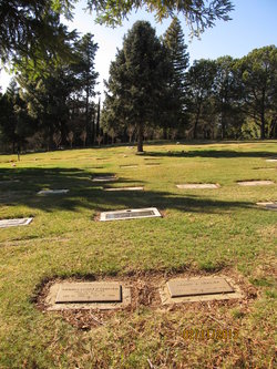
| Burial | : | Cold Springs Cemetery, Cold Springs, El Dorado County, USA |
| Coordinate | : | 38.7441444, -120.8721619 |
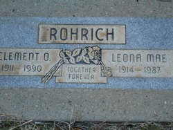
| Inscription | : | wife of Gust |
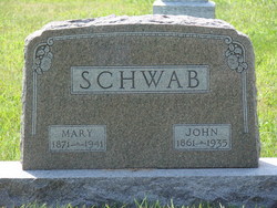
| Description | : | Louise Schwab Rohrich, daughter of John and Louise Schwab, was born April 2, 1883 near Sartoria, Nebraska where she spent her girlhood. On November 27, 1900, she was united in marriage to Gust Rohrich and to this union were born eight children, two preceding her in death, Lenora, age 5 months in 1903, and Rosalie age 10 in 1936. She spent her entire life in Buffalo County. She was a faithful wife and a kind and loving Mother and Grandmother and always generous with assistance to her friends and neighbors. She bore her long suffering patiently and without complaint. |
frequently asked questions (FAQ):
-
Where is Louisa E. Schwab Rohrich's memorial?
Louisa E. Schwab Rohrich's memorial is located at: Cold Springs Cemetery, Cold Springs, El Dorado County, USA.
-
When did Louisa E. Schwab Rohrich death?
Louisa E. Schwab Rohrich death on 26 Apr 1952 in Kearney, Buffalo County, Nebraska, USA
-
Where are the coordinates of the Louisa E. Schwab Rohrich's memorial?
Latitude: 38.7441444
Longitude: -120.8721619
Family Members:
Parent
Spouse
Siblings
Children
Flowers:
Nearby Cemetories:
1. Cold Springs Cemetery
Cold Springs, El Dorado County, USA
Coordinate: 38.7441444, -120.8721619
2. Gold Hill Cemetery
Gold Hill, El Dorado County, USA
Coordinate: 38.7604010, -120.8849970
3. Wakamastu Tea and Silk Farm Colony Burial Site
Coloma, El Dorado County, USA
Coordinate: 38.7674100, -120.8858100
4. Westwood Hills Memorial Park
Placerville, El Dorado County, USA
Coordinate: 38.7367363, -120.8326035
5. Westwood Hills Memorial Park Pet Cemetery
Placerville, El Dorado County, USA
Coordinate: 38.7365210, -120.8323130
6. Middletown Cemetery
Placerville, El Dorado County, USA
Coordinate: 38.7358704, -120.8301010
7. Missouri Flat Cemetery
Placerville, El Dorado County, USA
Coordinate: 38.7157360, -120.8403400
8. Kingsville Cemetery
El Dorado, El Dorado County, USA
Coordinate: 38.6993870, -120.8516060
9. Chili Bar Toll House Cemetery
Placerville, El Dorado County, USA
Coordinate: 38.7700530, -120.8177660
10. Jewish Pioneer Cemetery
Placerville, El Dorado County, USA
Coordinate: 38.7299500, -120.8091965
11. Placerville Union Cemetery
Placerville, El Dorado County, USA
Coordinate: 38.7317390, -120.8084106
12. Pioneer Cemetery
Coloma, El Dorado County, USA
Coordinate: 38.7943192, -120.8894577
13. Boles Family Cemetery
Placerville, El Dorado County, USA
Coordinate: 38.7309860, -120.8069580
14. Saint Patrick Cemetery
Placerville, El Dorado County, USA
Coordinate: 38.7327995, -120.8047638
15. Old Placerville City Cemetery
Placerville, El Dorado County, USA
Coordinate: 38.7258987, -120.8059464
16. County Hospital Cemetery
Placerville, El Dorado County, USA
Coordinate: 38.7342796, -120.8028488
17. James Marshall Monument and Gravesite
Coloma, El Dorado County, USA
Coordinate: 38.7963104, -120.8953781
18. Saint John's Catholic Churchyard
Coloma, El Dorado County, USA
Coordinate: 38.7975311, -120.8919678
19. Old Saint Patricks Cemetery
Placerville, El Dorado County, USA
Coordinate: 38.7249107, -120.8024673
20. Rose Springs Cemetery
Rescue, El Dorado County, USA
Coordinate: 38.7146150, -120.9398390
21. Indian Creek Cemetery
Coloma, El Dorado County, USA
Coordinate: 38.7974230, -120.9104530
22. Methodist Episcopal Federated Cemetery
Placerville, El Dorado County, USA
Coordinate: 38.7283287, -120.7942200
23. Uniontown Cemetery
Lotus, El Dorado County, USA
Coordinate: 38.7994003, -120.9111023
24. Carpenter Family Residence Burial Plot
Diamond Springs, El Dorado County, USA
Coordinate: 38.6941590, -120.8187750


