
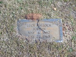
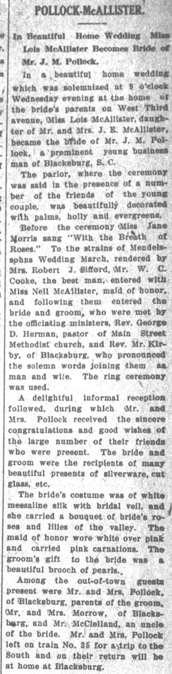
Lucy Pollock Jordan
| Birth | : | 6 May 1887 |
| Death | : | 22 May 1968 |
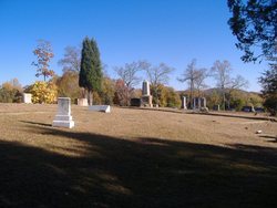
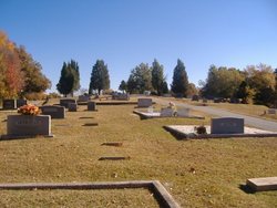
| Burial | : | St. Peter and St. Paul Churchyard, Charing, Ashford Borough, England |
| Coordinate | : | 51.2102230, 0.7966500 |
frequently asked questions (FAQ):
-
Where is Lucy Pollock Jordan's memorial?
Lucy Pollock Jordan's memorial is located at: St. Peter and St. Paul Churchyard, Charing, Ashford Borough, England.
-
When did Lucy Pollock Jordan death?
Lucy Pollock Jordan death on 22 May 1968 in
-
Where are the coordinates of the Lucy Pollock Jordan's memorial?
Latitude: 51.2102230
Longitude: 0.7966500
Family Members:
Parent
Siblings
Flowers:


Nearby Cemetories:
1. St. Peter and St. Paul Churchyard
Charing, Ashford Borough, England
Coordinate: 51.2102230, 0.7966500
2. Charing Cemetery
Charing, Ashford Borough, England
Coordinate: 51.2120247, 0.7922290
3. Kent County Crematorium
Charing, Ashford Borough, England
Coordinate: 51.2026560, 0.8006770
4. Holy Trinity Churchyard
Charing Heath, Ashford Borough, England
Coordinate: 51.2117420, 0.7510860
5. St. Mary's Churchyard
Stalisfield, Swale Borough, England
Coordinate: 51.2371410, 0.8169790
6. Westwell Burial Ground
Westwell, Ashford Borough, England
Coordinate: 51.1900100, 0.8434000
7. St Mary Churchyard
Westwell, Ashford Borough, England
Coordinate: 51.1919020, 0.8473350
8. St. Nicholas' Churchyard
Pluckley, Ashford Borough, England
Coordinate: 51.1749440, 0.7548470
9. St. James Churchyard
Egerton, Ashford Borough, England
Coordinate: 51.1953860, 0.7295170
10. Church of St. Margaret
Hothfield, Ashford Borough, England
Coordinate: 51.1661000, 0.8158000
11. St Cosmas and St Damian Churchyard
Challock, Ashford Borough, England
Coordinate: 51.2065340, 0.8781660
12. Lenham Cemetery
Lenham, Maidstone Borough, England
Coordinate: 51.2389480, 0.7223940
13. St Mary Churchyard
Lenham, Maidstone Borough, England
Coordinate: 51.2366860, 0.7191470
14. Egerton Free Church Graveyard
Egerton, Ashford Borough, England
Coordinate: 51.1871830, 0.7050080
15. St. Laurence Churchyard
Leaveland, Swale Borough, England
Coordinate: 51.2501510, 0.8773610
16. St. Nicholas' Churchyard
Boughton Malherbe, Maidstone Borough, England
Coordinate: 51.2142160, 0.6935330
17. St. Mary Churchyard
Eastling, Swale Borough, England
Coordinate: 51.2740700, 0.8155000
18. St. Michael and All Angels Churchyard
Throwley, Swale Borough, England
Coordinate: 51.2651000, 0.8540800
19. St. Margaret's Churchyard
Wichling, Maidstone Borough, England
Coordinate: 51.2682226, 0.7455862
20. St Peter Churchyard
Molash, Ashford Borough, England
Coordinate: 51.2328420, 0.8974670
21. St. Mary the Virgin Churchyard
Great Chart, Ashford Borough, England
Coordinate: 51.1422350, 0.8285800
22. All Saints Churchyard
Boughton Aluph, Ashford Borough, England
Coordinate: 51.1963280, 0.9086490
23. St. Mary's Churchyard
Kennington, Ashford Borough, England
Coordinate: 51.1699560, 0.8911560
24. Bybrook Cemetery
Ashford, Ashford Borough, England
Coordinate: 51.1590520, 0.8782920