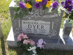
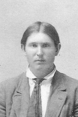
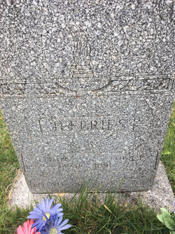
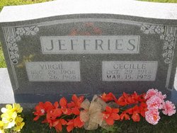
Margera Jeffries Dyer
| Birth | : | 22 Feb 1923 Kaiser, Miller County, Missouri, USA |
| Death | : | 30 Oct 1998 Osage Beach, Camden County, Missouri, USA |
| Burial | : | Clayhall Naval Cemetery, Gosport, Gosport Borough, England |
| Coordinate | : | 50.7833862, -1.1373420 |
| Description | : | Jefferson City News Tribune, Sunday, November 1, 1998 Margera Dyer, 75, Ulman, died Oct. 30, 1998, at Lake of the Ozarks General Hospital, Osage Beach. She was born Feb. 22, 1923, in Old Bagnell, a daughter of Elmer and Flora Pearl Bledsoe Jeffries. She worked as a dietary technician at Miller County Nursing Home in Tuscumbia. She attended Brumley Christian Church. Survivors include: five daughters, Helen Riley, Crocker, Bonnie Carter, Morehead, Ky., Phyllis Burdge, Seneca, Peggy Robinson, Montreal, and Linda Wynne, Hindsville, Ark.; two sons, Leroy Jeffries, Stoutland, and Wayne Boatman, Eldon; one sister, Irene Smith, Hanford, Calif.; two... Read More |
frequently asked questions (FAQ):
-
Where is Margera Jeffries Dyer's memorial?
Margera Jeffries Dyer's memorial is located at: Clayhall Naval Cemetery, Gosport, Gosport Borough, England.
-
When did Margera Jeffries Dyer death?
Margera Jeffries Dyer death on 30 Oct 1998 in Osage Beach, Camden County, Missouri, USA
-
Where are the coordinates of the Margera Jeffries Dyer's memorial?
Latitude: 50.7833862
Longitude: -1.1373420
Family Members:
Parent
Spouse
Siblings
Children
Flowers:
Nearby Cemetories:
1. Clayhall Naval Cemetery
Gosport, Gosport Borough, England
Coordinate: 50.7833862, -1.1373420
2. Turkish Naval Cemetery
Gosport, Gosport Borough, England
Coordinate: 50.7840710, -1.1383980
3. St. Mark's Churchyard
Alverstoke, Gosport Borough, England
Coordinate: 50.7826800, -1.1436100
4. St Mary Churchyard
Alverstoke, Gosport Borough, England
Coordinate: 50.7856760, -1.1480810
5. Holy Trinity Churchyard
Gosport, Gosport Borough, England
Coordinate: 50.7930600, -1.1207620
6. St John the Evangelist Churchyard
Gosport, Gosport Borough, England
Coordinate: 50.7995600, -1.1397800
7. Ann's Hill Cemetery
Gosport, Gosport Borough, England
Coordinate: 50.7982670, -1.1549450
8. Royal Garrison Churchyard
Portsmouth, Portsmouth Unitary Authority, England
Coordinate: 50.7890180, -1.1040520
9. Royal Garrison Church Churchyard
Plymouth, Plymouth Unitary Authority, England
Coordinate: 50.7889690, -1.1039650
10. Portsmouth Cathedral Churchyard
Portsmouth, Portsmouth Unitary Authority, England
Coordinate: 50.7904650, -1.1043720
11. Portsmouth Unitarian Church
Portsmouth, Portsmouth Unitary Authority, England
Coordinate: 50.7915640, -1.1011840
12. HMS Victory Ship
Portsmouth, Portsmouth Unitary Authority, England
Coordinate: 50.8017290, -1.1095590
13. Portsmouth Naval Memorial
Portsmouth, Portsmouth Unitary Authority, England
Coordinate: 50.7824440, -1.0957720
14. St Thomas the Apostle Churchyard
Gosport, Gosport Borough, England
Coordinate: 50.8137570, -1.1484570
15. HMS Victoria Monument
Portsmouth, Portsmouth Unitary Authority, England
Coordinate: 50.7997200, -1.0950800
16. St Mary the Virgin Churchyard
Gosport, Gosport Borough, England
Coordinate: 50.8112690, -1.1724800
17. Old Jewish Cemetery
Portsmouth, Portsmouth Unitary Authority, England
Coordinate: 50.7887000, -1.0738800
18. Mile End Cemetery
Portsea, Portsmouth Unitary Authority, England
Coordinate: 50.8108900, -1.0876400
19. St. Mary's Churchyard
Portsea, Portsmouth Unitary Authority, England
Coordinate: 50.8035350, -1.0763490
20. Highland Road Cemetery
Portsmouth, Portsmouth Unitary Authority, England
Coordinate: 50.7860500, -1.0671790
21. Kingston Cemetery
Portsmouth, Portsmouth Unitary Authority, England
Coordinate: 50.8031440, -1.0683260
22. Lee-On-Solent Memorial
Lee-on-the-Solent, Gosport Borough, England
Coordinate: 50.8045110, -1.2068440
23. Milton Cemetery
Portsmouth, Portsmouth Unitary Authority, England
Coordinate: 50.7988700, -1.0608030
24. St James Churchyard
Eastney, Portsmouth Unitary Authority, England
Coordinate: 50.7940650, -1.0581150

