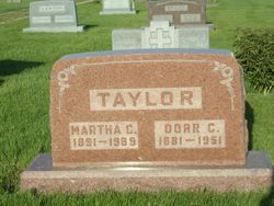
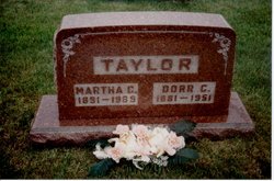
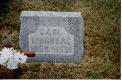
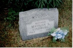
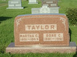
Martha Christina Lindberg Taylor
| Birth | : | 1891 |
| Death | : | 16 Jul 1989 El Centro, Imperial County, California, USA |
| Burial | : | St Mary Magdalene, Langridge, Bath and North East Somerset Unitary Authority, England |
| Coordinate | : | 51.4242860, -2.3750640 |
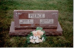
| Description | : | Dorr Taylor was married to Martha Lindberg. After Dorrs death Martha lived with her sister Mary Pierce in San Diego, CA. Later, in 1987 Mary died in a rest home and Martha moved to El Centro, CA into another rest home and died in 1989. Robert Pierce, son of Mary transfered burial of Martha to Guss cemetery in Iowa to be with her husband Dorr and Mary. Robert Pierce died on April 1, 2001 at his home in Ocotillo, CA. from cancer. He was buried at Evergreen cemetery in El Centro, CA. Robert was a Peral Harbor survivor and was... Read More |
frequently asked questions (FAQ):
-
Where is Martha Christina Lindberg Taylor's memorial?
Martha Christina Lindberg Taylor's memorial is located at: St Mary Magdalene, Langridge, Bath and North East Somerset Unitary Authority, England.
-
When did Martha Christina Lindberg Taylor death?
Martha Christina Lindberg Taylor death on 16 Jul 1989 in El Centro, Imperial County, California, USA
-
Where are the coordinates of the Martha Christina Lindberg Taylor's memorial?
Latitude: 51.4242860
Longitude: -2.3750640
Family Members:
Parent
Spouse
Siblings
Flowers:
Nearby Cemetories:
1. St Mary Magdalene
Langridge, Bath and North East Somerset Unitary Authority, England
Coordinate: 51.4242860, -2.3750640
2. All Saints Churchyard
Woolley, Bath and North East Somerset Unitary Authority, England
Coordinate: 51.4149600, -2.3612130
3. St. Mary the Blessed Virgin Churchyard
Swainswick, Bath and North East Somerset Unitary Authority, England
Coordinate: 51.4142080, -2.3514370
4. Landsdowne Hill Burial Ground
Lansdown, Bath and North East Somerset Unitary Authority, England
Coordinate: 51.4314290, -2.4014230
5. Lansdown Cemetery
Lansdown, Bath and North East Somerset Unitary Authority, England
Coordinate: 51.4063620, -2.3780520
6. Blessed Virgin Mary Churchyard
Charlcombe, Bath and North East Somerset Unitary Authority, England
Coordinate: 51.4046040, -2.3629440
7. Countess of Huntingdon's Chapel
Walcot, Bath and North East Somerset Unitary Authority, England
Coordinate: 51.3967020, -2.3907434
8. All Saints Churchyard
Weston, Bath and North East Somerset Unitary Authority, England
Coordinate: 51.3956850, -2.3881320
9. Holy Trinity Churchyard
Cold Ashton, South Gloucestershire Unitary Authority, England
Coordinate: 51.4530440, -2.3597430
10. St. Martin Churchyard
Northstoke, Bath and North East Somerset Unitary Authority, England
Coordinate: 51.4202400, -2.4273800
11. St Saviour's Church Crypt
Larkhall, Bath and North East Somerset Unitary Authority, England
Coordinate: 51.3956300, -2.3465100
12. Church of St Catherine
St Catherine, Bath and North East Somerset Unitary Authority, England
Coordinate: 51.4308200, -2.3212100
13. St Catherine Churchyard
Batheaston, Bath and North East Somerset Unitary Authority, England
Coordinate: 51.4307700, -2.3209500
14. Independent Burial Ground Argyle Chapel
Bath, Bath and North East Somerset Unitary Authority, England
Coordinate: 51.3925420, -2.3536920
15. Moravian Burial Ground
Bath, Bath and North East Somerset Unitary Authority, England
Coordinate: 51.3894150, -2.3798150
16. Walcot Methodist Chapel Burial Ground
Bath, Bath and North East Somerset Unitary Authority, England
Coordinate: 51.3897080, -2.3579610
17. St John the Baptist Churchyard
Batheaston, Bath and North East Somerset Unitary Authority, England
Coordinate: 51.4097940, -2.3213520
18. St. Swithin Churchyard
Bath, Bath and North East Somerset Unitary Authority, England
Coordinate: 51.3885480, -2.3594500
19. St. John the Baptist Churchyard
Bathwick, Bath and North East Somerset Unitary Authority, England
Coordinate: 51.3886890, -2.3547030
20. Locksbrook St Saviour's Cemetery
Bath and North East Somerset Unitary Authority, England
Coordinate: 51.3867880, -2.3863380
21. St. Michael's Cemetery
Bath, Bath and North East Somerset Unitary Authority, England
Coordinate: 51.3859700, -2.3814500
22. St. Mary's Churchyard
Bathwick, Bath and North East Somerset Unitary Authority, England
Coordinate: 51.3876120, -2.3543540
23. Locksbrook Cemetery
Lower Weston, Bath and North East Somerset Unitary Authority, England
Coordinate: 51.3845180, -2.3850300
24. St. Michael's Burial Ground
Bath, Bath and North East Somerset Unitary Authority, England
Coordinate: 51.3838810, -2.3594090

