
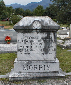

Martha R O'Shields Morris
| Birth | : | 28 Oct 1867 Greenville County, South Carolina, USA |
| Death | : | 10 Apr 1946 Polk County, North Carolina, USA |
| Burial | : | St. James' Churchyard, Briercliffe, Burnley Borough, England |
| Coordinate | : | 53.8107700, -2.2031800 |
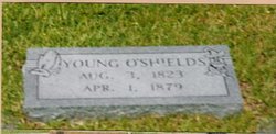
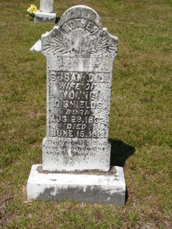
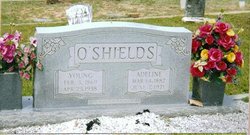
| Description | : | Daughter of Young & Susan Dill O'Shields; wife of J Seymore Morris; mother of Pearl, Maggie Sue, Robert Lee, Nora & Nina. |
frequently asked questions (FAQ):
-
Where is Martha R O'Shields Morris's memorial?
Martha R O'Shields Morris's memorial is located at: St. James' Churchyard, Briercliffe, Burnley Borough, England.
-
When did Martha R O'Shields Morris death?
Martha R O'Shields Morris death on 10 Apr 1946 in Polk County, North Carolina, USA
-
Where are the coordinates of the Martha R O'Shields Morris's memorial?
Latitude: 53.8107700
Longitude: -2.2031800
Family Members:
Parent
Spouse

Siblings
Children
Flowers:


Nearby Cemetories:
1. St. James' Churchyard
Briercliffe, Burnley Borough, England
Coordinate: 53.8107700, -2.2031800
2. Haggate Baptist Church Burial Ground
Burnley Borough, England
Coordinate: 53.8145048, -2.1960725
3. Hill Lane Baptist Church Churchyard
Briercliffe, Burnley Borough, England
Coordinate: 53.8161467, -2.1875368
4. Marsden Friends Burial Ground
Marsden, Metropolitan Borough of Kirklees, England
Coordinate: 53.8241910, -2.2197410
5. St. Paul's Churchyard
Nelson, Pendle Borough, England
Coordinate: 53.8289250, -2.2157520
6. John Ecroyd's Orchard
Lancaster, City of Lancaster, England
Coordinate: 53.8201990, -2.1697920
7. St. John the Evangelist Churchyard
Worsthorne, Burnley Borough, England
Coordinate: 53.7877640, -2.1887420
8. Ebenezer Baptist Chapel Chapelyard
Burnley, Burnley Borough, England
Coordinate: 53.7975120, -2.2397260
9. St. John the Evangelist Churchyard
Nelson, Pendle Borough, England
Coordinate: 53.8367000, -2.1977200
10. St. Peter's Churchyard
Burnley, Burnley Borough, England
Coordinate: 53.7924450, -2.2394890
11. Nelson Cemetery
Nelson, Pendle Borough, England
Coordinate: 53.8420330, -2.1972230
12. St. James' Churchyard
Burnley, Burnley Borough, England
Coordinate: 53.7905590, -2.2458280
13. Holy Trinity Churchyard
Burnley, Burnley Borough, England
Coordinate: 53.7898290, -2.2574200
14. Wheatley Lane Inghamite Church Churchyard
Wheatley Lane, Pendle Borough, England
Coordinate: 53.8412800, -2.2457100
15. All Souls Cemetery
Barrowford, Pendle Borough, England
Coordinate: 53.8462900, -2.2355600
16. Wheatley Lane Methodist Churchyard
Fence, Pendle Borough, England
Coordinate: 53.8341457, -2.2596202
17. Barrowford Cemetery
Nelson, Pendle Borough, England
Coordinate: 53.8521100, -2.2130300
18. St. Thomas Churchyard
Barrowford, Pendle Borough, England
Coordinate: 53.8513900, -2.2196600
19. St. Anne Churchyard
Fence, Pendle Borough, England
Coordinate: 53.8304372, -2.2679552
20. West Street Inghamite Chapel Chapelyard
Colne, Pendle Borough, England
Coordinate: 53.8555930, -2.1672140
21. St. Bartholomew Churchyard
Colne, Pendle Borough, England
Coordinate: 53.8570600, -2.1700470
22. St. Mary the Virgin Churchyard
Trawden Forest, Pendle Borough, England
Coordinate: 53.8431010, -2.1366050
23. St John Churchyard
Higham, Pendle Borough, England
Coordinate: 53.8251420, -2.2898120
24. Trawden Wesley Chapel Graveyard
Trawden Forest, Pendle Borough, England
Coordinate: 53.8459885, -2.1355791