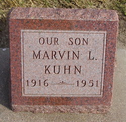
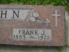
Marvin L. Kuhn
| Birth | : | 16 Mar 1916 Blue Hill, Webster County, Nebraska, USA |
| Death | : | 29 Oct 1951 Hastings, Adams County, Nebraska, USA |
| Burial | : | Poplar Grove Cemetery, Dyer, Gibson County, USA |
| Coordinate | : | 36.0574989, -88.9389038 |
| Plot | : | SW section Lot 12 |
| Description | : | MARVIN KUHN FOUND DEAD NEAR CAR Marvin L. Kuhn, 35, of 422 South Lexington, of Hastings, was found Monday morning lying by his auto with the motor running in the parking lot just west of Dalton's Cafe, on highway 281 and 6, according to the Hastings Daily Tribune. Police Chief George Maul and Adams County Attorney Richard Hundter were called to investigate the death after the man was found by John Colburn, Janitor at the cafe. Colburn told authorities he noticed the car motor running and went over to the car. Kuhn was lying at the side of the... Read More |
frequently asked questions (FAQ):
-
Where is Marvin L. Kuhn's memorial?
Marvin L. Kuhn's memorial is located at: Poplar Grove Cemetery, Dyer, Gibson County, USA.
-
When did Marvin L. Kuhn death?
Marvin L. Kuhn death on 29 Oct 1951 in Hastings, Adams County, Nebraska, USA
-
Where are the coordinates of the Marvin L. Kuhn's memorial?
Latitude: 36.0574989
Longitude: -88.9389038
Family Members:
Parent
Siblings
Flowers:
Nearby Cemetories:
1. Poplar Grove Cemetery
Dyer, Gibson County, USA
Coordinate: 36.0574989, -88.9389038
2. New Bethlehem Memorial Cemetery
Dyer, Gibson County, USA
Coordinate: 36.0689090, -88.9452540
3. New Bethlehem Baptist Church Cemetery
Dyer, Gibson County, USA
Coordinate: 36.0715180, -88.9448400
4. Cooper Family Cemetery
Trenton, Gibson County, USA
Coordinate: 36.0418840, -88.9371910
5. Keeley Cemetery
Gibson County, USA
Coordinate: 36.0511017, -88.9175034
6. Apostolic Faith Tabernacle Cemetery
Dyer, Gibson County, USA
Coordinate: 36.0732460, -88.9674180
7. Harrison Cemetery
Gibson County, USA
Coordinate: 36.0321300, -88.9191800
8. Griers Chapel Cemetery
Gibson County, USA
Coordinate: 36.0317001, -88.9617004
9. Cartwright Family
Dyer, Gibson County, USA
Coordinate: 36.0523510, -88.9001610
10. Keas Cemetery
Dyer, Gibson County, USA
Coordinate: 36.0769005, -88.9757996
11. Mount Sinai Cemetery
Gibson County, USA
Coordinate: 36.0238991, -88.9535980
12. Oakwood Cemetery
Dyer, Gibson County, USA
Coordinate: 36.0619011, -88.9875031
13. Salem Baptist Church Cemetery
Trenton, Gibson County, USA
Coordinate: 36.0266991, -88.9075012
14. Bobbitt Cemetery
Dyer, Gibson County, USA
Coordinate: 36.0774994, -88.9850006
15. Union United Methodist Cemetery
Gibson County, USA
Coordinate: 36.0203018, -88.9122009
16. Bucksnort Cemetery
Gibson County, USA
Coordinate: 36.0318985, -88.9888992
17. Beech Grove Baptist Church Cemetery
Dyer, Gibson County, USA
Coordinate: 36.0281710, -88.9886220
18. Hopper Cemetery
Dyer, Gibson County, USA
Coordinate: 36.0936200, -88.9878680
19. Mount Zion Cemetery
Dyer, Gibson County, USA
Coordinate: 36.0936775, -88.8878403
20. Biggs Family Cemetery
Grizzard, Gibson County, USA
Coordinate: 36.0184200, -88.9935500
21. Salem Cemetery
Rutherford, Gibson County, USA
Coordinate: 36.1217003, -88.9266968
22. Griffins Chapel United Methodist Church Cemetery
Gibson County, USA
Coordinate: 36.0793991, -88.8600006
23. Raines Cemetery
Trenton, Gibson County, USA
Coordinate: 35.9970680, -88.9811270
24. Antioch Cumberland Presbyterian Cemetery
Bradford, Gibson County, USA
Coordinate: 36.1050010, -88.8742630

