
| Birth | : | Apr 1826 |
| Death | : | 27 Feb 1904 Council Bluffs, Pottawattamie County, Iowa, USA |
| Burial | : | Fairview Cemetery, Council Bluffs, Pottawattamie County, USA |
| Coordinate | : | 41.2703018, -95.8480988 |
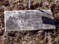
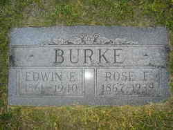
| Description | : | Tennessee State Marriages, 1780-2002; Groom-Hubbard Holder, BrideMary Ann VICE. Married 6 Mar 1845. Omaha Daily Bee, February 28, 1904, Page 8: Council Bluffs News - Mrs. Mary A. Holder, aged 78 years, died yesterday afternoon at her residence, 1635 Avenue G, from asthma, after an illness of five moths. She was the widow of Hubbard Holder and is survived by six daughters, Mrs. A. Heaston, Mrs. Sarah Bennett, Mrs. George Parker, Mrs. D. K. Shreves, Mrs. Edward Burke, of this city, and Mrs. John Orr of South Omaha, and one son, William A. Holder of this city. |
frequently asked questions (FAQ):
-
Where is Mary Ann Vice/Vise Holder's memorial?
Mary Ann Vice/Vise Holder's memorial is located at: Fairview Cemetery, Council Bluffs, Pottawattamie County, USA.
-
When did Mary Ann Vice/Vise Holder death?
Mary Ann Vice/Vise Holder death on 27 Feb 1904 in Council Bluffs, Pottawattamie County, Iowa, USA
-
Where are the coordinates of the Mary Ann Vice/Vise Holder's memorial?
Latitude: 41.2703018
Longitude: -95.8480988
Family Members:
Parent
Spouse

Siblings
Children
Flowers:


Nearby Cemetories:
1. Fairview Cemetery
Council Bluffs, Pottawattamie County, USA
Coordinate: 41.2703018, -95.8480988
2. Ridgewood Cemetery
Council Bluffs, Pottawattamie County, USA
Coordinate: 41.2694016, -95.8272018
3. Walnut Hill Cemetery
Council Bluffs, Pottawattamie County, USA
Coordinate: 41.2719002, -95.8255997
4. Memorial Park Cemetery
Council Bluffs, Pottawattamie County, USA
Coordinate: 41.2644005, -95.8261032
5. Bikhor Cholim Cemetery
Council Bluffs, Pottawattamie County, USA
Coordinate: 41.2703670, -95.8229350
6. Oak Hill Cemetery
Council Bluffs, Pottawattamie County, USA
Coordinate: 41.2700900, -95.8226400
7. Green Valley Cemetery
Council Bluffs, Pottawattamie County, USA
Coordinate: 41.2743988, -95.8225021
8. Saint Joseph Cemetery
Council Bluffs, Pottawattamie County, USA
Coordinate: 41.2722015, -95.8208008
9. Cedar Lawn Cemetery
Council Bluffs, Pottawattamie County, USA
Coordinate: 41.2694016, -95.8182983
10. Clark Cemetery
Pottawattamie County, USA
Coordinate: 41.2551610, -95.8223390
11. Garner Cemetery
Council Bluffs, Pottawattamie County, USA
Coordinate: 41.2956161, -95.8001709
12. Maple Grove Cemetery
Council Bluffs, Pottawattamie County, USA
Coordinate: 41.2265560, -95.8187100
13. Evans Cemetery
Crescent, Pottawattamie County, USA
Coordinate: 41.3255997, -95.8368988
14. Stoker-Graybill Cemetery
Council Bluffs, Pottawattamie County, USA
Coordinate: 41.2532620, -95.7751770
15. Council Point Cemetery
Council Bluffs, Pottawattamie County, USA
Coordinate: 41.2110830, -95.8788610
16. Trinity Cathedral Columbarium
Omaha, Douglas County, USA
Coordinate: 41.2603900, -95.9393660
17. Lewis Township Cemetery
Council Bluffs, Pottawattamie County, USA
Coordinate: 41.2117004, -95.7938995
18. Gregg Cemetery
Weston, Pottawattamie County, USA
Coordinate: 41.3330000, -95.7931000
19. Prospect Hill Cemetery
Omaha, Douglas County, USA
Coordinate: 41.2780991, -95.9593964
20. Hazel Dell Cemetery
Council Bluffs, Pottawattamie County, USA
Coordinate: 41.3489723, -95.7939911
21. First Central Congregational Columbarium
Omaha, Douglas County, USA
Coordinate: 41.2563456, -95.9658365
22. Nash Chapel Crypt
Omaha, Douglas County, USA
Coordinate: 41.2665090, -95.9721790
23. Crescent Cemetery
Crescent, Pottawattamie County, USA
Coordinate: 41.3664894, -95.8566208
24. Douglas County Poor Farm Cemetery
Omaha, Douglas County, USA
Coordinate: 41.2437240, -95.9723480