
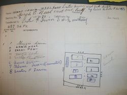
Mary B Neal
| Birth | : | 21 Jul 1889 Champaign County, Ohio, USA |
| Death | : | 1 May 1925 Champaign County, Ohio, USA |
| Burial | : | Smith Chapel Cemetery, La Plata, Charles County, USA |
| Coordinate | : | 38.5327988, -77.1117020 |
frequently asked questions (FAQ):
-
Where is Mary B Neal's memorial?
Mary B Neal's memorial is located at: Smith Chapel Cemetery, La Plata, Charles County, USA.
-
When did Mary B Neal death?
Mary B Neal death on 1 May 1925 in Champaign County, Ohio, USA
-
Where are the coordinates of the Mary B Neal's memorial?
Latitude: 38.5327988
Longitude: -77.1117020
Family Members:
Parent
Siblings
Flowers:


Nearby Cemetories:
1. Smith Chapel Cemetery
La Plata, Charles County, USA
Coordinate: 38.5327988, -77.1117020
2. Speake Cemetery
Pisgah, Charles County, USA
Coordinate: 38.5166800, -77.1221400
3. Pisgah United Methodist Church Cemetery
Pisgah, Charles County, USA
Coordinate: 38.5410995, -77.1342010
4. Pisgah Nazarene Church Cemetery
Pisgah, Charles County, USA
Coordinate: 38.5416400, -77.1440500
5. Zion Baptist Church Cemetery
Welcome, Charles County, USA
Coordinate: 38.4897003, -77.1219025
6. Marbury Baptist Church Cemetery
Marbury, Charles County, USA
Coordinate: 38.5686700, -77.1533700
7. Pleasant Grove Missionary Baptist Church Cemetery
Marbury, Charles County, USA
Coordinate: 38.5586014, -77.1669006
8. Saint Katherines Cemetery
Charles County, USA
Coordinate: 38.5024986, -77.0586014
9. Saint Catherine of Alexandria Cemetery
McConchie, Charles County, USA
Coordinate: 38.5024000, -77.0584600
10. Saint Ignatius of Loyola Cemetery
Hill Top, Charles County, USA
Coordinate: 38.4841995, -77.1402969
11. Church of the Lord Jesus Christ Cemetery
Ironsides, Charles County, USA
Coordinate: 38.4915600, -77.1594600
12. Park Hill Cemetery
Marbury, Charles County, USA
Coordinate: 38.5769005, -77.1580963
13. Thompson Grave
Ironsides, Charles County, USA
Coordinate: 38.4968500, -77.1688170
14. Thomas Stone National Historic Site
Port Tobacco, Charles County, USA
Coordinate: 38.5299900, -77.0375300
15. Smallwood State Park
Marbury, Charles County, USA
Coordinate: 38.5496000, -77.1876700
16. Ellerslie Estate Cemetery
Port Tobacco, Charles County, USA
Coordinate: 38.5037500, -77.0411600
17. Poynton Manor Farm Cemetery
Welcome, Charles County, USA
Coordinate: 38.4672240, -77.0887561
18. Christ Church Durham Parish Cemetery
Ironsides, Charles County, USA
Coordinate: 38.4731300, -77.1549400
19. Alexandria Cemetery
Indian Head, Charles County, USA
Coordinate: 38.5311600, -77.2010100
20. Saint Charles Cemetery
Glymont, Charles County, USA
Coordinate: 38.6006012, -77.1352997
21. Saint John's Episcopal Chapel Cemetery
Pomonkey, Charles County, USA
Coordinate: 38.5980988, -77.0781021
22. McDaniel Cemetery
Pomfret, Charles County, USA
Coordinate: 38.5853260, -77.0464920
23. Tubman Cemetery
Pomfret, Charles County, USA
Coordinate: 38.5974700, -77.0663710
24. Brawner Family Cemetery
McConchie, Charles County, USA
Coordinate: 38.4896870, -77.0344110