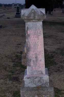
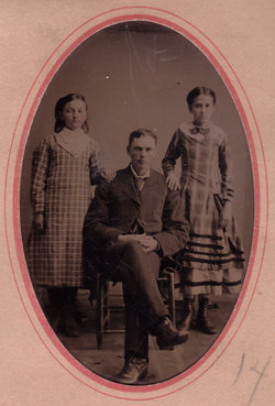
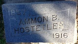
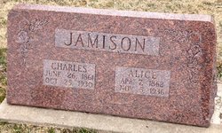
Mary Jane Coldren Hostetler
| Birth | : | 10 Dec 1830 Uniontown, Fayette County, Pennsylvania, USA |
| Death | : | 13 Aug 1894 Cloud County, Kansas, USA |
| Burial | : | St Mary Churchyard, Swinbrook, West Oxfordshire District, England |
| Coordinate | : | 51.8072090, -1.5954540 |
| Plot | : | 16W18 |
| Description | : | The Sun, Aug. 17, 1894, page 1: Died -- Monday, August 13, 1894, Mrs. Mary J. Hostetler, at her home with her daughter, Mrs. George W. Ott. Mary Jane Coldren was born near Uniontown, Fayette county, Pennsylvania, December 10th, 1830. She was united in marriage to Joseph Hostetler on February 8th, 1855. She came to this vicinity March 1st, 1872, having resided here ever since. She united with the Baptist church at the age of 15 years, and remained faithful during life, dying at the age of 63 years. Mrs. Hostetler was always a respected member of the community in... Read More |
frequently asked questions (FAQ):
-
Where is Mary Jane Coldren Hostetler's memorial?
Mary Jane Coldren Hostetler's memorial is located at: St Mary Churchyard, Swinbrook, West Oxfordshire District, England.
-
When did Mary Jane Coldren Hostetler death?
Mary Jane Coldren Hostetler death on 13 Aug 1894 in Cloud County, Kansas, USA
-
Where are the coordinates of the Mary Jane Coldren Hostetler's memorial?
Latitude: 51.8072090
Longitude: -1.5954540
Family Members:
Parent
Spouse
Siblings
Children
Flowers:
Nearby Cemetories:
1. St Mary Churchyard
Swinbrook, West Oxfordshire District, England
Coordinate: 51.8072090, -1.5954540
2. St Oswald's Churchyard
Widford, West Oxfordshire District, England
Coordinate: 51.8067780, -1.6047160
3. St Nicholas Parish Church
Asthall, West Oxfordshire District, England
Coordinate: 51.8003600, -1.5850500
4. St James The Great Churchyard
Fulbrook, West Oxfordshire District, England
Coordinate: 51.8153500, -1.6265430
5. Baptist Burial Ground
Burford, West Oxfordshire District, England
Coordinate: 51.8070150, -1.6338030
6. St. John the Baptist Churchyard
Burford, West Oxfordshire District, England
Coordinate: 51.8096490, -1.6341730
7. Burford Cemetery
Burford, West Oxfordshire District, England
Coordinate: 51.8084000, -1.6489600
8. Holy Rood Churchyard
Shilton, West Oxfordshire District, England
Coordinate: 51.7726519, -1.6142058
9. Holy Trinity Church
Witney, West Oxfordshire District, England
Coordinate: 51.7726500, -1.6142050
10. Saint Kenelm's Churchyard
Minster Lovell, West Oxfordshire District, England
Coordinate: 51.8000620, -1.5314550
11. St. John The Evangelist Churchyard
Taynton, West Oxfordshire District, England
Coordinate: 51.8216040, -1.6621950
12. St. Britius Churchyard
Brize Norton, West Oxfordshire District, England
Coordinate: 51.7662000, -1.5667000
13. Saint Michaels and All Angels Churchyard
Leafield, West Oxfordshire District, England
Coordinate: 51.8355550, -1.5390810
14. St. Britius Churchyard Extension
Brize Norton, West Oxfordshire District, England
Coordinate: 51.7660800, -1.5662600
15. Saint Mary the Virgin Churchyard and Vaults
Shipton-under-Wychwood, West Oxfordshire District, England
Coordinate: 51.8597520, -1.5952810
16. St Peter's Churchyard
Crawley, West Oxfordshire District, England
Coordinate: 51.8069700, -1.5100400
17. St. Mary's Churchyard
Westwell, West Oxfordshire District, England
Coordinate: 51.7886840, -1.6779678
18. St John The Baptist
Curbridge, West Oxfordshire District, England
Coordinate: 51.7764570, -1.5203140
19. Milton-under-Wychwood Friends Burial Ground
Milton-under-Wychwood, West Oxfordshire District, England
Coordinate: 51.8638040, -1.6109590
20. St. Simon-St. Jude
Milton-under-Wychwood, West Oxfordshire District, England
Coordinate: 51.8660230, -1.6170140
21. Holy Trinity Churchyard
Ascott under Wychwood, West Oxfordshire District, England
Coordinate: 51.8660100, -1.5644700
22. Milton-under-Wychwood Cemetery
Milton-under-Wychwood, West Oxfordshire District, England
Coordinate: 51.8684380, -1.6176370
23. Tower Hill Cemetery
Witney, West Oxfordshire District, England
Coordinate: 51.7852950, -1.4999610
24. St. Peter's Churchyard
Little Barrington, Cotswold District, England
Coordinate: 51.8130930, -1.6983770


