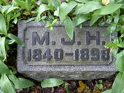
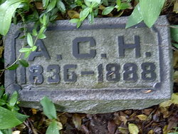
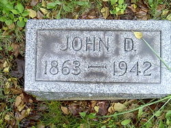
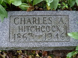
Mary Jane Drennen Hitchcock
| Birth | : | 1840 Northern Ireland |
| Death | : | 27 May 1898 Jefferson, Ashtabula County, Ohio, USA |
| Burial | : | Hopewell Friends Meeting Cemetery, Asheboro, Randolph County, USA |
| Coordinate | : | 35.6390840, -79.8765500 |
| Description | : | Her age is listed as 12 in the 16 September 1850 census (Braceville, Trumbull Co., OH). Her age is listed as 19 in the 03 July 1860 census (Southington Twp., Trumbull Co., OH). Her age is listed as 29 in the 05 July 1870 census (Penfield Twp., Lorain Co., OH). Her age is listed as 40 in the 16 June 1880 census (Brecksville, Cuyahoga Co., OH). Her age is listed as 58 years, 9 months in the 1898 Ashtabula Co., OH record of deaths, which would give an approximate birth date of August, 1839 |
frequently asked questions (FAQ):
-
Where is Mary Jane Drennen Hitchcock's memorial?
Mary Jane Drennen Hitchcock's memorial is located at: Hopewell Friends Meeting Cemetery, Asheboro, Randolph County, USA.
-
When did Mary Jane Drennen Hitchcock death?
Mary Jane Drennen Hitchcock death on 27 May 1898 in Jefferson, Ashtabula County, Ohio, USA
-
Where are the coordinates of the Mary Jane Drennen Hitchcock's memorial?
Latitude: 35.6390840
Longitude: -79.8765500
Family Members:
Parent
Spouse
Siblings
Children
Flowers:
Nearby Cemetories:
1. Hopewell Friends Meeting Cemetery
Asheboro, Randolph County, USA
Coordinate: 35.6390840, -79.8765500
2. Andrew Balfour Family Cemetery
Cedar Grove, Randolph County, USA
Coordinate: 35.6436005, -79.9005966
3. New Union United Methodist Church Cemetery
Asheboro, Randolph County, USA
Coordinate: 35.6736920, -79.8880540
4. Russells Grove Baptist Church Cemetery
Asheboro, Randolph County, USA
Coordinate: 35.6304300, -79.8266700
5. Science Hill Friends Meeting Cemetery
Asheboro, Randolph County, USA
Coordinate: 35.6554090, -79.9310680
6. Rock Hill Primitive Baptist Cemetery
Asheboro, Randolph County, USA
Coordinate: 35.6920480, -79.8466140
7. Saint Mark's United Methodist Church
Cedar Grove, Randolph County, USA
Coordinate: 35.6454300, -79.9484300
8. West Bend United Methodist Church Cemetery
Asheboro, Randolph County, USA
Coordinate: 35.6872610, -79.8345780
9. High Pine Wesleyan Church Cemetery
Asheboro, Randolph County, USA
Coordinate: 35.5815239, -79.8943787
10. West Chapel United Methodist Church Cemetery
Asheboro, Randolph County, USA
Coordinate: 35.6981560, -79.8602220
11. Antioch Missionary Baptist Church Cemetery
Asheboro, Randolph County, USA
Coordinate: 35.6014220, -79.8159830
12. Flag Springs United Methodist Church Cemetery
Asheboro, Randolph County, USA
Coordinate: 35.6102860, -79.8068910
13. New Hope Memorial Gardens
Asheboro, Randolph County, USA
Coordinate: 35.5975400, -79.8155130
14. Oaklawn Cemetery
Asheboro, Randolph County, USA
Coordinate: 35.6885986, -79.8246994
15. Back Creek Friends Meeting Cemetery
Asheboro, Randolph County, USA
Coordinate: 35.7065063, -79.8921153
16. First Presbyterian Church Columbarium
Asheboro, Randolph County, USA
Coordinate: 35.6912790, -79.8196490
17. Mitchell United Methodist Church Cemetery #2
Asheboro, Randolph County, USA
Coordinate: 35.6221700, -79.7929700
18. Old New Hope Cemetery
Union Township, Randolph County, USA
Coordinate: 35.5842500, -79.8230000
19. Bingham Graveyard
Randolph County, USA
Coordinate: 35.5814261, -79.9267622
20. Mitchell United Methodist Church Cemetery #1
Asheboro, Randolph County, USA
Coordinate: 35.6233300, -79.7910600
21. Uwharrie Friends Burial Ground
Asheboro, Randolph County, USA
Coordinate: 35.6024450, -79.9557920
22. New Hope United Methodist Church Cemetery
Asheboro, Randolph County, USA
Coordinate: 35.5804900, -79.8197100
23. Cooper Mountain Cemetery
Randolph County, USA
Coordinate: 35.5790298, -79.9351180
24. Farmer Baptist Church Cemetery
Farmer, Randolph County, USA
Coordinate: 35.6527300, -79.9716300

