
| Birth | : | 22 Jan 1862 Denver, Bremer County, Iowa, USA |
| Death | : | 11 Dec 1942 Denver, Bremer County, Iowa, USA |
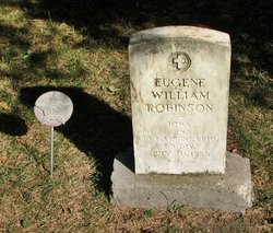
| Burial | : | St. Nicolas Churchyard, Portslade, Brighton and Hove Unitary Authority, England |
| Coordinate | : | 50.8430280, -0.2181350 |
frequently asked questions (FAQ):
-
Where is Mary Louise Nicol Robinson's memorial?
Mary Louise Nicol Robinson's memorial is located at: St. Nicolas Churchyard, Portslade, Brighton and Hove Unitary Authority, England.
-
When did Mary Louise Nicol Robinson death?
Mary Louise Nicol Robinson death on 11 Dec 1942 in Denver, Bremer County, Iowa, USA
-
Where are the coordinates of the Mary Louise Nicol Robinson's memorial?
Latitude: 50.8430280
Longitude: -0.2181350
Family Members:
Parent
Spouse

Siblings
Children
Flowers:


Nearby Cemetories:
1. St. Nicolas Churchyard
Portslade, Brighton and Hove Unitary Authority, England
Coordinate: 50.8430280, -0.2181350
2. Portslade Cemetery
Portslade, Brighton and Hove Unitary Authority, England
Coordinate: 50.8358780, -0.2135400
3. Southwick Cemetery
Southwick, Adur District, England
Coordinate: 50.8429050, -0.2316730
4. St Leonard Churchyard
Hove, Brighton and Hove Unitary Authority, England
Coordinate: 50.8329353, -0.2037728
5. Saint Helen's Churchyard
Hangleton, Brighton and Hove Unitary Authority, England
Coordinate: 50.8510910, -0.2008410
6. Hove Cemetery
Hove, Brighton and Hove Unitary Authority, England
Coordinate: 50.8383100, -0.1950460
7. St. Michael & All Angels Churchyard
Southwick, Adur District, England
Coordinate: 50.8348240, -0.2411970
8. Bishop Hannington Memorial Church
Hove, Brighton and Hove Unitary Authority, England
Coordinate: 50.8427530, -0.1871460
9. St. Julian's Churchyard
Shoreham-by-Sea, Adur District, England
Coordinate: 50.8340600, -0.2465500
10. West Blatchington St. Peter Churchyard
Hove, Brighton and Hove Unitary Authority, England
Coordinate: 50.8472720, -0.1851550
11. St Andrew the Old Churchyard
Hove, Brighton and Hove Unitary Authority, England
Coordinate: 50.8285760, -0.1750850
12. All Saints Church
Hove, Brighton and Hove Unitary Authority, England
Coordinate: 50.8303800, -0.1672270
13. Cardinal Newman Catholic School Cemetery
Hove, Brighton and Hove Unitary Authority, England
Coordinate: 50.8369870, -0.1586370
14. Mill Lane Cemetery
Shoreham-by-Sea, Adur District, England
Coordinate: 50.8378990, -0.2783270
15. Saint Peter's Churchyard
Preston, Brighton and Hove Unitary Authority, England
Coordinate: 50.8430580, -0.1506110
16. St. Nicolas' Churchyard
Old Shoreham, Adur District, England
Coordinate: 50.8407940, -0.2856690
17. St Andrew's Church
Hove, Brighton and Hove Unitary Authority, England
Coordinate: 50.8234900, -0.1569400
18. St. Michael's Churchyard
Brighton, Brighton and Hove Unitary Authority, England
Coordinate: 50.8274590, -0.1498000
19. All Saints Churchyard
Patcham, Brighton and Hove Unitary Authority, England
Coordinate: 50.8665100, -0.1510800
20. St. Nicholas Rest Garden
Brighton, Brighton and Hove Unitary Authority, England
Coordinate: 50.8255348, -0.1460460
21. Queen Elizabeth II Field
Brighton, Brighton and Hove Unitary Authority, England
Coordinate: 50.8261382, -0.1456460
22. St. Nicholas Churchyard
Brighton, Brighton and Hove Unitary Authority, England
Coordinate: 50.8254356, -0.1448820
23. Hanover Chapel Burial Ground
Brighton, Brighton and Hove Unitary Authority, England
Coordinate: 50.8252920, -0.1423620
24. Poynings Cemetery
Poynings, Mid Sussex District, England
Coordinate: 50.8931150, -0.2024450