
| Birth | : | 20 Jul 1856 |
| Death | : | 2 Mar 1950 |
| Burial | : | Graettinger City Cemetery, Graettinger, Palo Alto County, USA |
| Coordinate | : | 43.2550011, -94.7722015 |
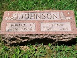
| Description | : | Mary Lucretia Horton was born at the Hill farm near East Bonne Terre, MO on July 20, 1856 and died March 2, 1950 at the home of her grandson Wallace Helber on Bonne Terre Route One, at the age of 93 years 7 months and 10 days. She was the daughter of Rebecca Jane & Josiah Clark Johnson and the great granddaughter of Thomas Hill and James Tyler, both of whom were early settlers in this locality. She received her schooling at the Old Brick Church and School at Big River Mills. In 1876 she was united in marriage to... Read More |
frequently asked questions (FAQ):
-
Where is Mary Lucretia Johnson Horton's memorial?
Mary Lucretia Johnson Horton's memorial is located at: Graettinger City Cemetery, Graettinger, Palo Alto County, USA.
-
When did Mary Lucretia Johnson Horton death?
Mary Lucretia Johnson Horton death on 2 Mar 1950 in
-
Where are the coordinates of the Mary Lucretia Johnson Horton's memorial?
Latitude: 43.2550011
Longitude: -94.7722015
Family Members:
Parent
Siblings

Children
Flowers:


Nearby Cemetories:
1. Graettinger City Cemetery
Graettinger, Palo Alto County, USA
Coordinate: 43.2550011, -94.7722015
2. Saint Jacobs Cemetery
Graettinger, Palo Alto County, USA
Coordinate: 43.2546997, -94.7705994
3. Valley View Cemetery
Walnut Township, Palo Alto County, USA
Coordinate: 43.2428000, -94.7212000
4. Wallingford Lutheran Cemetery
Wallingford, Emmet County, USA
Coordinate: 43.3128014, -94.7731018
5. Saint Paul Lutheran Cemetery
Walnut Township, Palo Alto County, USA
Coordinate: 43.1866740, -94.7872050
6. High Lake Jack Creek Cemetery
Wallingford, Emmet County, USA
Coordinate: 43.3006500, -94.7000620
7. Lost Island Lutheran Cemetery
Lost Island Township, Palo Alto County, USA
Coordinate: 43.1980000, -94.8375000
8. Highland Cemetery
Highland Township, Palo Alto County, USA
Coordinate: 43.1497002, -94.8578033
9. Center Township Cemetery
Emmet County, USA
Coordinate: 43.3608000, -94.6790000
10. Fairview Cemetery
Terril, Dickinson County, USA
Coordinate: 43.2977982, -94.9349976
11. Vernon Township Cemetery
Vernon Township, Palo Alto County, USA
Coordinate: 43.1840000, -94.6185000
12. Saint Patricks Cemetery
Estherville, Emmet County, USA
Coordinate: 43.3843994, -94.8283005
13. Crown Hill Cemetery
Ruthven, Palo Alto County, USA
Coordinate: 43.1328011, -94.8878021
14. Calvary Cemetery
Ruthven, Palo Alto County, USA
Coordinate: 43.1314011, -94.8869019
15. Oak Hill Cemetery
Estherville, Emmet County, USA
Coordinate: 43.3986015, -94.8518982
16. East Side Cemetery
Estherville, Emmet County, USA
Coordinate: 43.4068985, -94.8264008
17. Swan Lake Township Cemetery
Maple Hill, Emmet County, USA
Coordinate: 43.3850746, -94.6381378
18. Evergreen Cemetery
Emmetsburg, Palo Alto County, USA
Coordinate: 43.0940018, -94.6791992
19. East Side Memorial Cemetery
Estherville, Emmet County, USA
Coordinate: 43.4267750, -94.8265600
20. Saint Johns Catholic Cemetery
Emmetsburg, Palo Alto County, USA
Coordinate: 43.0913200, -94.6790000
21. Norwegian Cemetery
Estherville, Emmet County, USA
Coordinate: 43.4291992, -94.8261032
22. Estherville Lutheran Cemetery
Estherville, Emmet County, USA
Coordinate: 43.4298000, -94.8263000
23. Prosser Cemetery
Estherville, Emmet County, USA
Coordinate: 43.4422000, -94.7783000
24. Richland Township Cemetery
Terril, Dickinson County, USA
Coordinate: 43.3565323, -94.9927821