
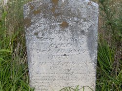
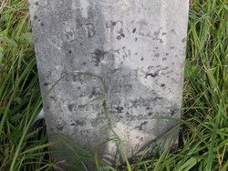
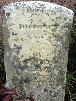
Mary M Howell
| Birth | : | 5 May 1873 Floyd County, Virginia, USA |
| Death | : | 10 Oct 1890 Floyd County, Virginia, USA |
| Burial | : | St Andrew Churchyard, Whissendine, Rutland Unitary Authority, England |
| Coordinate | : | 52.7200520, -0.7682370 |
| Inscription | : | 17 years, 4 months, 28 days |
| Description | : | According to the death record, Mary M Howell was the daughter of William B. Howell and Mary A Castle. She died of consumption at the age of 17. She is buried between her mother and father in the Castle Family Cemetery. |
frequently asked questions (FAQ):
-
Where is Mary M Howell's memorial?
Mary M Howell's memorial is located at: St Andrew Churchyard, Whissendine, Rutland Unitary Authority, England.
-
When did Mary M Howell death?
Mary M Howell death on 10 Oct 1890 in Floyd County, Virginia, USA
-
Where are the coordinates of the Mary M Howell's memorial?
Latitude: 52.7200520
Longitude: -0.7682370
Family Members:
Parent
Siblings
Flowers:


Nearby Cemetories:
1. St Andrew Churchyard
Whissendine, Rutland Unitary Authority, England
Coordinate: 52.7200520, -0.7682370
2. SS Peter and Paul Church
Langham, Rutland Unitary Authority, England
Coordinate: 52.6918700, -0.7529300
3. St Mary the Virgin Churchyard
Ashwell, Rutland Unitary Authority, England
Coordinate: 52.7144490, -0.7200580
4. Holy Trinity Churchyard
Teigh, Rutland Unitary Authority, England
Coordinate: 52.7348560, -0.7207040
5. Saint Michael and All Angels Churchyard
Edmondthorpe, Melton Borough, England
Coordinate: 52.7488800, -0.7301600
6. Edmondthorpe Main Street Cemetery
Edmondthorpe, Melton Borough, England
Coordinate: 52.7491560, -0.7300030
7. St. Mary Magdalen Churchyard
Stapleford, Melton Borough, England
Coordinate: 52.7553000, -0.7987000
8. St Peter Churchyard
Wymondham, Melton Borough, England
Coordinate: 52.7585970, -0.7395410
9. St John the Baptist Churchyard
Cold Overton, Melton Borough, England
Coordinate: 52.6829560, -0.8027660
10. Oakham Cemetery
Oakham, Rutland Unitary Authority, England
Coordinate: 52.6768700, -0.7297400
11. All Saints Churchyard, Pickwell
Melton Mowbray, Melton Borough, England
Coordinate: 52.6943280, -0.8388740
12. Saint Peter and Saint Paul's Churchyard
Market Overton, Rutland Unitary Authority, England
Coordinate: 52.7385000, -0.6893000
13. St James the Greater Churchyard
Little Dalby, Melton Borough, England
Coordinate: 52.7149700, -0.8543800
14. St Peter's Churchyard
Melton Mowbray, Melton Borough, England
Coordinate: 52.7720980, -0.7865420
15. St. Mary Churchyard
Wyfordby, Melton Borough, England
Coordinate: 52.7621940, -0.8257020
16. Pickwell Road Cemetery
Somerby, Melton Borough, England
Coordinate: 52.6865550, -0.8444540
17. St Peter Churchyard
Knossington, Melton Borough, England
Coordinate: 52.6699000, -0.8168600
18. St Mary's Churchyard
Freeby, Melton Borough, England
Coordinate: 52.7727300, -0.8099500
19. All Saints Churchyard
Somerby, Melton Borough, England
Coordinate: 52.6864700, -0.8482390
20. St Mary Churchyard
Garthorpe, Melton Borough, England
Coordinate: 52.7795740, -0.7685920
21. St. Nicholas Churchyard
Cottesmore, Rutland Unitary Authority, England
Coordinate: 52.7128800, -0.6655820
22. St James Churchyard
Burton Lazars, Melton Borough, England
Coordinate: 52.7446910, -0.8643730
23. St Andrew Churchyard
Coston, Melton Borough, England
Coordinate: 52.7905590, -0.7439280
24. St Mary the Virgin Churchyard
Somerby, Melton Borough, England
Coordinate: 52.6894150, -0.8806740