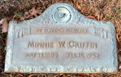
Minnie Bell Witmore Griffin
| Birth | : | 13 May 1889 |
| Death | : | 16 Feb 1952 |
| Burial | : | Brookwood Military Cemetery, Brookwood, Woking Borough, England |
| Coordinate | : | 51.3012619, -0.6419710 |
| Description | : | d/o Robert Whitmore & Sallie Plyler |
frequently asked questions (FAQ):
-
Where is Minnie Bell Witmore Griffin's memorial?
Minnie Bell Witmore Griffin's memorial is located at: Brookwood Military Cemetery, Brookwood, Woking Borough, England.
-
When did Minnie Bell Witmore Griffin death?
Minnie Bell Witmore Griffin death on 16 Feb 1952 in
-
Where are the coordinates of the Minnie Bell Witmore Griffin's memorial?
Latitude: 51.3012619
Longitude: -0.6419710
Family Members:
Parent
Spouse
Siblings
Children
Flowers:
Nearby Cemetories:
1. Brookwood Military Cemetery
Brookwood, Woking Borough, England
Coordinate: 51.3012619, -0.6419710
2. Brookwood 1914-1918 Memorial
Brookwood, Woking Borough, England
Coordinate: 51.3007800, -0.6403300
3. Brookwood 1939-1945 Memorial
Brookwood, Woking Borough, England
Coordinate: 51.3002815, -0.6409460
4. Brookwood American Military Cemetery
Brookwood, Woking Borough, England
Coordinate: 51.3014080, -0.6397010
5. Brookwood French Military Cemetery
Brookwood, Woking Borough, England
Coordinate: 51.3011700, -0.6384920
6. Brookwood Cemetery
Brookwood, Woking Borough, England
Coordinate: 51.3013535, -0.6297340
7. St Michael and All Angels Churchyard
Pirbright, Guildford Borough, England
Coordinate: 51.2945800, -0.6500000
8. Woking Crematorium
Woking, Woking Borough, England
Coordinate: 51.3122590, -0.6022630
9. St. John the Baptist Churchyard
Bisley, Surrey Heath Borough, England
Coordinate: 51.3273600, -0.6266370
10. St John the Baptist Churchyard
St Johns, Woking Borough, England
Coordinate: 51.3104700, -0.5929170
11. St Mary the Virgin Churchyard
Worplesdon, Guildford Borough, England
Coordinate: 51.2730100, -0.6067360
12. Deepcut Military Cemetery
Deepcut, Surrey Heath Borough, England
Coordinate: 51.3062170, -0.7049060
13. Holy Trinity Churchyard
West End, Surrey Heath Borough, England
Coordinate: 51.3434880, -0.6420670
14. St Mary the Virgin Churchyard
Horsell, Woking Borough, England
Coordinate: 51.3227460, -0.5703770
15. St. Mark's Churchyard
Pirbright, Guildford Borough, England
Coordinate: 51.2549050, -0.6812810
16. St Edward the Confessor Churchyard
Sutton Green, Woking Borough, England
Coordinate: 51.2741930, -0.5608230
17. Stoke New Cemetery
Guildford, Guildford Borough, England
Coordinate: 51.2543900, -0.5824700
18. Stoke Old Cemetery
Guildford, Guildford Borough, England
Coordinate: 51.2522600, -0.5828500
19. St Peter's Churchyard
Frimley, Surrey Heath Borough, England
Coordinate: 51.3149770, -0.7393330
20. Valley End St Saviour Churchyard
Chobham, Surrey Heath Borough, England
Coordinate: 51.3647100, -0.6317100
21. Church of Saint Francis of Assisi
Camberley, Surrey Heath Borough, England
Coordinate: 51.3311000, -0.7350400
22. St Peter's Church
Old Woking, Woking Borough, England
Coordinate: 51.3017410, -0.5372560
23. Ash War Memorial
Ash, Guildford Borough, England
Coordinate: 51.2546746, -0.7157783
24. Windlesham Cemetery
Windlesham, Surrey Heath Borough, England
Coordinate: 51.3654000, -0.6654900


