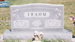
Minnie Lora Waechter Frahm
| Birth | : | 27 Jun 1901 Webster County, Nebraska, USA |
| Death | : | 7 Nov 1994 Blue Hill, Webster County, Nebraska, USA |
| Burial | : | Bloom Chapel Cemetery, Bairdstown, Wood County, USA |
| Coordinate | : | 41.1875000, -83.5888977 |
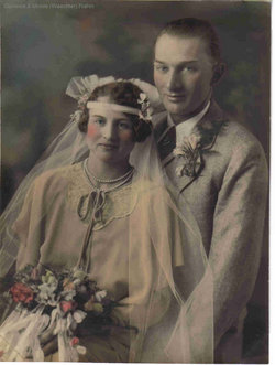
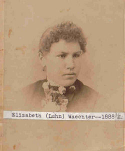
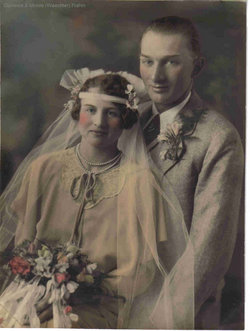
| Description | : | Minnie Laura (Waechter) Frahm was born June 27,1901, to Christian and Elizabeth (Luhn) Waechter at Bladen, Nebraska. She died at Community Care in Blue Hill, Nebraska, on Monday, November 7, 1994, at the age of 93. She was baptized and confirmed at St. Paul's Lutheran Church in Blue Hill, where she remained a member all of her life. On February 26, 1928, she was united in marriage with Clarence Frahm. To this union a daughter and a son were born. Clarence and Minnie lived on a farm northeast of Blue Hill until 1966, when they retired and... Read More |
frequently asked questions (FAQ):
-
Where is Minnie Lora Waechter Frahm's memorial?
Minnie Lora Waechter Frahm's memorial is located at: Bloom Chapel Cemetery, Bairdstown, Wood County, USA.
-
When did Minnie Lora Waechter Frahm death?
Minnie Lora Waechter Frahm death on 7 Nov 1994 in Blue Hill, Webster County, Nebraska, USA
-
Where are the coordinates of the Minnie Lora Waechter Frahm's memorial?
Latitude: 41.1875000
Longitude: -83.5888977
Family Members:
Parent
Spouse
Siblings
Children
Flowers:
Nearby Cemetories:
1. Bloom Chapel Cemetery
Bairdstown, Wood County, USA
Coordinate: 41.1875000, -83.5888977
2. Weaver Cemetery
Bairdstown, Wood County, USA
Coordinate: 41.1838989, -83.6093979
3. Stony Barter Cemetery
Bloom Center, Wood County, USA
Coordinate: 41.1824760, -83.6314430
4. Bechtel Cemetery
Van Buren, Hancock County, USA
Coordinate: 41.1427994, -83.6303024
5. Whitacre Cemetery
Cygnet, Wood County, USA
Coordinate: 41.2403110, -83.6322990
6. Old Maplewood Cemetery
North Baltimore, Wood County, USA
Coordinate: 41.1730170, -83.6734200
7. Vickers Cemetery
Washington Township, Hancock County, USA
Coordinate: 41.1585999, -83.5074997
8. Hough Cemetery
North Baltimore, Wood County, USA
Coordinate: 41.1903300, -83.6810400
9. Jerry City Cemetery
Jerry City, Wood County, USA
Coordinate: 41.2580986, -83.6050034
10. Radar Cemetery (Defunct)
Van Buren, Hancock County, USA
Coordinate: 41.1314498, -83.6498657
11. New Maplewood Cemetery
North Baltimore, Wood County, USA
Coordinate: 41.1711006, -83.6889038
12. Mennonite Cemetery
Perry Township, Wood County, USA
Coordinate: 41.2531100, -83.5279800
13. Mount Zion Cemetery
Wayne, Wood County, USA
Coordinate: 41.2668300, -83.5445600
14. Riverview Cemetery
West Millgrove, Wood County, USA
Coordinate: 41.2403183, -83.4954071
15. Baker-Hamblin Cemetery
Findlay, Hancock County, USA
Coordinate: 41.0983340, -83.5734660
16. Perry Center Cemetery
Perry Township, Wood County, USA
Coordinate: 41.2133860, -83.4721490
17. Bethel Cemetery
Hancock County, USA
Coordinate: 41.1622009, -83.7086029
18. Arcadia Cemetery
Arcadia, Hancock County, USA
Coordinate: 41.1100006, -83.5100021
19. Knollcrest Cemetery
Arcadia, Hancock County, USA
Coordinate: 41.0997360, -83.5316490
20. Faylor Cemetery
Cygnet, Wood County, USA
Coordinate: 41.2332993, -83.7146988
21. Wells Family Cemetery
Arcadia, Hancock County, USA
Coordinate: 41.1225482, -83.4785878
22. Pleasant Hill Cemetery
McComb, Hancock County, USA
Coordinate: 41.1236000, -83.7027969
23. Saint Wendelin Catholic Cemetery
Fostoria, Hancock County, USA
Coordinate: 41.1618996, -83.4321976
24. Fountain Cemetery
Fostoria, Hancock County, USA
Coordinate: 41.1641998, -83.4302979

