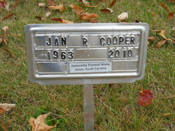
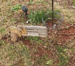
Miriam Jan Rector Cooper
| Birth | : | 21 Jul 1963 Jonesville, Union County, South Carolina, USA |
| Death | : | 17 Jul 2010 Spartanburg, Spartanburg County, South Carolina, USA |
| Burial | : | St. Thomas of Canterbury Churchyard, Goring, South Oxfordshire District, England |
| Coordinate | : | 51.5221440, -1.1399970 |
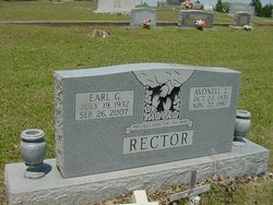
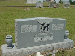
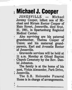
| Description | : | Jan was the wife of Micheal Cooper and a daughter of the late Earl Gault Rector and Avonelle Lipsey Rector. She had one daughter, Mika Erin Cooper;two sisters, Vickie Alexander and Tammy Tilley; one brother, Eugene Rector. She was predeceased by a son, Micheal Jeremy Cooper and a brother, Steve Rector. Jan will be missed by her family and all her many friends. |
frequently asked questions (FAQ):
-
Where is Miriam Jan Rector Cooper's memorial?
Miriam Jan Rector Cooper's memorial is located at: St. Thomas of Canterbury Churchyard, Goring, South Oxfordshire District, England.
-
When did Miriam Jan Rector Cooper death?
Miriam Jan Rector Cooper death on 17 Jul 2010 in Spartanburg, Spartanburg County, South Carolina, USA
-
Where are the coordinates of the Miriam Jan Rector Cooper's memorial?
Latitude: 51.5221440
Longitude: -1.1399970
Family Members:
Parent
Siblings
Children
Flowers:
Nearby Cemetories:
1. St. Thomas of Canterbury Churchyard
Goring, South Oxfordshire District, England
Coordinate: 51.5221440, -1.1399970
2. St. Mary Churchyard
Streatley, West Berkshire Unitary Authority, England
Coordinate: 51.5240170, -1.1449500
3. Whitehill Burial Ground
Goring, South Oxfordshire District, England
Coordinate: 51.5214730, -1.1180180
4. St Andrew Churchyard
South Stoke, South Oxfordshire District, England
Coordinate: 51.5479065, -1.1377167
5. St John the Baptist
Moulsford, South Oxfordshire District, England
Coordinate: 51.5531050, -1.1482640
6. St. John the Baptist Churchyard
Whitchurch Hill, South Oxfordshire District, England
Coordinate: 51.5050469, -1.0824315
7. St. Mary the Virgin Churchyard
Aldworth, West Berkshire Unitary Authority, England
Coordinate: 51.5106800, -1.2030150
8. St. Leonard's Churchyard
Woodcote, South Oxfordshire District, England
Coordinate: 51.5348117, -1.0731299
9. St Mary the Virgin Churchyard
Whitchurch-on-Thames, South Oxfordshire District, England
Coordinate: 51.4881640, -1.0868770
10. Pangbourne Cemetery
Pangbourne, West Berkshire Unitary Authority, England
Coordinate: 51.4805420, -1.0961030
11. St. Mary's Churchyard
North Stoke, South Oxfordshire District, England
Coordinate: 51.5714910, -1.1228080
12. Buckhold (Holy Trinity) Churchyard
Pangbourne, West Berkshire Unitary Authority, England
Coordinate: 51.4710470, -1.1438470
13. Saint Bartholomew Chapelyard
Goring Heath, South Oxfordshire District, England
Coordinate: 51.5102184, -1.0545583
14. St. Mary the Virgin Cemetery
Ipsden, South Oxfordshire District, England
Coordinate: 51.5674164, -1.0866686
15. St. Mary's Churchyard
Cholsey, South Oxfordshire District, England
Coordinate: 51.5788078, -1.1589500
16. St Michael's Cemetery
Aston Tirrold, South Oxfordshire District, England
Coordinate: 51.5730994, -1.1967145
17. Checkendon Churchyard
Checkendon, South Oxfordshire District, England
Coordinate: 51.5424461, -1.0449720
18. All Saints Churchyard
Aston Upthorpe, South Oxfordshire District, England
Coordinate: 51.5715900, -1.2037500
19. St. Laurence Churchyard
Tidmarsh, West Berkshire Unitary Authority, England
Coordinate: 51.4663800, -1.0873800
20. Saint Mary and Saint Nicholas Churchyard
Compton, West Berkshire Unitary Authority, England
Coordinate: 51.5131760, -1.2430860
21. St. John the Baptist Church (Defunct)
Mongwell, South Oxfordshire District, England
Coordinate: 51.5860980, -1.1233580
22. St Peter and St Paul Churchyard
Yattendon, West Berkshire Unitary Authority, England
Coordinate: 51.4671669, -1.2036310
23. Saint Nicholas Churchyard
Sulham, West Berkshire Unitary Authority, England
Coordinate: 51.4632900, -1.0729000
24. St. John the Baptist South Moreton
South Moreton, South Oxfordshire District, England
Coordinate: 51.5881630, -1.1895850

