


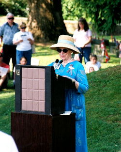
Mrs Anne Martin Wilson Rowe
| Birth | : | 31 Dec 1934 Fredericksburg City, Virginia, USA |
| Death | : | 24 Jan 2009 Fredericksburg City, Virginia, USA |
| Burial | : | Spalding Cemetery, Spalding, South Holland District, England |
| Coordinate | : | 52.7954960, -0.1519390 |
| Plot | : | Section 7, Lot 74, south of stone 117 |
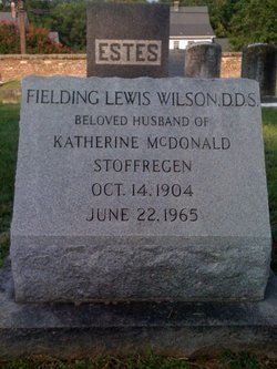
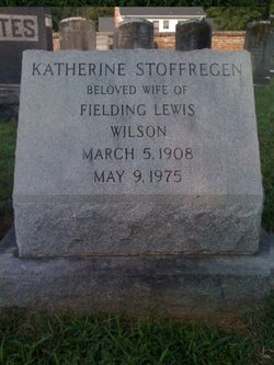
| Description | : | A native and lifelong resident of Fredericksburg, Mrs. Rowe was the daughter of Katherine Stoffregen Wilson and Dr. Fielding Lewis Wilson, a longtime dentist in Fredericksburg. She grew up in the family home on Hawke Street in the very neighborhood she would call home for the rest of her life. Mrs. Rowe attended public schools in the city and was valedictorian of the class of 1953 at James Monroe High School. Hers was the first class to graduate from the new building on Washington Avenue following the school's move from its former location in what became Maury Elementary School. |
frequently asked questions (FAQ):
-
Where is Mrs Anne Martin Wilson Rowe's memorial?
Mrs Anne Martin Wilson Rowe's memorial is located at: Spalding Cemetery, Spalding, South Holland District, England.
-
When did Mrs Anne Martin Wilson Rowe death?
Mrs Anne Martin Wilson Rowe death on 24 Jan 2009 in Fredericksburg City, Virginia, USA
-
Where are the coordinates of the Mrs Anne Martin Wilson Rowe's memorial?
Latitude: 52.7954960
Longitude: -0.1519390
Family Members:
Parent
Spouse

Flowers:


Nearby Cemetories:
1. Spalding Cemetery
Spalding, South Holland District, England
Coordinate: 52.7954960, -0.1519390
2. St Paul's Churchyard
Spalding, South Holland District, England
Coordinate: 52.7969559, -0.1305557
3. St. Mary's Churchyard
Pinchbeck, South Holland District, England
Coordinate: 52.8135340, -0.1589220
4. St. Laurence Churchyard
Surfleet, South Holland District, England
Coordinate: 52.8369500, -0.1436110
5. St Bartholomew's Church West Pinchbeck
Pinchbeck, South Holland District, England
Coordinate: 52.8080873, -0.2216285
6. Surfleet Cemetery
Surfleet, South Holland District, England
Coordinate: 52.8391670, -0.1383330
7. St. Mary's Cemetery
Weston, South Holland District, England
Coordinate: 52.8078662, -0.0809039
8. South Lincolnshire Crematorium
Surfleet, South Holland District, England
Coordinate: 52.8451100, -0.1475110
9. All Saints Churchyard
Moulton, South Holland District, England
Coordinate: 52.7990056, -0.0629691
10. Moulton Cemetery
Moulton, South Holland District, England
Coordinate: 52.8017000, -0.0632400
11. St Gilbert and St Hugh Churchyard
Gosberton Clough, South Holland District, England
Coordinate: 52.8518081, -0.2166268
12. St. Mary's Churchyard
Whaplode, South Holland District, England
Coordinate: 52.7974840, -0.0385520
13. Gosberton Baptist Church
Gosberton, South Holland District, England
Coordinate: 52.8651820, -0.1533940
14. Gosberton Cemetery
Gosberton, South Holland District, England
Coordinate: 52.8659400, -0.1623000
15. St. Peter and St. Paul Churchyard
Gosberton, South Holland District, England
Coordinate: 52.8690870, -0.1629740
16. Whaplode Cemetery
Whaplode, South Holland District, England
Coordinate: 52.8016190, -0.0281347
17. St. Margaret's Churchyard
Quadring, South Holland District, England
Coordinate: 52.8903400, -0.1819700
18. All Saints Churchyard
Holbeach, South Holland District, England
Coordinate: 52.8036140, 0.0142530
19. Holbeach Cemetery
Holbeach, South Holland District, England
Coordinate: 52.8062100, 0.0171500
20. St. John's Churchyard
Holbeach, South Holland District, England
Coordinate: 52.7457510, -0.0024000
21. All Saints Churchyard
Fosdyke, Boston Borough, England
Coordinate: 52.8811100, -0.0469440
22. Fosdyke Village Cemetery
Fosdyke, Boston Borough, England
Coordinate: 52.8808330, -0.0447220
23. Sutterton Village Cemetery
Sutterton, Boston Borough, England
Coordinate: 52.8994440, -0.0900000
24. St. John the Baptist Churchyard
Whaplode Drove, South Holland District, England
Coordinate: 52.7034435, -0.0476688