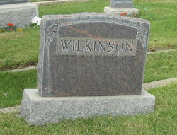
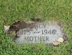
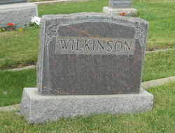
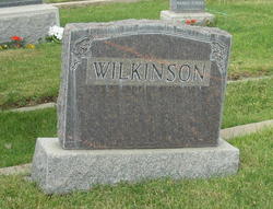
Nancy Dickinson Wilkinson
| Birth | : | 9 Apr 1875 Tipton, Cedar County, Iowa, USA |
| Death | : | 24 Sep 1946 Helena, Lewis and Clark County, Montana, USA |
| Burial | : | Dow-77, Wakefield, Carroll County, USA |
| Inscription | : | MOTHER |
| Description | : | FORMER EAST HELENA WOMAN CAME TO MONTANA FROM IOWA Mrs Nancy Wilkinson, 71, resident of Helena for 20 years, died this morning in St John's hospital, following an illness of two months. Mrs Wilkinson came with her family in 1922 to East Helena, from her native town of Tipton, Iowa, where she was born April 9, 1876. Before her marriage to Mr Wilkinson in Tipton, Dec 23, 1896, she was Nancy Dickinson. She and Mr Wilkinson planned to celebrate their golden wedding anniversary next December. The family resided in East Helena until 1927, when they moved to Helena. During her residence here, Mrs... Read More |
frequently asked questions (FAQ):
-
Where is Nancy Dickinson Wilkinson's memorial?
Nancy Dickinson Wilkinson's memorial is located at: Dow-77, Wakefield, Carroll County, USA.
-
When did Nancy Dickinson Wilkinson death?
Nancy Dickinson Wilkinson death on 24 Sep 1946 in Helena, Lewis and Clark County, Montana, USA
Family Members:
Parent
Spouse
Siblings
Children
Flowers:
Nearby Cemetories:
1. Doctors Cemetery
Bartlett, Carroll County, USA
Coordinate: 43.8542000, -71.4426000
2. Garland Ridge Cemetery
Bartlett, Carroll County, USA
Coordinate: 43.8385671, -71.5158940
3. Glidden Field Cemetery
Bartlett, Carroll County, USA
Coordinate: 43.8410750, -71.3953610
4. Hill Cemetery
Bartlett, Carroll County, USA
Coordinate: 43.8607300, -71.3636400
5. Moulton Cemetery
Bartlett, Carroll County, USA
Coordinate: 43.8433000, -71.4148000
6. Old Catholic Cemetery
Bartlett, Carroll County, USA
Coordinate: 43.8567140, -71.3907470
7. Rogers Cemetery
Bartlett, Carroll County, USA
Coordinate: 43.8678460, -71.3950260
8. Saint Josephs Cemetery
Bartlett, Carroll County, USA
Coordinate: 43.8754000, -71.2187000
9. Stillings-Towle Cemetery
Bartlett, Carroll County, USA
Coordinate: 43.8810309, -71.2175539
10. Harmon Farm Cemetery
East Madison, Carroll County, USA
Coordinate: 43.8554370, -71.3204530
11. Atwood Cemetery
North Sandwich, Carroll County, USA
Coordinate: 43.8959600, -71.3004300
12. G.G. Smith Cemetery
North Sandwich, Carroll County, USA
Coordinate: 43.8267000, -71.2344000
13. Mason Cemetery
North Sandwich, Carroll County, USA
Coordinate: 43.8542000, -71.4426000
14. Mount Delight Burying Ground
North Sandwich, Carroll County, USA
Coordinate: 43.8385671, -71.5158940
15. North Sandwich Cemetery
North Sandwich, Carroll County, USA
Coordinate: 43.8410750, -71.3953610
16. North Sandwich Friends Cemetery
North Sandwich, Carroll County, USA
Coordinate: 43.8607300, -71.3636400
17. Quinby Cemetery
North Sandwich, Carroll County, USA
Coordinate: 43.8433000, -71.4148000
18. Weed Cemetery
North Sandwich, Carroll County, USA
Coordinate: 43.8567140, -71.3907470
19. Weeds Mills Cemetery
North Sandwich, Carroll County, USA
Coordinate: 43.8678460, -71.3950260
20. Chapman Cemetery
Tamworth, Carroll County, USA
Coordinate: 43.8754000, -71.2187000
21. Chocorua Cemetery
Tamworth, Carroll County, USA
Coordinate: 43.8810309, -71.2175539
22. Cleveland Family Cemetery
Tamworth, Carroll County, USA
Coordinate: 43.8554370, -71.3204530
23. Fowlers Mill Cemetery
Tamworth, Carroll County, USA
Coordinate: 43.8959600, -71.3004300
24. Gilman Cemetery
Tamworth, Carroll County, USA
Coordinate: 43.8267000, -71.2344000


