
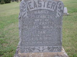
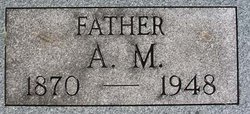
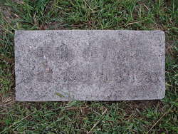
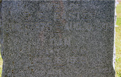
Nancy Elizabeth Kendall Easter
| Birth | : | 1 Jul 1875 Morris County, Kansas, USA |
| Death | : | 16 Aug 1909 Parkerville, Morris County, Kansas, USA |
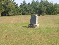
| Burial | : | Saint Marys Cemetery, Doniphan County, USA |
| Coordinate | : | 39.6897011, -95.3174973 |
| Description | : | Wife of D. E. Easter |
frequently asked questions (FAQ):
-
Where is Nancy Elizabeth Kendall Easter's memorial?
Nancy Elizabeth Kendall Easter's memorial is located at: Saint Marys Cemetery, Doniphan County, USA.
-
When did Nancy Elizabeth Kendall Easter death?
Nancy Elizabeth Kendall Easter death on 16 Aug 1909 in Parkerville, Morris County, Kansas, USA
-
Where are the coordinates of the Nancy Elizabeth Kendall Easter's memorial?
Latitude: 39.6897011
Longitude: -95.3174973
Family Members:
Parent

Siblings


Children
Flowers:


Nearby Cemetories:
1. Saint Marys Cemetery
Doniphan County, USA
Coordinate: 39.6897011, -95.3174973
2. Anderson Cemetery
Doniphan County, USA
Coordinate: 39.6601700, -95.3214200
3. Miller Cemetery
Everest, Brown County, USA
Coordinate: 39.6866989, -95.3628006
4. Denton Cemetery
Denton, Doniphan County, USA
Coordinate: 39.7263985, -95.2838974
5. Wolf River Cemetery
Brown County, USA
Coordinate: 39.7476900, -95.3397500
6. Kimberlin Cemetery
Everest, Brown County, USA
Coordinate: 39.7111015, -95.3964005
7. Page Cemetery
Brown County, USA
Coordinate: 39.7000600, -95.4015400
8. Robertson Cemetery
Doniphan County, USA
Coordinate: 39.6678009, -95.2277985
9. Saint Benedict Cemetery
Bendena, Doniphan County, USA
Coordinate: 39.7195015, -95.2285995
10. Victory Cemetery
Denton, Doniphan County, USA
Coordinate: 39.7327995, -95.2358017
11. Bitner Cemetery
Severance, Doniphan County, USA
Coordinate: 39.7439003, -95.2466965
12. Springer Cemetery
Doniphan County, USA
Coordinate: 39.7695389, -95.2683792
13. Chain Family Cemetery
Huron, Atchison County, USA
Coordinate: 39.6238518, -95.3964767
14. Huron Cemetery
Huron, Atchison County, USA
Coordinate: 39.6058006, -95.3585968
15. Saint Louis Cemetery
Good Intent, Atchison County, USA
Coordinate: 39.6241035, -95.2268753
16. Upper Wolf Lutheran Cemetery
Robinson, Brown County, USA
Coordinate: 39.7690010, -95.3893509
17. Zion Lutheran Church Cemetery
Everest, Brown County, USA
Coordinate: 39.7290611, -95.4336777
18. Oak Hill Cemetery
Severance, Doniphan County, USA
Coordinate: 39.7780991, -95.2557983
19. All Saints Cemetery
Everest, Brown County, USA
Coordinate: 39.7008018, -95.4507980
20. Pleasant Ridge Cemetery
Brown County, USA
Coordinate: 39.7928009, -95.3654022
21. Carr Cemetery
Everest, Brown County, USA
Coordinate: 39.7254600, -95.4521600
22. Good Intent Cemetery
Lancaster, Atchison County, USA
Coordinate: 39.6025009, -95.2275009
23. Madison Cemetery
Robinson, Brown County, USA
Coordinate: 39.7717700, -95.4201700
24. Dittemore Cemetery
Doniphan County, USA
Coordinate: 39.7911000, -95.2364500