
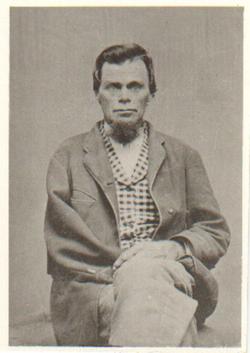
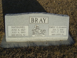

Nathaniel Bray
| Birth | : | 8 Jun 1827 Bristol, Ontario County, New York, USA |
| Death | : | 6 Jul 1883 Syracuse, Otoe County, Nebraska, USA |
| Burial | : | Parklawn Memorial Park and Menorah Gardens, Rockville, Montgomery County, USA |
| Coordinate | : | 39.0639000, -77.1091995 |
| Plot | : | No Headstone |
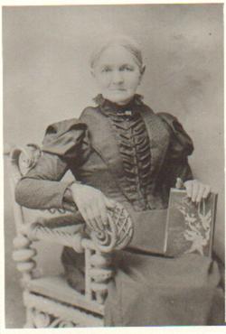
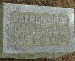
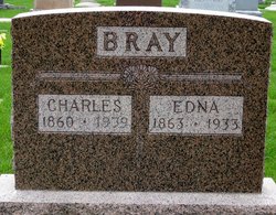
| Description | : | Source: Syracuse Newspaper July 7, 1883. Nathaniel Bray was born in Ontario County, New York, June 8, 1827, and died at Syracuse, Neb., July 6, 1883. In 1860-1861 he removed to this state and settled on the farm where he died, and was therefore, one of the oldest residents of this place. He was married in Ontario County to Miss Emily Damon,of Livingston County, New York, where her friends still reside. Mr. Bray had seven children, all of whom are still living, his being the first death ever had in the family. For many years, Mr Bray has held the office... Read More |
frequently asked questions (FAQ):
-
Where is Nathaniel Bray's memorial?
Nathaniel Bray's memorial is located at: Parklawn Memorial Park and Menorah Gardens, Rockville, Montgomery County, USA.
-
When did Nathaniel Bray death?
Nathaniel Bray death on 6 Jul 1883 in Syracuse, Otoe County, Nebraska, USA
-
Where are the coordinates of the Nathaniel Bray's memorial?
Latitude: 39.0639000
Longitude: -77.1091995
Family Members:
Parent
Spouse
Siblings
Children

Flowers:


Nearby Cemetories:
1. Parklawn Memorial Park and Menorah Gardens
Rockville, Montgomery County, USA
Coordinate: 39.0639000, -77.1091995
2. Higgins Family Cemetery
Rockville, Montgomery County, USA
Coordinate: 39.0597400, -77.1162300
3. Rockville United Church Memorial Garden
Rockville, Montgomery County, USA
Coordinate: 39.0783570, -77.1158440
4. New Saint Mary's Catholic Church Cemetery
Rockville, Montgomery County, USA
Coordinate: 39.0830994, -77.1268997
5. Rockville Cemetery
Rockville, Montgomery County, USA
Coordinate: 39.0844002, -77.1260986
6. Faith United Methodist Church Memorial Garden
Rockville, Montgomery County, USA
Coordinate: 39.0536300, -77.1392600
7. Trinity Lutheran Church Columbarium
Rockville, Montgomery County, USA
Coordinate: 39.0387727, -77.1235788
8. Avery Road Colored Cemetery
Rockville, Montgomery County, USA
Coordinate: 39.0897220, -77.1255560
9. Aspin Hill Memorial Park
Silver Spring, Montgomery County, USA
Coordinate: 39.0799600, -77.0772300
10. Gate of Heaven Cemetery
Silver Spring, Montgomery County, USA
Coordinate: 39.0825005, -77.0738983
11. Old Saint Mary's Catholic Church Cemetery
Rockville, Montgomery County, USA
Coordinate: 39.0819830, -77.1453850
12. Saint Mark Presbyterian Memorial Garden
Rockville, Montgomery County, USA
Coordinate: 39.0317950, -77.1251710
13. Montgomery County Poor Farm Cemetery
Rockville, Montgomery County, USA
Coordinate: 39.0727400, -77.1540500
14. Christ Episcopal Church Columbarium
Rockville, Montgomery County, USA
Coordinate: 39.0823100, -77.1528500
15. Rockville United Methodist Church Columbarium
Rockville, Montgomery County, USA
Coordinate: 39.0839060, -77.1554180
16. Martin Family Cemetery
Rockville, Montgomery County, USA
Coordinate: 39.0960100, -77.1428960
17. Rockville Baptist Cemetery
Rockville, Montgomery County, USA
Coordinate: 39.0835400, -77.1562300
18. Lincoln Park Cemetery
Rockville, Montgomery County, USA
Coordinate: 39.0954300, -77.1452900
19. Mount Zion Cemetery
Bethesda, Montgomery County, USA
Coordinate: 39.0225182, -77.1239777
20. Beall Cemetery
Silver Spring, Montgomery County, USA
Coordinate: 39.0877991, -77.0607986
21. Saint Pauls United Methodist Church Memorial Garde
Kensington, Montgomery County, USA
Coordinate: 39.0268500, -77.0744600
22. Haiti Cemetery
Rockville, Montgomery County, USA
Coordinate: 39.0931000, -77.1573100
23. Prather Family Cemetery
Montgomery County, USA
Coordinate: 39.1133330, -77.1147220
24. Scotland AME Zion Church Cemetery
Potomac Falls, Montgomery County, USA
Coordinate: 39.0333351, -77.1609018