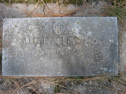
| Birth | : | 6 Apr 1873 Virginia, USA |
| Death | : | 9 Jan 1962 Malta, Phillips County, Montana, USA |
| Burial | : | Henley-on-Thames Cemetery, Henley-on-Thames, South Oxfordshire District, England |
| Coordinate | : | 51.5543570, -0.9271320 |
| Description | : | Vesta was the daughter of Alfred and Rebecca Johnson of Lee County, Virginia. She was married on August 26, 1894, in Harlan, Kentucky, to James Lee Booth. They lived in Lee County, Virginia, for a while before returning to Lee's home in Elliott County, Kentucky. Life was very hard for Vesta and the family moved to Catlettsburg, Kentucky, then to Portsmouth, Ohio. While in Portsmouth, Ohio, Vesta and some of her older children got jobs at the Selby Shoe Company. Her husband left and went to Montana, sending for her sometime after that. Life... Read More |
frequently asked questions (FAQ):
-
Where is Nervesta “Vesta” Johnson Dunn's memorial?
Nervesta “Vesta” Johnson Dunn's memorial is located at: Henley-on-Thames Cemetery, Henley-on-Thames, South Oxfordshire District, England.
-
When did Nervesta “Vesta” Johnson Dunn death?
Nervesta “Vesta” Johnson Dunn death on 9 Jan 1962 in Malta, Phillips County, Montana, USA
-
Where are the coordinates of the Nervesta “Vesta” Johnson Dunn's memorial?
Latitude: 51.5543570
Longitude: -0.9271320
Family Members:
Spouse
Children
Flowers:
Nearby Cemetories:
1. Henley-on-Thames Cemetery
Henley-on-Thames, South Oxfordshire District, England
Coordinate: 51.5543570, -0.9271320
2. St. James's Churchyard
Bix and Assendon, South Oxfordshire District, England
Coordinate: 51.5610070, -0.9511270
3. St. Mary the Virgin Churchyard
Fawley, Wycombe District, England
Coordinate: 51.5743000, -0.9140000
4. St. Mary the Virgin Churchyard
Henley-on-Thames, South Oxfordshire District, England
Coordinate: 51.5377790, -0.9017520
5. Holy Trinity Churchyard
Henley-on-Thames, South Oxfordshire District, England
Coordinate: 51.5338500, -0.9066600
6. Christ Church
Henley-on-Thames, South Oxfordshire District, England
Coordinate: 51.5347880, -0.9032820
7. St. Nicholas' Churchyard
Rotherfield Greys, South Oxfordshire District, England
Coordinate: 51.5351017, -0.9541395
8. St. James' Old Churchyard
South Oxfordshire District, England
Coordinate: 51.5769360, -0.9532550
9. St Margaret's Churchyard
Harpsden, South Oxfordshire District, England
Coordinate: 51.5219160, -0.9012270
10. All Saints Churchyard
Rotherfield Peppard, South Oxfordshire District, England
Coordinate: 51.5280531, -0.9725009
11. St. Pauls Highmoor Cross
Highmoor, South Oxfordshire District, England
Coordinate: 51.5532740, -0.9910110
12. Saint Mary the Virgin Churchyard
Hambleden, Wycombe District, England
Coordinate: 51.5773100, -0.8709500
13. Stonor Park Cemetery
Henley-on-Thames, South Oxfordshire District, England
Coordinate: 51.5967370, -0.9289660
14. St. Bartholomew's Churchyard
Nettlebed, South Oxfordshire District, England
Coordinate: 51.5752360, -0.9936230
15. Pishill Parish Church Cemetery
Pishill, South Oxfordshire District, England
Coordinate: 51.6027550, -0.9527530
16. St Peter and St Paul Churchyard
Medmenham, Wycombe District, England
Coordinate: 51.5533800, -0.8407110
17. St. Peter and St. Paul Churchyard
Shiplake, South Oxfordshire District, England
Coordinate: 51.4980750, -0.8963940
18. St. John the Evangalist Churchyard
Stoke Row, South Oxfordshire District, England
Coordinate: 51.5510570, -1.0226630
19. Stoke Row Independant Chapel
Stoke Row, South Oxfordshire District, England
Coordinate: 51.5510570, -1.0226630
20. Stoke Row Independent Chapel Cemetery
Stoke Row, South Oxfordshire District, England
Coordinate: 51.5510570, -1.0226630
21. St. John the Baptist Churchyard
Kidmore End, South Oxfordshire District, England
Coordinate: 51.5085170, -0.9951240
22. Kidmore End Cemetery
Kidmore End, South Oxfordshire District, England
Coordinate: 51.5071600, -0.9942160
23. St Mary's Churchyard
Turville, Wycombe District, England
Coordinate: 51.6139860, -0.8938190
24. All Saints Churchyard
Dunsden Green, South Oxfordshire District, England
Coordinate: 51.4917730, -0.9461650


