
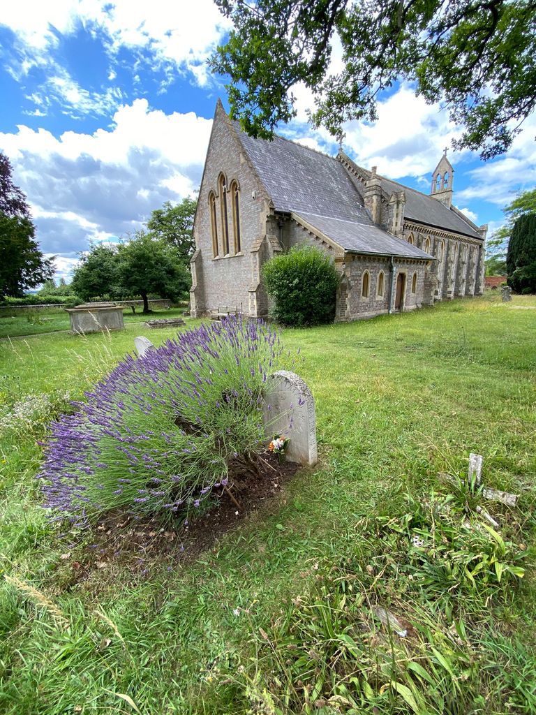
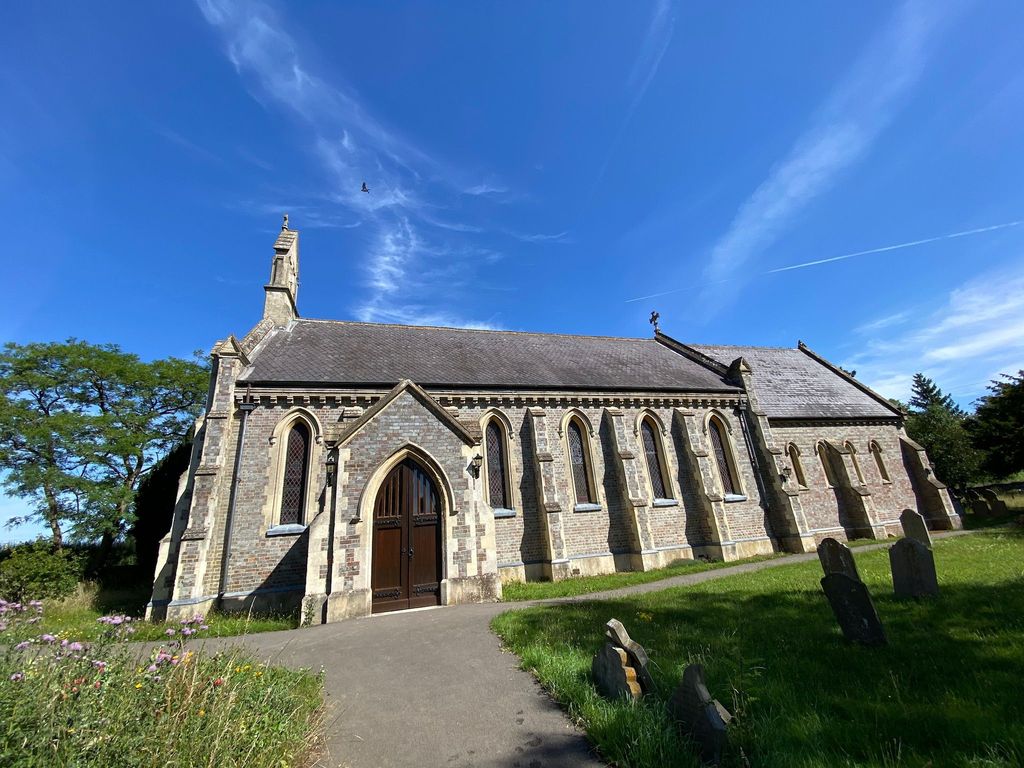
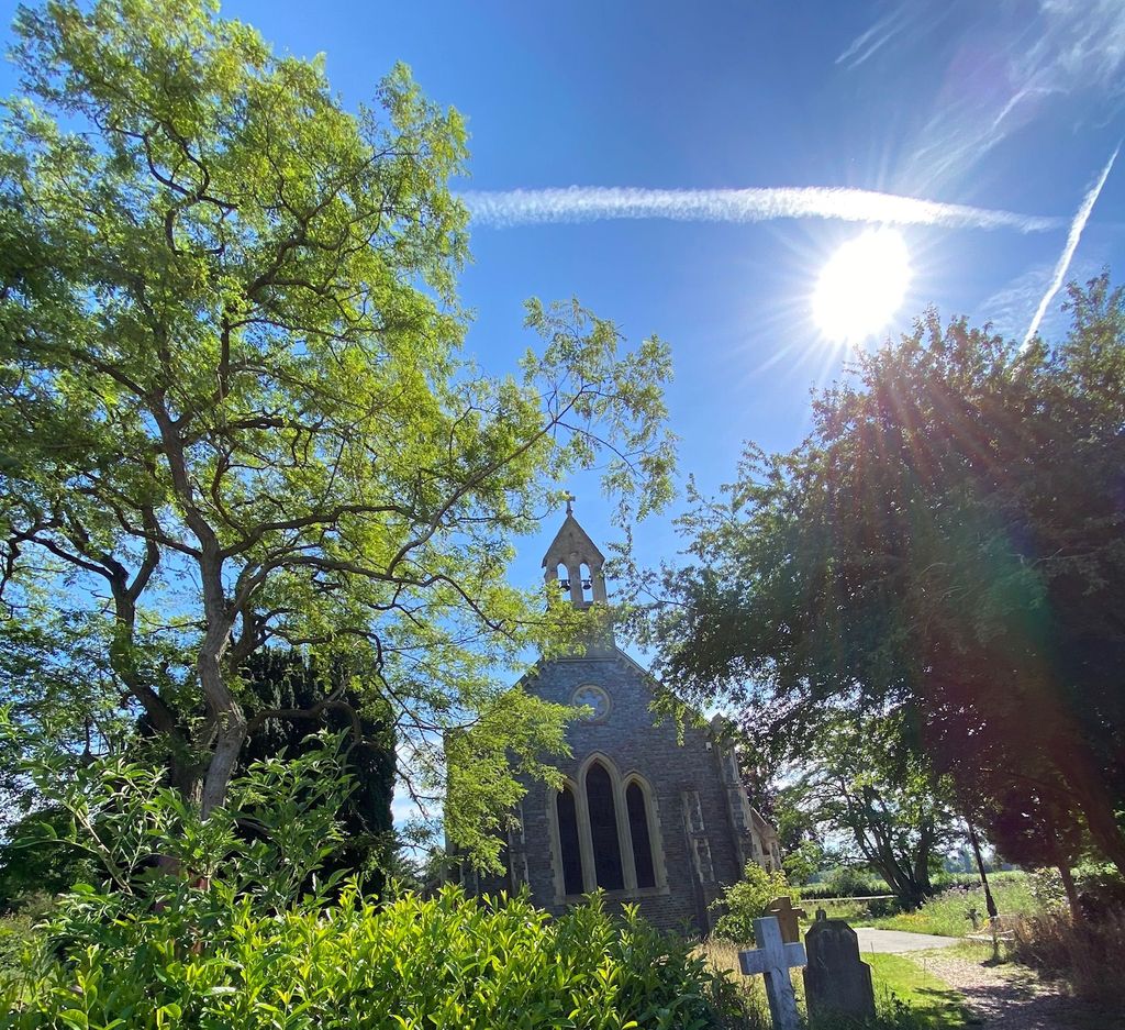
| Memorials | : | 23 |
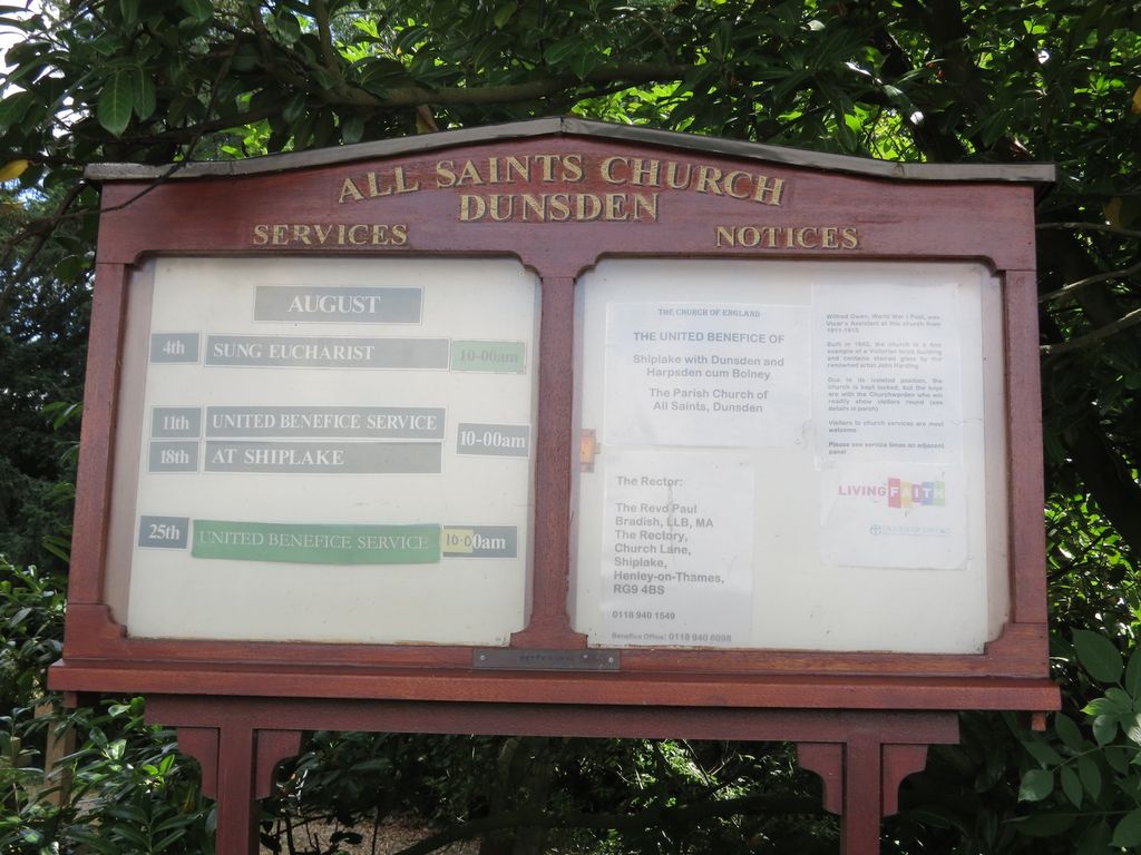
| Location | : | Dunsden Green, South Oxfordshire District, England |
| Phone | : | 0118 9403484 |
| Website | : | www.shiplakedunsdenharpsden.org.uk/dunsden/ |
| Coordinate | : | 51.4917730, -0.9461650 |
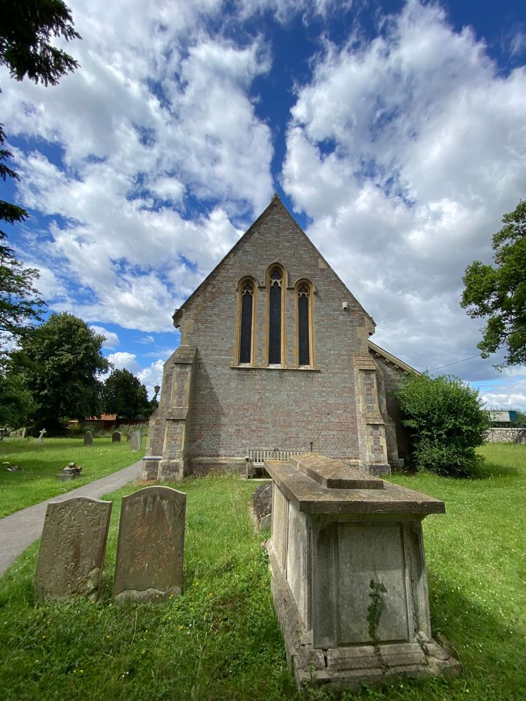
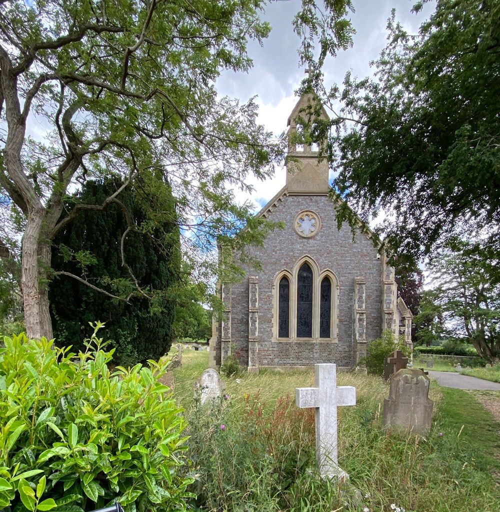
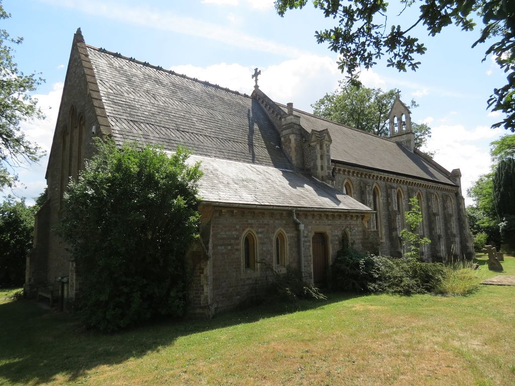
| Description | : | Please note that this church is in Dunsden, not in Duns Tew. It is awaiting amendment. The church is a spacious, uncluttered, unpretentious Victorian building seating about 140. An open area at the back of the church has been formed to provide facilities for refreshments. The nave is wide, furnished partly with deal pews. In 1875 a chancel and sanctuary were added with oak choir stalls and a carved stone reredos possibly designed by the Victorian sculptor Henry Woodyer, who designed the stone pulpit. The pulpit was moved to All Saints from St. Andrew’s,... Read More |
frequently asked questions (FAQ):
-
Where is All Saints Churchyard?
All Saints Churchyard is located at Church Lane Dunsden Green, South Oxfordshire District ,Oxfordshire , RG4 9PTEngland.
-
All Saints Churchyard cemetery's updated grave count on graveviews.com?
23 memorials
-
Where are the coordinates of the All Saints Churchyard?
Latitude: 51.4917730
Longitude: -0.9461650
Nearby Cemetories:
1. Reading Cemetery and Crematorium
Caversham, Reading Borough, England
Coordinate: 51.4737690, -0.9546570
2. Caversham Cemetery
Caversham, Reading Borough, England
Coordinate: 51.4745850, -0.9758020
3. St. Andrew's Churchyard
Sonning, Wokingham Borough, England
Coordinate: 51.4740300, -0.9131640
4. St. Peter's Churchyard
Caversham, Reading Borough, England
Coordinate: 51.4686597, -0.9807669
5. St. Peter and St. Paul Churchyard
Shiplake, South Oxfordshire District, England
Coordinate: 51.4980750, -0.8963940
6. Kidmore End Cemetery
Kidmore End, South Oxfordshire District, England
Coordinate: 51.5071600, -0.9942160
7. St. John the Baptist Churchyard
Kidmore End, South Oxfordshire District, England
Coordinate: 51.5085170, -0.9951240
8. Reading Prison Cemetery
Reading, Reading Borough, England
Coordinate: 51.4564910, -0.9641120
9. Reading Abbey Ruins
Reading, Reading Borough, England
Coordinate: 51.4563710, -0.9651130
10. St. Laurence Churchyard
Reading, Reading Borough, England
Coordinate: 51.4567474, -0.9686236
11. Reading Cemetery
Reading, Reading Borough, England
Coordinate: 51.4529450, -0.9480160
12. Greyfriars Churchyard
Reading, Reading Borough, England
Coordinate: 51.4567920, -0.9764880
13. All Saints Churchyard
Rotherfield Peppard, South Oxfordshire District, England
Coordinate: 51.5280531, -0.9725009
14. St. Mary's Churchyard
Reading, Reading Borough, England
Coordinate: 51.4544953, -0.9735278
15. St Margaret's Churchyard
Harpsden, South Oxfordshire District, England
Coordinate: 51.5219160, -0.9012270
16. St Giles Churchyard
Reading, Reading Borough, England
Coordinate: 51.4509510, -0.9704450
17. St. Nicholas' Churchyard
Rotherfield Greys, South Oxfordshire District, England
Coordinate: 51.5351017, -0.9541395
18. St. Mary's Churchyard
Wargrave, Wokingham Borough, England
Coordinate: 51.4998329, -0.8735808
19. Holy Trinity Churchyard
Henley-on-Thames, South Oxfordshire District, England
Coordinate: 51.5338500, -0.9066600
20. Earley St Peter Churchyard
Earley, Wokingham Borough, England
Coordinate: 51.4434820, -0.9290850
21. Mays Lane Burial Ground
Earley, Wokingham Borough, England
Coordinate: 51.4431680, -0.9240020
22. Christ Church
Henley-on-Thames, South Oxfordshire District, England
Coordinate: 51.5347880, -0.9032820
23. St Mary's Churchyard
Twyford, Wokingham Borough, England
Coordinate: 51.4763850, -0.8673190
24. St. Mary the Virgin Churchyard
Henley-on-Thames, South Oxfordshire District, England
Coordinate: 51.5377790, -0.9017520